Nine Partners Creek

Last updated
Nine Partners Creek
Other name(s) Leslie Creek
Etymology association of early settlers who came from Connecticut
Physical characteristics
Main source small unnamed pond on a hill in New Milford Township, Susquehanna County, Pennsylvania
1,615 feet (492 m) above sea level
River mouth Tunkhannock Creek in Lenox Township, Susquehanna County, Pennsylvania near East Lenox
869 feet (265 m) above sea level
41°42′42″N75°40′16″W / 41.71162°N 75.67122°W / 41.71162; -75.67122 Coordinates: 41°42′42″N75°40′16″W / 41.71162°N 75.67122°W / 41.71162; -75.67122
Length 10 miles (16 km)
Basin features
Progression Tunkhannock Creek → Susquehanna RiverChesapeake Bay
Tributaries

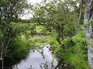
Nine Partners Creek (also known as Leslie Creek) is a tributary of Tunkhannock Creek in Susquehanna County, Pennsylvania, in the United States. It is approximately 10 miles (16 km) long and flows through New Milford Township, Harford Township, and Lenox Township. The watershed of the creek has an area of 38.6 square miles (100 km2). The creek has two named tributaries: Butler Creek and Leslie Creek. The surficial geology in the vicinity of Nine Partners Creek includes Wisconsinan Till, alluvium, bedrock, alluvial fan, and wetlands. The creek's drainage basin is designated as a Coldwater Fishery and a Migratory Fishery.

Tributary stream or river that flows into a main stem river or lake

A tributary or affluent is a stream or river that flows into a larger stream or main stem river or a lake. A tributary does not flow directly into a sea or ocean. Tributaries and the main stem river drain the surrounding drainage basin of its surface water and groundwater, leading the water out into an ocean.

Susquehanna County, Pennsylvania County in the United States

Susquehanna County is a county located in the U.S. state of Pennsylvania. As of the 2010 census, the population was 43,356. Its county seat is Montrose. The county was created on February 21, 1810, from part of Luzerne County and later organized in 1812. It is named for the Susquehanna River.

New Milford Township, Susquehanna County, Pennsylvania Township in Pennsylvania, United States

New Milford Township is a township in Susquehanna County, Pennsylvania, United States. The population was 2,042 at the 2010 census. Children living in New Milford Township are served by the schools in the Blue Ridge School District, including Blue Ridge High School.

Contents

Course

Nine Partners Creek begins in a small unnamed pond on a hill in New Milford Township. It flows east-northeast for a few tenths of a mile before passing through Hunt Lake, and then turns south. After a few tenths of a mile, the creek turns southeast for more than a mile, entering Harford Township. Here, it turns south-southeast for several tenths of a mile before beginning to flow south alongside Interstate 81, crossing Pennsylvania Route 547 and receiving the tributary Leslie Creek from the right. After a few miles, it flows south-southeast for more than a mile before turning south again. Several tenths of a mile further downstream, the creek receives the tributary Butler Creek from the left and enters Lenox Township. Here, it continues flowing south for several tenths of a mile before turning south-southeast. Several tenths of a mile further downstream, the creek crosses Pennsylvania Route 92 and reaches its confluence with Tunkhannock Creek. [1]

Interstate 81 Interstate through Appalachian Mountains

Interstate 81 (I-81) is a north–south Interstate Highway in the eastern part of the United States. Its southern terminus is at I-40 in Dandridge, Tennessee; its northern terminus is on Wellesley Island at the Canadian border, where the Thousand Islands Bridge connects it to Highway 401, the main Ontario freeway connecting Detroit via Toronto to Montreal. The major metropolitan areas that I-81 connects to include Harrisburg in Pennsylvania and Syracuse in New York.

Pennsylvania Route 547 highway in Pennsylvania

Pennsylvania Route 547 (PA 547) is an 11-mile-long (18 km) state highway located in Susquehanna County, Pennsylvania. The southern terminus is at U.S. Route 11 in Harford Township. The northern terminus is at Route 492 in Jackson Township.

Pennsylvania Route 92 highway in Pennsylvania

Pennsylvania Route 92 is a 66-mile-long (106 km) north–south state highway located in northeast Pennsylvania. The southern terminus of the route is at U.S. Route 11 in West Pittston. The northern terminus is at the New York-Pennsylvania border in Oakland Township, where PA 92 continues northward as New York State Route 79 (NY 79).

Nine Partners Creek is approximately 10 miles (16 km) long. [1] The creek joins Tunkhannock Creek 26.39 miles (42.47 km) upstream of its mouth. [2]

Tributaries

Nine Partners Creek has two named tributaries: Butler Creek and Leslie Creek. [1] Butler Creek joins Nine Partners Creek 1.40 miles (2.25 km) upstream of its mouth, within 1 mile (1.6 km) of Harding Corners, and drains an area of 20.8 square miles (54 km2). Leslie Creek joins Nine Partners Creek 4.48 miles (7.21 km) upstream of its mouth, within 1 mile (1.6 km) of Lenox, and drains an area of 4.59 square miles (11.9 km2). [2]

Geography and geology

The elevation near the mouth of Nine Partners Creek is 869 feet (265 m) above sea level. [3] The elevation near the creek's source is 1,615 feet (492 m) above sea level. [1]

River mouth end of a river

A river mouth is the part of a river where the river debouches into another river, a lake, a reservoir, a sea, or an ocean.

Sea level Average level for the surface of the ocean at any given geographical position on the planetary surface

Mean sea level (MSL) is an average level of the surface of one or more of Earth's oceans from which heights such as elevation may be measured. MSL is a type of vertical datum – a standardised geodetic datum – that is used, for example, as a chart datum in cartography and marine navigation, or, in aviation, as the standard sea level at which atmospheric pressure is measured to calibrate altitude and, consequently, aircraft flight levels. A common and relatively straightforward mean sea-level standard is the midpoint between a mean low and mean high tide at a particular location.

River source The starting point of a river

The source or headwaters of a river or stream is the furthest place in that river or stream from its estuary or confluence with another river, as measured along the course of the river.

The surficial geology inside the valley of Nine Partners Creek in its lower reaches mainly consists of alluvium and fill, although there is a small patch of alluvial fan. The sides of the valley have surficial geology containing a till known as Wisconsinan Till and bedrock consisting of sandstone and shale. [4] Further upstream the surficial geology is similar, but with two more alluvial fan patches and a wetland patch. Along the uppermost reaches of the creek, includes Wisconsinan Till (especially at the headwaters) and alluvium, as well as small patches of alluvial fan and wetland. [5]

Alluvium Loose soil or sediment that is eroded and redeposited in a non-marine setting

Alluvium is loose, unconsolidated soil or sediment that has been eroded, reshaped by water in some form, and redeposited in a non-marine setting. Alluvium is typically made up of a variety of materials, including fine particles of silt and clay and larger particles of sand and gravel. When this loose alluvial material is deposited or cemented into a lithological unit, or lithified, it is called an alluvial deposit.

Cut and fill

In earthmoving, cut and fill is the process of constructing a railway, road or canal whereby the amount of material from cuts roughly matches the amount of fill needed to make nearby embankments, so minimizing the amount of construction labor.

Alluvial fan A fan- or cone-shaped deposit of sediment crossed and built up by streams

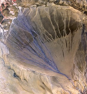
Alluvial fans are triangular-shaped deposits of water-transported material, often referred to as alluvium. They are an example of an unconsolidated sedimentary deposit and tend to be larger and more prominent in arid to semi-arid regions. These alluvial fans typically form in elevated or even mountainous regions where there is a rapid change in slope from a high to low gradient. The river or stream carrying the sediment flows at a relatively high velocity due to the high slope angle which is why coarse material is able to remain in the flow. When the slope decreases rapidly into a relatively plain or plateau, the stream loses the energy it needs to move its sediment. Deposition subsequently occurs and the sediment ultimately spreads out, creating an alluvial fan. Three primary zones occur within an alluvial fan which includes the proximal fan, medial fan, and the distal fan.

Nine Partners Creek has been described as a "small creek". [6] Some sources describe the creek as flowing into Leslie Creek, which is one of its tributaries. [7] [1]

Watershed

The watershed of Nine Partners Creek has an area of 38.6 square miles (100 km2). [2] The mouth of the creek is in the United States Geological Survey quadrangle of Lenoxville. However, its source is in the quadrangle of Harford. [3] The creek's mouth is located near East Lenox. [2]

A natural lake known as Hunt Lake is located in Nine Partners Creek. It has an area of 18 acres (7.3 ha) and is located in New Milford Township. Other lakes in the creek's watershed, on tributaries of the creek, include the 35.9-acre (14.5 ha) Tyler Lake and the 42.3-acre (17.1 ha) Tingley Lake. [8]

Interstate 81 is located in the vicinity of Nine Partners Creek. The reach of the highway running in the creek's vicinity was built in the 1960s. [7]

History

Nine Partners Creek was entered into the Geographic Names Information System on August 2, 1979. Its identifier in the Geographic Names Information System is 1182461. The creek is also known as Leslie Creek. [3] This variant name appears in a 1981 map of Susquehanna County from the Pennsylvania Department of Transportation. [9] However, in the 1960s, it was found that all locals who were asked referred to the creek as Nine Partners Creek. [10]

Nine Partners Creek receives its name from an association of early settlers who came from Connecticut. [6]

Biology

The drainage basin of Nine Partners Creek is designated as a Coldwater Fishery and a Migratory Fishery. [11]

In 2005, one of a number of brook trout released into Tunkhannock Creek to study trout movement made its way 7.5 miles (12.1 km) downstream to go up Nine Partners Creek as far as the tributary Butler Creek. This was the only occurrence of a trout entering a tributary stream during the study. [12] Fishing can be done in the creek. [13]

In the upper part of the Nine Partners Creek watershed, 65.4 percent of the watersheds have a Habitat Quality Index (the maximum probability of finding brook trout in a zero-stress situation) of at least 0.50. [14]

See also

Related Research Articles

Newton Run river in the United States of America

Newton Run is a tributary of Roaring Run in Wyoming County, Pennsylvania, in the United States. It is approximately 2.7 miles (4.3 km) long and flows through Eaton Township and Monroe Township. The watershed of the stream has an area of 2.55 square miles (6.6 km2). The stream is not designated as an impaired waterbody. The surficial geology in its vicinity consists of alluvium, alluvial fan, Wisconsinan Till, and bedrcok.

Hettesheimer Run river in the United States of America

Hettesheimer Run is a tributary of Bowman Creek in Wyoming County, Pennsylvania, in the United States. It is approximately 1.6 miles (2.6 km) long and flows through Noxen Township. The watershed of the stream has an area of 1.94 square miles (5.0 km2). It is not designated as an impaired waterbody. The stream was historically used as an industrial water supply. Its watershed is designated as a High-Quality Coldwater Fishery and a Migratory Fishery and the stream is Class A Wild Trout Waters.

York Run river in the United States of America

York Run is a tributary of Bowman Creek in Wyoming County, Pennsylvania, in the United States. It is approximately 2.3 miles (3.7 km) long and flows through Noxen Township. The watershed of the creek has an area of 1.42 square miles (3.7 km2). The surficial geology in its vicinity consists of alluvium, Wisconsinan Till, alluvial fan, and Wisconsinan Ice-Contact Stratified Drift. The watershed of the stream is designated as a High-Quality Coldwater Fishery and a Migratory Fishery and the stream is Class A Wild Trout Waters.

Horton Creek is a tributary of Oxbow Creek in Susquehanna County and Wyoming County, in Pennsylvania, in the United States. It is approximately 3.3 miles (5.3 km) long and flows through Springville Township in Susquehanna County and Lemon Township and Nicholson Township in Wyoming County. The watershed of the creek has an area of 3.60 square miles (9.3 km2). The creek is not designated as an impaired waterbody. The surficial geology in its vicinity mainly consists of alluvium, Wisconsinan Till, Wisconsinan Ice-Contact Stratified Drift, alluvial terrace, and wetlands.

Monroe Creek (Tunkhannock Creek tributary)

Monroe Creek is a tributary of Tunkhannock Creek in Susquehanna County and Wyoming County, in Pennsylvania, in the United States. It is approximately 6.1 miles (9.8 km) long and flows through Springville Township in Susquehanna County and Nicholson Township in Wyoming County. The watershed of the creek has an area of 6.64 square miles (17.2 km2). The creek is not designated as an impaired waterbody. The surficial geology in its vicinity consists mostly of alluvium, Wisconsinan Till, and other things. Its watershed is designated as a Coldwater Fishery and a Migratory Fishery.

Field Brook

Field Brook is a tributary of Tunkhannock Creek in Susquehanna County and Wyoming County, in Pennsylvania, in the United States. It is approximately 5.8 miles (9.3 km) long and flows through Lathrop Township in Susquehanna County and Nicholson Township in Wyoming County. The watershed of the stream has an area of 7.41 square miles (19.2 km2). The stream has one named tributary, which is known as East Branch Field Brook. The surficial geology in the vicinity of Field Brook consists of alluvium, Wisconsinan Till, alluvial terrace, alluvial fan, bedrock, wetlands, and a lake. The watershed of the stream is designated as a Coldwater Fishery and a Migratory Fishery.

Horton Creek (Tunkhannock Creek tributary)

Horton Creek is a tributary of Tunkhannock Creek in Susquehanna County and Wyoming County, in Pennsylvania, in the United States. It is approximately 11 miles (18 km) long and flows through Brooklyn Township and Lathrop Township in Susquehanna County and Nicholson Township and Nicholson in Wyoming County. The watershed of the creek has an area of 16.9 square miles (44 km2). The creek is not designated as an impaired waterbody and has no named tributaries. The topography of the creek's watershed has been described as "rough and hilly" and its channel is sinuous.

East Branch Martins Creek is a tributary of Martins Creek in Susquehanna County, Pennsylvania, in the United States. It is approximately 5.1 miles (8.2 km) long and flows through New Milford Township and Harford Township. The watershed of the creek has an area of 7.36 square miles (19.1 km2). The creek is not designated as an impaired waterbody. The surficial geology in its vicinity consists of Wisconsinan Till, alluvium, alluvial fan, Wisconsinan Ice-Contact Stratified Drift, and bedrock.

Utley Brook is a tributary of Tunkhannock Creek in Susquehanna County and Wyoming County, in Pennsylvania, in the United States. It is approximately 4.5 miles (7.2 km) long and flows through Lenox Township in Susquehanna County and Nicholson Township in Wyoming County. The stream is in the United States Geological Survey quadrangles of Hop Bottom and Lenoxville. The surficial geology in its vicinity consists of Wisconsinan Till, alluvium, bedrock, wetlands, and lakes. The creek is a Coldwater Fishery and a Migratory Fishery. It has one named tributary, which is known as Willow Brook.

Millard Creek is a tributary of Tunkhannock Creek in Susquehanna County, Pennsylvania. It is approximately 6.2 miles (10.0 km) long and flows through Harford Township and Lenox Township. The watershed of the creek has an area of 5.66 square miles (14.7 km2). The creek is not designated as an impaired waterbody. The surficial geology in its vicinity includes Wisconsinan Till, alluvium, wetlands, lakes, bedrock, and alluvial fan. The dominant land uses in the creek's watershed include forested land and agricultural land. A number of bridges have been constructed over the creek. Its drainage basin is designated as a Coldwater Fishery and a Migratory Fishery.

Tower Branch is a tributary of Tunkhannock Creek in Susquehanna County, Pennsylvania, in the United States. It is approximately 4.8 miles (7.7 km) long and flows through Harford Township and Lenox Township. The watershed of the stream has an area of 3.69 square miles (9.6 km2). The stream is not designated as an impaired waterbody and has no named tributaries. The surficial geology in its vicinity consists mainly of Wisconsinan Till, alluvium, with some lakes, wetlands, bedrock, and alluvial fan. The stream's drainage basin is classified as a Coldwater Fishery and a Migratory Fishery.

Partners Creek is a tributary of Tunkhannock Creek in Susquehanna County, Pennsylvania, in the United States. It is approximately 6.4 miles (10.3 km) long and flows through Harford Township and Lenox Township. The watershed of the creek has an area of 5.84 square miles (15.1 km2). The creek has one named tributary, which is known as Sterling Brook. The drainage basin of Partners Creek is classified as a Coldwater Fishery and a Migratory Fishery. The surficial geology in the vicinity of the creek consists of Wisconsinan Till, alluvium, bedrock, wetlands, lakes, and alluvial fan.

Leslie Creek is a tributary of Nine Partners Creek in Susquehanna County, Pennsylvania, in the United States. It is approximately 4.7 miles (7.6 km) long and flows through New Milford Township and Harford Township. The watershed of the creek has an area of 4.59 square miles (11.9 km2). The creek is not designated as an impaired waterbody. It flows through a lake known as Tingley Lake in its upper reaches. The surficial geology in the vicinity of Leslie Creek mainly includes Wisconsinan Till and alluvium, with some alluvial fan, wetlands, and lakes.

Bell Creek (Tunkhannock Creek tributary)

Bell Creek is a tributary of Tunkhannock Creek in Susquehanna County, Pennsylvania, in the United States. It is approximately 5.2 miles (8.4 km) long and flows through Gibson Township. The watershed of the creek has an area of 5.64 square miles (14.6 km2). The surficial geology the creek's vicinity includes Wisconsinan Till, alluvium, bedrock, wetlands, lakes, and alluvial fan. It has no named tributaries, but does flow through a lake known as Potter Lake. A bridge on the National Register of Historic Places crosses Bell Creek as well. The creek's watershed is designated as a Coldwater Fishery and a Migratory Fishery.

Bear Swamp Creek is a tributary of Tunkhannock Creek in Susquehanna County, Pennsylvania, in the United States. It is approximately 4.3 miles (6.9 km) long and flows through Gibson Township and Clifford Township. The watershed of the creek has an area of 3.92 square miles (10.2 km2). The creek has no named tributaries, and is not designated as an impaired waterbody. It does pass through a wetland known as Bear Swamp. The drainage basin of the creek is designated as a Coldwater Fishery and a Migratory Fishery.

Rock Creek is a tributary of Tunkhannock Creek in Susquehanna County, Pennsylvania, in the United States. It is approximately 3.8 miles (6.1 km) long and flows through Herrick Township, Ararat Township, and Gibson Township. The watershed of the creek has an area of 3.76 square miles (9.7 km2). The creek has no named tributaries and is not designated as an impaired waterbody. It is classified as Class A Wild Trout Waters.

Little Creek is a tributary of East Branch Tunkhannock Creek in Susquehanna County, Pennsylvania, in the United States. It is approximately 3.0 miles (4.8 km) long and flows through Herrick Township and Clifford Township. The watershed of the creek has an area of 4.56 square miles (11.8 km2). The creek has one unofficially named tributary, which is known as Tinker Hollow. Little Creek is designated as Class A Wild Trout Waters. The surficial geology in its vicinity mainly consists of Wisconsinan Till and alluvium.

Tinker Creek is a tributary of East Branch Tunkhannock Creek in Susquehanna County, Pennsylvania, in the United States. It is approximately 4.3 miles (6.9 km) long and flows through Clifford Township. The watershed of the creek has an area of 5.02 square miles (13.0 km2). The creek is not designated as an impaired waterbody and has no named tributaries. It is classified as Class A Wild Trout Waters.

Taques Creek is a tributary of the Susquehanna River in Wyoming County, Pennsylvania, in the United States. It is approximately 2.9 miles (4.7 km) long and flows through Washington Township and Tunkhannock Township. The watershed of the creek has an area of 4.96 square miles (12.8 km2). The creek is not designated as an impaired waterbody and has no named tributaries. Its watershed is designated as a Coldwater Fishery and a Migratory Fishery.

Butler Creek is a tributary of Nine Partners Creek in Susquehanna County, Pennsylvania, in the United States. It is approximately 12 miles (19 km) long and flows through Jackson Township, Gibson Township, and Harford Township. The watershed of the creek has an area of 20.6 square miles (53 km2). The creek has one named tributary, which is known as Little Butler Creek, and is not designated as an impaired waterbody. The creek's valley is a "beaded valley", at least in its upper reaches, and has thick deposits of till in its valley.

References

  1. 1 2 3 4 5 United States Geological Survey, The National Map Viewer , retrieved July 9, 2016
  2. 1 2 3 4 Pennsylvania Gazetteer of Streams (PDF), November 2, 2001, pp. 43, 85, 105, retrieved July 23, 2016
  3. 1 2 3 Geographic Names Information System, Feature Detail Report for: Nine Partners Creek , retrieved July 9, 2016
  4. Duane D. Braun (2007), Surficial geology of the Lenoxville 7.5-minute quadrangle, Susquehanna, Lackawanna, and Wyoming Counties, Pennsylvania, p. 14, retrieved July 22, 2016
  5. Duane D. Braun (2010), Surficial geology of the Harford 7.5-minute quadrangle, Susquehanna County, Pennsylvania, p. 12, retrieved July 22, 2016
  6. 1 2 Sherman Day (1843), Historical Collections of the State of Pennsylvania, p. 621
  7. 1 2 David G. Lappin (1968), PA_1182461_002_Nine Partners Creek_frm_1968.pdf , retrieved July 20, 2016
  8. Pennsylvania Water Supply Commission (1917), Water Resources Inventory Report ...: Act of July 25, 1913, Part 4, pp. 104, 179, 185
  9. Geographic Names Information System, Variant Citation , retrieved July 9, 2016
  10. David G. Lappin (1968), PA_1182461_001_Nine Partners Creek_frm_1968.pdf , retrieved July 22, 2016
  11. §93.9i Drainage List I Susquehanna River Basin in Pennsylvania Susquehanna River (PDF), Independent Regulatory Review Commission, p. 45, retrieved July 19, 2016
  12. Pennsylvania Fish and Boat Commission (Spring 2005), Radio Telemetry Update Susquehanna and Bradford Counties Spring 2005 , retrieved July 19, 2016
  13. Recreation , retrieved July 19, 2016
  14. Chesapeake Bay Watershed Agreement Brook Trout Management Strategy , retrieved July 20, 2016