Cleish

Last updated
Cleish Parish School 1835 Cleish Parish School 1835.jpg
Cleish Parish School 1835
Cleish Parish Church Cleish Parish Church.jpg
Cleish Parish Church
A typical house in Cleish with Cleish Cemetery beyond A typical house in Cleish with Cleish Cemetery beyond.jpg
A typical house in Cleish with Cleish Cemetery beyond
Houses in Cleish with the Cleish Hills behind Houses in Cleish with the Cleish Hills behind.jpg
Houses in Cleish with the Cleish Hills behind

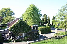
Cleish is a rural hamlet off the B9097 between Crook of Devon and the M90 motorway, three miles south-west of Kinross in central Scotland. It lies in the historic county of Kinross-shire.

Contents

At the last census (2011), the population of the civil parish was 685. [1]

The village is mentioned in Sir Walter Scott's novel The Abbot. The majority of buildings date from the 18th century and the village retains much charm. The school dates from 1835.

[2] It is a designated conservation area. [3]

Cleish Castle lies to the west (see separate article).

Cleish Church

The church can trace its roots to the 13th century and was originally dedicated to St. Cuthbert.

The current church was built in 1775 by John Adam who lived nearby at Blair Adam. The church was again rebuilt following a fire in 1832 and the tower was added in 1897, nominally to mark Queen Victoria's diamond jubilee. [4] It is a Category B listed building. [5]

Thomas James was ordained here in 1691 but left in 1698 to be official chaplain to the ill-fated Darien Expedition to colonise Panama, all in the employ of the Company of Scotland. He died at sea on 23 October 1698 and was buried at sea en route to Darien. [6]

John Gib, (not Adam Gib's father) was minister of Cleish from 1701 to 1741. His successor, Alexander Dalling, was minister from 1743 to 1790 and was succeeded by his son William Dalling who served until 1835 - a span of 92 years between father and son. [6]

The minister 1836 to 1843 was the William Wallace Duncan (1808-1864) the son of Henry Duncan founder of he TSB. He left to serve in Peebles Free church and died there of smallpox. [7] Duncan was replaced in 1843 by Charles Ross who resigned in 1893 and died in Wolverhampton in 1897. [6]

Notable Interments

Nivingston House

Nivingston is of long-standing but the current Nivingston House dates from the late 19th century and operates as a country house hotel. It lies to the south-east of the village. [8]

Cleish Hills

The low rolling hills to the south extend to Dunfermline which are less dramatic than the Lomond Hills to their east. Several small lochs including Loch Glow and the Black Loch lie amongst the hills. [9] Loch Fitty lies on the southern side of the hills. The highest point is Dumglow (379m). [10] The hills are geologically complex consisting of a variety of sedimentary rocks of Carboniferous age within which are some volcanic rocks and into which other igneous rocks have been intruded. The sedimentary rocks are a collection of mudstones and sandstones and limestones assigned to the Strathclyde and Inverclyde groups. Two separate sills are identified; one forming a part of the Midland valley Sill-complex consisting of quartz-microgabbro and to the south, the Hawkcraig Point Sill of analcime-microgabbro, part of a wider Carboniferous to Permian set of intrusions. Knockhill Racing Circuit lies at the western end of the hills. [11]

Related Research Articles

<span class="mw-page-title-main">Perthshire</span> Historic administrative division in Scotland

Perthshire, officially the County of Perth, is a historic county and registration county in central Scotland. Geographically it extends from Strathmore in the east, to the Pass of Drumochter in the north, Rannoch Moor and Ben Lui in the west, and Aberfoyle in the south; it borders the counties of Inverness-shire and Aberdeenshire to the north, Angus to the east, Fife, Kinross-shire, Clackmannanshire, Stirlingshire and Dunbartonshire to the south and Argyllshire to the west. It was a local government county from 1890 to 1930.

<span class="mw-page-title-main">Kinross</span> Human settlement in Scotland

Kinross is a burgh in Perth and Kinross, Scotland, around 13 miles south of Perth and around 20 miles northwest of Edinburgh. It is the traditional county town of the historic county of Kinross-shire.

<span class="mw-page-title-main">Kinross-shire</span> Historic county in Scotland

The County of Kinross or Kinross-shire is a historic county and registration county in eastern Scotland, administered as part of Perth and Kinross since 1930. Surrounding its largest settlement and county town of Kinross, the county borders Perthshire to the north and Fife to the east, south and west.

<span class="mw-page-title-main">Milnathort</span> Human settlement in Scotland

Milnathort is a small town in the parish of Orwell in the county of Kinross-shire, Scotland and since 1996, the local council area of Perth and Kinross. The smaller neighbour of nearby Kinross, Milnathort has a population of around 2,000 people. It is situated amidst countryside at the foot of the Ochil Hills, and near the north shore of Loch Leven. From 1977 it became more easily accessible due to the development of the M90 motorway. The name comes from the Gaelic maol coirthe meaning "bare hill of the standing stones".

<span class="mw-page-title-main">Clunie</span> Village in Perthshire, Scotland

Clunie is a small settlement in Perthshire, Scotland, four miles west of Blairgowrie. It lies on the western shore of the Loch of Clunie.

<span class="mw-page-title-main">Amulree</span> Human settlement in Scotland

Amulree is a small hamlet in Perth and Kinross, Scotland. It lies in hilly country on the A822 road, 1 km (0.62 mi) east of Loch Freuchie in Strathbraan, 8 km (5.0 mi) west of Dunkeld and 10 km (6.2 mi) north of Crieff. It lies close to the geographical centre of Scotland.

<span class="mw-page-title-main">Saline, Fife</span> Human settlement in Scotland

Saline is a village and parish in Fife, Scotland, situated 5 miles (8.0 km) to the north-west of Dunfermline. It lies in an elevated position on the western slopes of the Cleish Hills.

<span class="mw-page-title-main">Lomond Hills</span> Range of hills in central Scotland

The Lomond Hills, also known outside the locality as the Paps of Fife, are a range of hills in central Scotland. They lie in western central Fife and Perth and Kinross, Scotland. At 522 metres (1,713 ft) West Lomond is the highest point in the county of Fife.

<span class="mw-page-title-main">Torryburn</span> Human settlement in Scotland

Torryburn is a village and parish in Fife, Scotland, lying on the north shore of the Firth of Forth. It is one of a number of old port communities on this coast and at one point served as port for Dunfermline. It lies in the Bay of Torry in south western Fife.

<span class="mw-page-title-main">Portmoak</span>

Portmoak is a parish in Kinross-shire, Scotland. It consists of a group of settlements running north to south: Glenlomond, Wester Balgedie, Easter Balgedie, Kinnesswood, Kilmagadwood and Scotlandwell.

<span class="mw-page-title-main">Rubers Law</span>

Rubers Law is a prominent, conical hill in the Scottish Borders area of south-east Scotland. It stands on the south bank of the River Teviot, between the towns of Hawick and Jedburgh, and south of the village of Denholm. The hill is on the border between the historic parishes of Cavers and Hobkirk, and until 1975 it stood within the historic county of Roxburghshire.

<span class="mw-page-title-main">Scotlandwell</span> Human settlement in Scotland

Scotlandwell is a village in Portmoak, Kinross-shire, Scotland. It is within the Perth and Kinross council area. It lies to the east of Loch Leven, at the junction of the A977 and B920 roads, approximately 4 miles west of Glenrothes and 4 miles east of Kinross.

Moonzie is a small parish in Fife, Scotland, about 3 miles north-west of Cupar. It is bounded on the west by Creich, on the north by Kilmany, on the south-east by Cupar and on the south-west by Monimail.

<span class="mw-page-title-main">Abdie</span> Human settlement in Scotland

Abdie is a parish in north-west Fife, Scotland, lying on the south shore of the Firth of Tay on the eastern outskirts of Newburgh, extending about 3 miles eastwards to the boundary of Dunbog parish, with which it is now united ecclesiastically and for the Community Council. It is also bounded by Collessie on the south and has a small border with the parish of Moonzie in the south-east.

<span class="mw-page-title-main">Cameron, Fife</span> Human settlement in Scotland

Cameron is a parish in east Fife, Scotland, 3½ miles south-west of St Andrews.

Mary Lundie Duncan was a Scottish poet and hymnwriter from Kelso, Scotland.

<span class="mw-page-title-main">Sgor Gaibhre</span>

Sgor Gaibhre is a mountain in the Grampian Mountains of Scotland. It lies on the border of Highland and Perth and Kinross, near Loch Ossian.

The geology of national parks in Britain strongly influences the landscape character of each of the fifteen such areas which have been designated. There are ten national parks in England, three in Wales and two in Scotland. Ten of these were established in England and Wales in the 1950s under the provisions of the National Parks and Access to the Countryside Act 1949. With one exception, all of these first ten, together with the two Scottish parks were centred on upland or coastal areas formed from Palaeozoic rocks. The exception is the North York Moors National Park which is formed from sedimentary rocks of Jurassic age.

The geology of Loch Lomond and The Trossachs National Park in the southwestern part of the Scottish Highlands consists largely of Neoproterozoic and Palaeozoic bedrock faulted and folded and subjected to low grade metamorphism during the Caledonian orogeny. These older rocks, assigned to the Dalradian Supergroup, lie to the northwest of the northeast – southwest aligned Highland Boundary Fault which defines the southern edge of the Highlands. A part of this mountainous park extends south of this major geological divide into an area characterised by younger Devonian rocks which are assigned to the Old Red Sandstone.

The geology of Northumberland National Park in northeast England includes a mix of sedimentary, intrusive and extrusive igneous rocks from the Palaeozoic and Cenozoic eras. Devonian age volcanic rocks and a granite pluton form the Cheviot massif. The geology of the rest of the national park is characterised largely by a thick sequence of sedimentary rocks of Carboniferous age. These are intruded by Permian dykes and sills, of which the Whin Sill makes a significant impact in the south of the park. Further dykes were intruded during the Palaeogene period. The whole is overlain by unconsolidated sediments from the last ice age and the post-glacial period.

References

  1. Census of Scotland 2011, Table KS101SC – Usually Resident Population, publ. by National Records of Scotland, web site www.scotlandscensus.gov.uk - See "Standard Outputs", Table KS101SC, Area type: Civil Parish Retrieved April 2021.
  2. website, Cleish Primary School. "Cleish Primary School - Home" . Retrieved 25 January 2017.
  3. "Conservation Areas" . Retrieved 25 January 2017.
  4. 1 2 "Cleish Parish Church - Welcome – 226878". cleishchurch.com. Retrieved 11 February 2018.
  5. Historic Environment Scotland. "CLEISH KIRK (ST. MARY'S) KIRKTON OF CLEISH (Category B Listed Building) (LB5708)" . Retrieved 28 February 2019.
  6. 1 2 3 Scott, Hew (1925). Fasti ecclesiae scoticanae; the succession of ministers in the Church of Scotland from the reformation. Vol. 5. Edinburgh: Oliver and Boyd. pp.  60-62.PD-icon.svg This article incorporates text from this source, which is in the public domain .
  7. Ewing, William Annals of the Free Church
  8. "Cleish, Nivingston House - Canmore" . Retrieved 25 January 2017.
  9. "Route113" . Retrieved 25 January 2017.
  10. Walkhighlands. "Dumglow - Sub 2000 (Walkhighlands)" . Retrieved 25 January 2017.
  11. "Geoindex Onshore". British Geological Survey. Retrieved 20 June 2020.
56°10′01″N3°27′32″W / 56.167°N 3.459°W / 56.167; -3.459