Related Research Articles

Appomattox County is a United States county located in the Piedmont region and near the center of the Commonwealth of Virginia. The county is part of the Lynchburg, VA Metropolitan Statistical Area, and its county seat is the town of Appomattox.
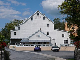
Edinburg is a town in Shenandoah County, Virginia, United States. The population was 1,041 at the 2010 census.
Mill Branch is a 9.1-mile-long (14.6 km) tributary stream of the Cacapon River, belonging to the Potomac River and Chesapeake Bay watersheds. The stream is located in eastern Hampshire County in West Virginia's Eastern Panhandle.
Mill Creek is an 8.7-mile-long (14.0 km) tributary stream of Patterson Creek in Mineral County, West Virginia. It is also known as Mill Run.
Abrams Creek is an 11.2-mile-long (18.0 km) tributary stream of Opequon Creek in Frederick County and the independent city of Winchester in Virginia. Abrams Creek rises north of Round Hill and flows in a southeasterly direction through Winchester. From Winchester, Abrams Creek flows east into Opequon Creek. The stream was originally known as Abraham's Creek.

Morven is an unincorporated community in Amelia County, Virginia, United States. It lies at the intersection of SR 681 Clementown Road and SR 616 Genito Road.
Nancy Wrights Corner is an unincorporated community in Caroline County, in the U.S. state of Virginia. It is located along US 1 and VSR 605, west of Woodford. The community was one of the sites of the Battle of North Anna.
Olive is an unincorporated community in Spotsylvania County, in the U.S. state of Virginia.
Giles Mill is an unincorporated community located in northwestern Amelia County, in the U.S. state of Virginia on the banks of the Appomattox River. Wigwam which was home to former Virginia senator and 24th Governor of Virginia William Branch Giles, is located near Giles Mill.
Truxillo is an unincorporated community located in Amelia County, in the U.S. state of Virginia. Located at SR 681 and Mt. Zion Road.
Paynes Mill is an unincorporated community in Buckingham County and Fluvanna Counties, in the U.S. state of Virginia.
Union Mills is an unincorporated community in Fluvanna County, in the U.S. state of Virginia.
Guinea Mills is an unincorporated community in Cumberland County, in the U.S. state of Virginia.
Trenton Mills is an unincorporated community in Cumberland County, in the U.S. state of Virginia.
Trents Mill is an unincorporated community in Cumberland County, in the U.S. state of Virginia.
Curdsville is an unincorporated community in Buckingham County, in the U.S. state of Virginia.
Eldridge Mill is an unincorporated community in Buckingham County, in the U.S. state of Virginia.
Patterson Creek is a 51.2-mile-long (82.4 km) tributary of the North Branch Potomac River in West Virginia's Eastern Panhandle, in the United States. It enters the North Branch east of Cumberland, Maryland, with its headwaters located in Grant County, West Virginia. Patterson Creek is the watershed for two-thirds of Mineral County, West Virginia. The creek passes through Lahmansville, Forman, Medley, Williamsport, Burlington, Headsville, Reeses Mill, Champwood, and Fort Ashby.
Mill Run is a 9.1-mile-long (14.6 km) tributary stream of the South Branch Potomac River, belonging to the Potomac River and Chesapeake Bay watersheds. The stream is located in Hampshire County in the Eastern Panhandle of the U.S. state of West Virginia. Mill Run rises on Nathaniel Mountain and flows northeast, then northwest into the South Branch south of Romney near Hampshire Park on South Branch River Road.
East Fork Pacheco Creek is a 5 mile long tributary stream of North Fork Pacheco Creek in the Diablo Range in Santa Clara County, California. Its confluence with the North Fork is at an elevation of 610 feet / 186 meters. Its source is located about a half mile nortnortheast of the Fifield Ranch at 37°08′07″N121°13′47″W at an elevation of 1600 feet / 488 meters just west of County Line Road that runs along the crest of the Diablo Range between Santa Clara County and Stanislaus County, California about a quarter mile before its intersection with the Fifield Grade and McCabe Road that climbs upward from the canyon of Romero Creek on the east slope of the Diablo Range in Merced County, California.
References
Municipalities and communities of Amelia County, Virginia, United States | ||
|---|---|---|
| CDP |  | |
| Unincorporated communities | ||
Coordinates: 37°26′28″N78°05′25″W / 37.44111°N 78.09028°W
| | This Amelia County, Virginia state location article is a stub. You can help Wikipedia by expanding it. |