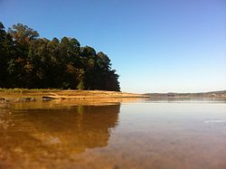
Clemson Experimental Forest

Last updated
Clemson Experimental Forest
Clemsonforest.jpg
A view from Lake Hartwell of the Clemson Experimental Forest
SCMap-doton-Clemson.PNG
Location of Clemson, South Carolina
Coordinates: 34°41′6″N82°48′53″W / 34.68500°N 82.81472°W / 34.68500; -82.81472
Country United States
State South Carolina
Counties Pickens, Anderson
Website

Clemson Experimental Forest, a 17,500 acre forest surrounding Clemson University, is a natural resource laboratory. It is a product of a land reclamation project funded by Franklin D. Roosevelt Administration's New Deal programs. [1] The forest is habitat for more than 195 species of birds and more than 90 species of trees. The forest is used for research, education, and recreation. [2]

Contents

History

The United States Congress addressed the problem of sub-marginal agricultural lands in the Agricultural Act of 1929. In 1933, with an effort to improve economic conditions, President Franklin D. Roosevelt issued an executive order establishing public funds to be made available to acquire worn-out farmland. [2] In August 1933, Dr. George Aull, a 1918 graduate of Clemson Agricultural College, sent a proposal for Fant’s Grove Community Development Project to Washington. He proposed that the government purchase 8,500 acres. This proposal was turned down. He adjusted his proposal, now named the Clemson College Conservation Project, and resubmitted it. Under the condition that the government would own and manage the land, the proposal was accepted. E.W. Sikes, president of Clemson College at the time, named Aull project manager. Work of the project started in August 1934. Starting off, Aull directed men to clear stands of timber, to build fire lanes, and to clear streambeds. Aull hired two Clemson College engineers to design and build a dam on Six Mile Creek to form Lake Issaquena. He also started them planting seedlings. In particular, the men planted gum, pine, poplar and oak. At the end of his second year as project manager, Aull decided to resign his duties and regain his position as chairman of the Department of Agricultural Economics at Clemson. Between 1942 and 1945, one hundred thirty-five acres of northern forest were leased to the United States Air Corps for bombing practice. In 1946, Clemson’s President R.F. Poole hired Norbert B. Goebel, a graduate in forest management of Duke University, as Forest manager of the project, then known as the Land Use Project. On December 22, 1954, a bill introduced by Senator Charles E. Daniel and Senator Strom Thurmond was passed deeding the 27,469 acres of land of the project to Clemson College for the price of one dollar. This bill reserved the United States certain mineral rights and restricted the lands to be forever used for public purposes. In 1977, the Forest was selected by the Institute of Ecology as one of the 67 primary experimental ecological reserves in the nation. Only 17 of the 171 considered ranked higher than Clemson. [3]

Geography and geology

The Clemson Experimental Forest lands extend eight miles north and eight miles south of the Clemson University campus. [2] The land is in the Southern Piedmont Soil Resource area. The parent soil consisted of granites, phyllites and various schists and gneisses formed in the late Precambrian to early Paleozoic age. Elevations of the forest range from 650 to 1,000 feet above mean sea level. The northern section of the forest is in the transition zone between the Piedmont and Mountain Physiographic regions. The southern section of the forest is of the Piedmont physiographic region. [3]

Ecology

Trees

The Clemson Experimental Forest is home to more than 90 species of trees. In the dry ridges, these species include blackjack oak, post oak, shortleaf pine and Virginia pine. In the mid-slopes of the forest the major species of trees are bitternut hickory, black oak, black gum, flowering dogwood, sourwood, southern red oak and white oak. In the lower slopes of the forest, the main species of trees include American beech, northern red oak, sweet gum, tulip poplar and white pine. In the bottom lands of the forest, the species of trees include black walnut, box elder, green ash, hackberry, river birch and sycamore. There are three South Carolina champion trees that are found in the forest: a 115-foot white basswood, a 97-foot chinkapin oak, and a 20-foot rusty blackhaw. [2]

Wildlife

Birds of the forest include bald eagle, broad-winged hawk, Cooper’s hawk, northern harrier, osprey, kestrel falcon, merlin falcon, barn owl, and barred owl. Mammals of the forest include beaver, American black bear, bobcat, coyote, gray fox, raccoon, red fox, and white-tail deer. [2]

Management and protection

Closeup of Waldrop Stone Falls in the Clemson Experimental Forest. Clemsonforest2.JPG
Closeup of Waldrop Stone Falls in the Clemson Experimental Forest.

The Clemson Experimental Forest is managed for maintained yield of forest products including timber, clean water and air, and wildlife. The revenue generated by the forest supports the forest personnel, and forest equipment and supplies. [1] A continuous forest inventory, CFI, system was launched in 1958. Measurement locations were set at grid intervals, 2000 ft apart, over the entire forest. The data recorded from the CFI system is used to adjust allowable harvest, schedule harvest and evaluate forest health. [1] In 1978, The Management Alternative Research Project, MARP, was initiated to evaluate the long-term effects of three management strategies on large forest areas. For this, the forest was divided into three separate forests: the commercial forest, the multiple-use forest, and the protection forest. MARP’s purpose is to measure the biological, economic, and social responses to the effects of forest cultural practices and to interpret those responses on the environment and society. [4] The forest is a member of the American Tree Farm System and the Sustainable Forestry Initiative. [1]

Research and teaching

The Fire and Fire Surrogate study is conducted by the USDA Forest Service along with Clemson University's Experimental Forest. It is part of a national network of research sites analyzing the effects of fuel reduction techniques on ecosystems. The Clemson Experimental Forest serves as an outdoor laboratory for many disciplines at the university. In 2012, 37 classes utilize the forest. Clemson and Furman University Army ROTC use the south forest to perform dismounted tactical maneuvers and orienteering training. [1]

Recreation

The Clemson Experimental Forest trail system is divided into three areas: Todds Creek, Issaqueena, and Fants Grove. The trails are used for teaching, research and public recreation. Public recreation use of the trails includes birdwatching, mountain biking, hiking and horseback riding. Fishing and hunting are also allowed in the forest and are regulated by South Carolina Department of Natural Resources.

Waterfall:

Waldrop Stone Falls- The location for parking is at the corner of Madden Bridge Road and Waldrop Stone Road. The waterfall is a one-mile hike that leads to a 50-foot tall waterfall. The trail difficulty is easy, and it is dog friendly. Camping and mountain biking are not allowed on this trail. [5] The GPS coordinates are as follows:Parking Area: 34.738505, -82.826153 Actual Location: 34.739568, -82.820751 [6]

Mountain Biking:

Issaqueena Mountain Biking: Located at the Old 6 Mile Road and Issaqueena Lake Road, there are various trails that consist of intersecting courses. Some of the trails are maintained while others are not and contain various routes. The outer loop trail around the lake is 10.3 miles long. [7] All trails are also open to pedestrians and people on horseback.

Fant's Grove Mountain Biking: Parking area is located on Seed Orchard Road, and this location consists of three separate trails: Fant's Grove Trail (4.3 Miles long), Quarry Trail (5.9 miles long), and Swine Farm Trail (2.6 miles long). The trails are open to the public for pedestrians, people on horseback, and mountain bikers. [8] A map is available thanks to Clemson University if you click here.

Related Research Articles

<span class="mw-page-title-main">Ozark–St. Francis National Forest</span> United States National Forest located in the state of Arkansas

The Ozark – St. Francis National Forest is a United States National Forest that is located in the state of Arkansas. It is composed of two separate forests, Ozark National Forest in the Ozark Mountains; and St. Francis National Forest on Crowley's Ridge. Each forest has distinct biological, topographical, and geological differences.

<span class="mw-page-title-main">Kisatchie National Forest</span> National forest in Louisiana, US

Kisatchie National Forest, the only National forest in Louisiana, United States, is located in the forested piney hills and hardwood bottoms of seven central and northern parishes. It is part of the Cenozoic uplands and has large areas of longleaf pine forests. It is one of the largest pieces of natural landscape in Louisiana, with some 604,000 acres (2,440 km2) of public land, more than half of which is vital longleaf pine and flatwoods vegetation. These support many rare plant and animal species. There are also rare habitats, such as hillside seepage bogs and calcareous prairies. The forest also contains and provides a buffer for the Kisatchie Hills Wilderness, a nationally designated wilderness area that contributes to protecting biodiversity of the coastal plain region of the United States.

<span class="mw-page-title-main">Oak Mountain State Park</span> State park in Shelby County, Alabama

Oak Mountain State Park is a public recreation area located approximately 20 miles (32 km) south of Birmingham in the northeast quadrant of the city of Pelham, Alabama, United States. It is the state's largest state park at 9,940 acres (4,020 ha) and is home to the Alabama Wildlife Center, Oak Mountain Interpretive Center, and Oak Mountain BMX Track. Park activities include hiking, running, mountain biking, swimming, camping, fishing, horseback riding, and golf. The park is managed by the Alabama Department of Conservation and Natural Resources.

<span class="mw-page-title-main">The Forest of Nisene Marks State Park</span> State park in Santa Cruz County, California, United States

The Forest of Nisene Marks State Park is a state park of California, United States, protecting a secondary forest in the watershed of Aptos Creek and Soquel Creek within the Santa Cruz Mountains. It is located outside Aptos, California, and contains over 40 miles (64 km) of hiking trails and fire roads through 10,223 acres (4,137 ha) of variable terrain.

<span class="mw-page-title-main">Midstate Trail (Massachusetts)</span>

The Midstate Trail is a scenic footpath which runs 92 miles (148 km) through Worcester County, Massachusetts, from the Rhode Island border to the New Hampshire border, approximately 45 miles (72 km) west of Boston. The trail is considered highly accessible, scenic, and remarkably rural despite its proximity to urban Boston. The trail includes the summits of Mount Wachusett and Mount Watatic, as well as many interesting geologic, historic, and natural features.

<span class="mw-page-title-main">Rothrock State Forest</span> State forest in Pennsylvania, United States

Rothrock State Forest is a Pennsylvania state forest in Pennsylvania Bureau of Forestry District #5. The main offices are located in Huntingdon in Huntingdon County, Pennsylvania in the United States.

Manuel F. Correllus State Forest is a Massachusetts state forest located on Martha's Vineyard. The forest borders Martha's Vineyard Airport on three sides and is chiefly in the towns of West Tisbury and Edgartown. The forest is managed by the Department of Conservation and Recreation.

<span class="mw-page-title-main">Joseph E. Ibberson Conservation Area</span>

Joseph E. Ibberson Conservation Area is a 783-acre (317 ha) Pennsylvania state park in Middle Paxton and Wayne Townships, Dauphin County, Pennsylvania in the United States.

<span class="mw-page-title-main">Kings Gap Environmental Education</span>

Kings Gap Environmental Education Center is a 1,454-acre (588 ha) Pennsylvania state park in Cooke, Dickinson, and Penn Townships, Cumberland County, Pennsylvania, in the United States. The Commonwealth of Pennsylvania acquired the land in 1973 from the C. H. Masland and Son Carpet Company. Kings Gap Environmental Education Center is 2.5 miles (4.0 km) from Pennsylvania Route 233 on South Mountain.

Clark State Forest, located just north of Henryville, Indiana in the United States, is Indiana's oldest state forest, formed in 1903 as a forest research facility and a nursery and later expanded by the Works Progress Administration. Originally 2,028 acres (8 km2) of total land area, it is now almost 24,000 acres (100 km2) and is bisected by Interstate 65. It features three trails used exclusively for hikers trails: two internal trails, and the 59-mile (95 km) Knobstone Trail. There are nine horse trails, and five miles (8 km) of mountain bike trails. Two nature preserves are also situated within the forest. The forest also contains a 100-yard (91 m) outdoor gun range.

<span class="mw-page-title-main">Withlacoochee State Forest</span> Forest in Florida

The Withlacoochee State Forest is 157,479-acre (637 km2) in the western central part in the U.S. state of Florida, near Lecanto, Inverness, Floral City, Brooksville, Ridge Manor, and Dade City. The forest was named for the Withlacoochee River, which passes through some of the major tracts within.

<span class="mw-page-title-main">Boggs Mountain Demonstration State Forest</span> State forest in California

Boggs Mountain Demonstration State Forest is a state forest in Lake County, California that covers the northwest of Boggs Mountain. It was founded in 1949, and came into operation in 1950 when most of the site had been clear cut. The purpose was to demonstrate good practices in restoring and managing a forest. The state forest was open for recreational use, including camping, hiking, mountain biking etc. The 2015 Valley Fire destroyed 80% of the trees. The state forest as of 2021 was replanting saplings.

The Appomattox-Buckingham State Forest is a state forest located in the Piedmont of Virginia in Appomattox and Buckingham counties. Its 19,513 acres are covered with a mix of oak-hickory and pine forest. Dominant tree species include oaks, hickories, yellow poplar, red maple, and pines. It is the largest state forest in Virginia.

<span class="mw-page-title-main">F. Gilbert Hills State Forest</span> Protected area in Massachusetts, United States

F. Gilbert Hills State Forest is a 1,027-acre (416 ha), pine and oak Massachusetts state forest located in the towns of Foxborough and Wrentham. The forest, which is managed by the Massachusetts Department of Conservation and Recreation (DCR), was named for a former State Forester and employee.

The Foot Hills State Forest is a state forest located in Cass and Hubbard counties, Minnesota. The forest is a popular recreation spot due to its proximity to the greater Minneapolis – Saint Paul metropolitan area.

The General C. C. Andrew State Forest is a state forest located in Pine County, Minnesota. The forest is named in honor of major general Christopher Columbus Andrews, a Civil War veteran, and an early Minnesota state Forestry Commissioner and proponent for scientific forestry and forest management. The Minnesota Department of Natural Resources manages the majority of the forest.

The Cumberland County Biker/Hiker Trail is a Pennsylvania rail trail at Pine Grove Furnace State Park and is almost entirely on the "Old Railroad Bed Road" between Fuller Lake and Laurel Lake. The trail is a pleasant 2.2 miles within the Pine Grove Furnace State Park located in the Michaux State Forest. The park is home to many species of wildlife and is a common attraction for locals and tourists alike. Walking, hiking, and biking are the opportunities offered by the trail year round. The biker/hiker trail shares roughly half of its trail with the Appalachian Trail and is a very popular route within the State Park.

<span class="mw-page-title-main">Farlow Gap</span>

Farlow Gap is a popular trail for mountain biking and hiking, located in the western area of North Carolina. It is an expert-level trail, and considered "one of the toughest mountain bike trails in Pisgah National Forest." It is primarily a downhill trail, about 3.1 miles (5.0 km) in length. It can be combined with other trails to form a loop of about 14 miles (23 km), requiring anywhere from three to six hours to complete.

Hoop Hole, a wildland in the George Washington and Jefferson National Forests of western Virginia, has been recognized by the Wilderness Society as a special place worthy of protection from logging and road construction. The Wilderness Society has designated the area as a "Mountain Treasure".

<span class="mw-page-title-main">Crawfish Valley (Bear Creek)</span> Protected natural area in Virginia, United States

Crawfish Valley, a wildland in the George Washington and Jefferson National Forests of western Virginia, has been recognized by the Wilderness Society as a special place worthy of protection from logging and road construction.

References

  1. 1 2 3 4 5 "Clemson University Forest and Natural Resources". Clemson Experimental Forest. Clemson University. Archived from the original on 2012-11-20. Retrieved October 1, 2012.
  2. 1 2 3 4 5 Garton, John (2007). Quiet Reflections. Clemson University.
  3. 1 2 Sorrells, Robert (1984). The Clemson Experimental Forest: Its First Fifty Years. Clemson University.
  4. Cox, K.S. "The Clemson Land Use Project: A Jewel of the "New Deal"" (PDF). Department of Forestry Resources. Clemson University. Archived from the original (PDF) on 2012-12-22. Retrieved October 2, 2012.
  5. http://www.alltrails.com/trail/us/south-carolina/waldrop-stone-falls " Waldrop Stone Falls". alltrails.com Web Access. 5 September 2016
  6. http://visitclemson.com/attractions/waldrop-stone-falls/ Mitchum, Sam. "Waldrop Stone Falls". visitclemson.com 29 January 2016. Web Access 5 September 2016
  7. http://www.mtbproject.com/trail/4706494 "Tour of Isaqueena." Web Access 5 September 2016.
  8. http://www.sctrails.net/trails/alltrails/Multi-use/FantsGrove.html Archived 2016-09-11 at the Wayback Machine Web Access 5 September 2016