Related Research Articles

The Skipanon River is a tributary of the Columbia River, approximately 7 miles (11 km) long, on the Pacific coast of northwest Oregon in the United States. It is the last tributary of the Columbia on the Oregon side, draining an area of coastal bottom land bordered by sand dunes and entering the river from the south at its mouth west of Astoria.

The Klickitat River is a tributary of the Columbia River, nearly 96 miles (154 km) long, in south-central Washington in the United States. It drains a rugged plateau area on the eastern side of the Cascade Range northeast of Portland, Oregon. In 1986, 10 miles (16 km) of the river were designated Wild and Scenic from the confluence with Wheeler Creek, near the town of Pitt, to the confluence with the Columbia River.

The Squamish River is a short but very large river in the Canadian province of British Columbia. Its drainage basin is 3,328 square kilometres (1,285 sq mi) in size. The total length of the Squamish River is approximately 80 kilometres (50 mi).
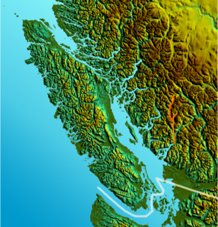
The Elaho River is a c.70 km long river beginning in the Coast Mountains northwest of the towns of Whistler and Pemberton, British Columbia. It is a tributary of the Squamish River and is known for its whitewater rafting and kayaking as well as for the intense alpine scenery lining its route.
The Mamquam River is a c.35 km tributary of the Squamish River.

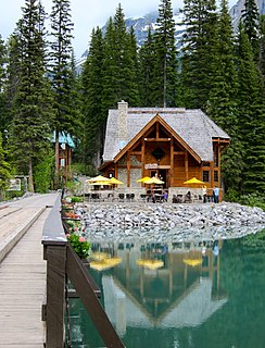
The Yoho River is a silty, swift tributary of the Kicking Horse River in the Canadian province of British Columbia. The river is entirely within Yoho National Park.
Fairview Creek is a 5-mile (8.0 km) tributary of the Columbia Slough in the U.S. state of Oregon. The creek forms in a wetland near Grant Butte in Gresham and flows north for 5 miles (8.0 km) to Fairview Lake in Fairview. Grant Butte, rising to 602 feet (183 m) above sea level, is one of eight dormant volcanic formations near Gresham. Fairview Creek begins northeast of the butte at an elevation of 278 feet (85 m) and falls to an elevation of 10 feet (3.0 m) at the lake.
The Sweltzer River is a river in British Columbia, Canada, that drains the waters of Cultus Lake into the Chilliwack River. It is about 3 kilometres (2 mi) long, and much of it runs through Soowahlie Indian Reserve No. 14, which is under the administration of the Soowahlie Indian Band.
Ashlu Creek is a short and swift river-like creek in British Columbia. It is a tributary of the Squamish River and enters it about 24.3 km northwest of Squamish.
The Rainy River is a short river that enters the Thornbrough Channel at Port Mellon, British Columbia, Canada. While it does come close to doing so, it never enters Tetrahedron Provincial Park.
The Stawamus River is a small, creek-like river in British Columbia. It enters the Howe Sound east of the mouth of the Squamish River.
Clendinning Lake is a medium sized, very remote lake located in the Clendinning Range about 98.5 km northwest of Squamish. It is the source of Clendinning Creek, a major tributary of the Elaho River.
The Clowhom River is a short, 19.8-kilometre (12.3 mi) river in British Columbia. It flows into the head of the Salmon Inlet about 26.2 km west of Squamish.
The Tzoonie River is a remote, short river that enters the head of the Narrows Inlet about 36.6 km north of Sechelt, British Columbia.
The Templeton River is a 21-kilometre (13 mi) long river in British Columbia. It is a tributary of the Columbia River, entering the Columbia via the Columbia Wetlands, upstream from the mouth of the Spillimacheen River.
The Emerald River is a short river in British Columbia. It is about 6.5 kilometres (4.0 mi) long and drains the waters of Emerald Lake to the Kicking Horse River. The river exits the lake's south end and flows in a southern direction for about 6.5 kilometres (4.0 mi) to its mouth, which is at almost exactly the same place as the mouth of the Amiskwi River. It picks up three named tributaries; Hamilton Creek, Russell Creek and Kendel Creek.
The Marron River is a very small & very short river in southern British Columbia. It is located just west of Skaha Lake, and is about 7.8 km long.

Mission Creek is a tributary, roughly 9 miles (14 km) long, of Champoeg Creek in Marion County in the U.S. state of Oregon. The creek arises southwest of St. Paul in the French Prairie region of the Willamette Valley and flows generally northeast to meet Champoeg Creek near Champoeg. The combined streams then flow less than 1 mile (1.6 km) before entering the Willamette River, 45 miles (72 km) from its confluence with the Columbia River.

The Muddy River is a stream, about 29 miles (47 km) long, southeast of Mount St. Helens in the U.S. state of Washington. The Muddy River flows south–southeast and joins the Lewis River just above the Swift Reservoir. The Lewis River flows west and is a tributary to the Columbia River. The east flank of Mount St. Helens is within the watershed of Muddy Creek.
Rock Creek is a 56-mile (90 km) intermittent stream flowing in Lake and Harney counties in the U.S. state of Oregon. The source of Rock Creek is at an elevation of 6,914 feet (2,107 m) on Hart Mountain, while the mouth is at an elevation of 4,557 feet (1,389 m) in the Catlow Valley. Rock Creek has a 269-square-mile (700 km2) watershed.
References
- ↑ Source elevation derived from Google Earth search using GNIS source coordinates.
- ↑ Mouth elevation derived from Google Earth search using GNIS source coordinates.
- ↑ "Clendinning Creek". BC Geographical Names.
q