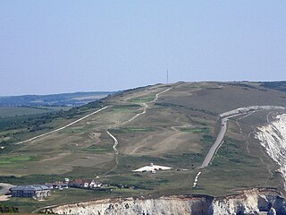
Cliffe Hill is a hill to the east of the town of Lewes in East Sussex, England. It is impressive on its western edge, where it looms over Lewes. Its summit is covered in a golf course. It is the second lowest Marilyn in England.
Also to be found on the hill is an obelisk known as Martyrs' Memorial commemorating the destruction of Lewes' monastery by Henry VIII and the burning of the 17 Protestantmartyrs known as the Lewes Martyrs in 1555–1557. The obelisk is located close the site where a bonfire was located in 1606 on the first anniversary of the discovery of the Gunpowder Plot.
A Bronze Agebarrow was located on the hill, and excavated in 1930 before being destroyed by quarrying. The barrow contained several cremations topped by a cairn of flints, and was roughly 15metres in diameter. Another long barrow is used as a hazard on one of the golf course holes.
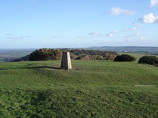
Although the summit is on the Lewes golf course, a public footpath runs along the southern flank of the hill, from which the golf course can readily be reached by any one of several stiles which are located on the course's southern boundary.
East Sussex is a ceremonial county in South East England. It is bordered by Kent to the north-east, West Sussex to the west, Surrey to the north-west, and the English Channel to the south. The largest settlement is the city of Brighton and Hove, and the county town is Lewes.
Brighton and Hove is a city and unitary authority area, ceremonially in East Sussex, England. There are multiple villages alongside the seaside resorts of Brighton and Hove in the district. It is administered by Brighton and Hove City Council, which is currently under Labour majority control.
Rodmell is a small village and civil parish in the Lewes District of East Sussex, England. It is located three miles (4.8 km) south-east of Lewes, on the Lewes to Newhaven road and six and a half miles from the City of Brighton & Hove and is situated by the west banks of the River Ouse. The village is served by Southease railway station, opened in 1906. The Prime Meridian passes just to the west of the village.
Mount Caburn is a 150-metre prominent landmark in East Sussex, England, about one mile (1.6 km) east of Lewes overlooking the village of Glynde. It is the highest part of an outlier of the South Downs, separated from the main range by Glynde Reach, a tributary of the River Ouse.
Cleeve Hill is the highest point both of the Cotswolds hill range and of the county of Gloucestershire, at 330 m (1,080 ft). It is located on Cleeve Common, which is a Site of Special Scientific Interest (SSSI) looked after by a small charity called Cleeve Common Trust. It commands a clear view to the west, over Cheltenham and the racecourse, over the River Severn and into Wales; and to the north over Winchcombe. It is a conspicuous outcrop on the edge of the limestone escarpment,. It is crossed by the Cotswold Way footpath.
Iford is a village and civil parish in the Lewes District of East Sussex, England. The village is located two miles (3.2 km) south of Lewes. The parish lies on the slopes of the South Downs in the valley of the River Ouse.
Newtimber is a small village and civil parish in the Mid Sussex District of West Sussex, England. It is located north-west of Brighton. The parish also includes the hamlet of Saddlescombe. The parish lies almost wholly with the South Downs National Park, with the exception of a small section of the parish north of the B2117 road. The planning authority for Newtimber is therefore the South Downs National Park Authority (SDNPA), the statutory planning authority for the National Park area. The downland scarp, which includes Newtimber Hill, Newtimber Holt, Saddlescombe chalk quarry and Summer Down, is mostly part of the Beeding Hill to Newtimber Hill, designated Site of Special Scientific Interest.
Pyecombe is a village and civil parish in the Mid Sussex District of West Sussex, England. Pyecombe is located 7 miles (11 km) to the north of Brighton. The civil parish covers an area of 887 hectares and has a population of 200, increasing at the 2011 Census to a population of 237.
Hollingbury is an area of the city of Brighton and Hove, East Sussex. The area sits high on a hillside across the north of the city, east of Patcham which lies in a valley to the west, Coldean in a valley to the east, and the A27 bypass forming the northern limit. To the south it blends into the leafy Surrenden area and the busy Fiveways local shopping area.
Roedean is a village in the city of Brighton and Hove, England, east of the seaside resort of Brighton.
Afton Down is a chalk down near the village of Freshwater on the Isle of Wight. Afton Down faces Compton Bay directly to the west, while Freshwater is approximately one mile north.
Wild Park is a 239.8-hectare (593-acre) Local Nature Reserve adjacent to Lewes Road in Brighton, East Sussex. It is owned and managed by Brighton and Hove City Council. It includes Hollingbury Castle, an Iron Age hillfort which is a Scheduled Monument, and Hollingbury Park golf course.
Balsdean is a deserted hamlet in a remote downland valley east of Brighton, East Sussex, England, on record since about 1100. It was formerly a chapelry of the parish of Rottingdean, and its territory touched that of the mother parish only at a single point. Despite its remoteness, it falls within the boundaries of the city of Brighton and Hove.
Afton is a hamlet just outside Freshwater on the west side of the Isle of Wight. It features a local hill known as Afton Down which was the site of the Isle of Wight Festival in 1970, one of the largest rock concerts to be held in the UK. Freshwater Bay Golf Course is located on Afton Down. Afton lends its name to a number of local properties, including Afton Lodge, Afton Manor and Afton Thatch, the latter two dating from the 17th Century.
Clayton to Offham Escarpment is a 422.5-hectare (1,044-acre) linear biological Site of Special Scientific Interest (SSSI) which runs from Clayton in West Sussex to Lewes in East Sussex. Its ownership and management is divided between over fifteen landowners and farmers. Parts of Ditchling's Downs, e.g. TQ 323 133, and the scarp between Blackcap and Mount Harry, e.g. TQ 378 124, are owned by the National Trust. What remains of Ditchling Tenantry Down common at Ditchling Beacon is leased to the Sussex Wildlife Trust.
Lewes Downs is a 165-hectare (410-acre) biological Site of Special Scientific Interest east of Lewes in East Sussex. It is a Nature Conservation Review site, Grade I and a Special Area of Conservation. Part of it is a national nature reserve, part is Malling Down nature reserve, which is managed by the Sussex Wildlife Trust, and part is Mount Caburn, an Iron Age hill fort which is a Scheduled Monument.
Blackcap is a hill and nature reserve in East Sussex, England. It is on a peak of the South Downs, just south east of Plumpton and west of Lewes. The flatter landscape is made up of open ground with chalk paths, surrounded by thickets. The steeper ground leading up to the ridge is low-density woodland. The top is more open, with patches of pine woodland and gorse bushes.
St George's Hill is a 964-acre (3.9 km2) private gated community in Weybridge, Surrey, United Kingdom. The estate has golf and tennis clubs, as well as approximately 420 houses. Land ownership is divided between homes with gardens, belonging to home owners, and the estate roads and verges belonging to its residents' association. The hill first served as a home and leisure location to celebrities and successful entrepreneurs on its division into lots in the 1910s and 1920s when Walter George Tarrant built its first homes. In a survey, most roads in the estate showed an average house sale price of over £5,500,000, with many properties selling for in excess of £15m and a handful selling for between £20m & £30m, meaning it is one of the most expensive and exclusive places to live in the UK and worldwide.
Priddy Nine Barrows Cemetery and Ashen Hill Barrow Cemetery are a collection of round barrows, dating from the Bronze Age, near Priddy in the English county of Somerset. They are designated as ancient monuments.
Lewes War Memorial is a war memorial at the top of School Hill in the centre of Lewes in East Sussex, prominently sited at the junction of High Street and Market Street. It commemorates 251 men from Lewes who died in the First World War, and 126 who died in the Second World War. It was unveiled in 1922 and became a listed building in 1985.
This page is based on this Wikipedia article Text is available under the CC BY-SA 4.0 license; additional terms may apply. Images, videos and audio are available under their respective licenses.