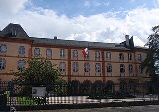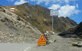
Col du Tourmalet is the highest paved mountain pass in the French Pyrenees, located in the department of Hautes-Pyrénées. Sainte-Marie-de-Campan is at the foot on the eastern side and the ski station La Mongie two-thirds of the way up. The village of Barèges lies on the western side, above the town of Luz-Saint-Sauveur.

Aneto is the highest mountain in the Pyrenees and in Aragon, and Spain's third-highest mountain, reaching a height of 3,404 metres (11,168 ft). It stands in the Spanish province of Huesca, the northernmost of all three Aragonese provinces, 4 miles south of the French border. It forms the southernmost part of the Maladeta massif. It is also still locally known as Pic de Néthou in French, that name and its variants having been in general use until the beginning of the 20th century.

Sare is a village in the traditional Basque province of Labourd, now a commune in the Pyrénées-Atlantiques department in south-western France on the border with Spain.

Arette is a commune in the Pyrénées-Atlantiques department in the Nouvelle-Aquitaine region of southwestern France. It is located in the arrondissement of Oloron-Sainte-Marie and is one of the six communes of the canton of Aramits: the other five being Ance, Aramits (commune), Féas, Issor, and Lanne-en-Barétous.

Moncayo is a 15 km long and about 7 km wide mountain massif giving name to the Tarazona y el Moncayo comarca, Aragon, Spain. The Moncayo's highest summit, San Miguel (2,314 m), is the highest point in the 500 km long Sistema Ibérico.

The Montcalm Massif is a mountain massif located in the Pyrenees, at the border between France and Spain, it has an altitude of 3077 metres above sea level.
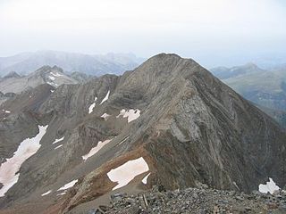
The Espadas Peak is a mountain on the Spanish side of the Pyrenees, in Grist, Sahún municipality, in the North of Ribagorza comarca, Aragon. This mountain is one of the highest in the Pyrenees.
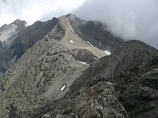
The Serre Mourene is a pyrenean summit, located on the Franco-Spanish border between the cirques of Troumouse and Barrosa, culminating at 3,090 m (10,140 ft); it is the second highest summit of the massif de la Munia after the pic de la Munia.

The Pic de la Munia culminating at 3,133 m (10,279 ft) is the highest point of the three cirques of Troumouse, Barroude and Barrosa. It is located on the border between France and Spain.
The Pic Schrader or Grand Batchimale is a central pyrenean summit, culminating at 3,177 m (10,423 ft), located for the most part in Spain. It buckles the vallée du Louron with its impressive silhouette

The Cerbillona, culminating at 3,247 m (10,653 ft) in the massif du Vignemale, constitutes the south-western high fringe of the glacier d'Ossoue with the Pic central and the Clot de la Hount. The Montferrat constitutes the southern fringe. The Pique longue is the highest summit of the massif and also of the French Pyrenees.

The pic Central is a pyrenean summit, culminating at 3,235 m (10,614 ft), located on the Franco-Spanish border in the massif du Vignemale, of which it constitutes the fourth highest peak.
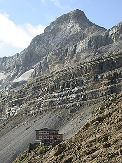
The Casque du Marboré, or Casque de Gavarnie or simply le Casque, is a pyrenean summit, culminating at 3,006 m (9,862 ft), located on the crest of three-thousanders in the Monte Perdido Range above Cirque de Gavarnie on the Franco-Spanish border.

Tour du Marboré or Tour de Gavarnie is a pyrenean summit, culminating at 3,009 m (9,872 ft), located on the Franco-Spanish border crest in the Monte Perdido Range.
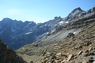
Épaule du Marboré is a pyrenean summit, culminating at 3,073 m (10,082 ft) in the Monte Perdido Range, marking the Franco-Spanish border. It lies on the Greenwich meridien.

La Pointe Chausenque, culminating at 3,204 m is a summit in the Massif du Vignemale in the French Pyrenees.
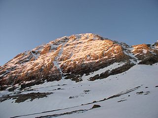
Pic du Taillon or Pico Taillón is a summit in the Pyrenees, culminating at 3,144 m (10,315 ft) on the Franco-Spanish border in the Monte Perdido Range.
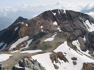
Pic de Montcalm is a French pyrenean summit, culminating at 3,077 m (10,095 ft), located in the Ariège department, Midi-Pyrénées region of France.


