
Clover Point is a waterfront adjacent park in Victoria, British Columbia. The park contains ten acres of land. [1]
Clover Point is a waterfront adjacent park in Victoria, British Columbia. The park contains ten acres of land. [1]
James Douglas named Clover Point after the red clover present in the landscape. [2] The specific species of clover present was likely Trifolium wormskioldii ; [3] the plant's rhizomes were an important food source for Indigenous peoples of the Pacific Northwest Coast. Clover was often prepared with Pacific silverweed, dried out, and pit cooked. Exact practices for traditional preparation varied between particular Indigenous peoples. [4] It is disputed whether Douglas named the area when he disembarked from the HMS Beaver or Cadboro. [5] Douglas wrote a letter to John McLoughlin describing Clover Point in 1842. [3]
Clover Point is referenced as a boundary marker in treaty negotiations between the Swengwhung people and the Hudson's Bay Company, with land east of the area being included as part of the treaty. [6] Douglas purchased land through a series of fourteen treaties while acting as an agent for the company. His intentions surrounding permanent ownership of the land may not have been fully understood. He asked those who signed to mark the paper with an X before receiving goods, which may have been misconstrued as a spiritual gesture. [7] He also did not take into account that various Indigenous peoples had overlapping shared use of certain areas. [8] Land within the James Bay Peninsula was purchased for 75 sterling pounds, which was a small portion of his total wealth. [6]


The clover that was originally present in Clover Point was eradicated and replaced with non-native grass. [3] From 1900 to 1930, public access to Clover's Point was prohibited. The military used it as the Clover Point Rifle Range. Access to Clover Point was restricted once again during World War II. [2] Trench warfare practice was conducted elsewhere near the waterfront. [9] In 1988, the Department of Defense transferred ownership of the property to the city. [3]
Since the 1970s, an underground sewage pumping centre has existed at Clover Point. [10] In 2016, heavy rainfall caused the station's equipment to fail and release accidental discharge. [11] That same year, Clover Point was rejected as a location for an additional plant. [12] Before 2020, the station only screened sewage before dumping the untreated wastewater directly into the ocean. [13] Mr. Floatie, a seven foot mascot depicting fecal matter, was retired once sewage treatment was implemented. [14]
In 2021, a redesign was planned by the city where half of the loop open to cars would be converted into a space for pedestrians. These proposed changes had an estimated cost of $275,000. [15] Similar changes were first proposed by a city councillor in 1992. [2] The COVID-19 pandemic resulted in a delay in the redesign's implementation. [16] The planned redesign included public washrooms, increased picnic space, a drinking fountain, and reduced parking spaces from 90 to 17. [1] Painting and "pavement play" features on the pedestrian side of the park were rejected by the city council as an unnessecary expense. [17] The redesign was criticized for its approach to accessibility by community advocates. [18] [19]

Victoria is the capital city of the Canadian province of British Columbia, on the southern tip of Vancouver Island off Canada's Pacific coast. The city has a population of 91,867, and the Greater Victoria area has a population of 397,237. The city of Victoria is the seventh most densely populated city in Canada with 4,406 inhabitants per square kilometre (11,410/sq mi).
Highway 1 is a provincial highway in British Columbia, Canada, that carries the main route of the Trans-Canada Highway (TCH). The highway is 1,047 kilometres (651 mi) long and connects Vancouver Island, the Greater Vancouver region in the Lower Mainland, and the Interior. It is the westernmost portion of the main TCH to be numbered "Highway 1", which continues through Western Canada and extends to the Manitoba–Ontario boundary. The section of Highway 1 in the Lower Mainland is the second-busiest freeway in Canada, after Ontario Highway 401 in Toronto.

Greater Victoria is located in British Columbia, Canada, on the southern tip of Vancouver Island. It is usually defined as the thirteen municipalities of the Capital Regional District (CRD) on Vancouver Island as well as some adjacent areas and nearby islands.
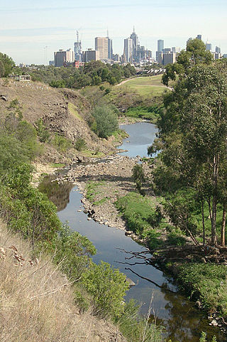
The Merri Creek is a waterway in southern parts of Victoria, Australia which flows through the northern suburbs of Melbourne. It begins near Wallan and flows south for 70 km until joining the Yarra River at Dights Falls. The area where the creek meets the river was traditionally the location for large gatherings of the Wurundjeri people and is suspected to have been the location for one of the earliest land treaties in Australia between Indigenous Australians and European settlers.

The Snuneymuxw First Nation is located in and around the city of Nanaimo on east-central Vancouver Island, British Columbia, Canada. The nation previously had also occupied territory along the Fraser River, in British Columbia.

Mount Douglas, usually referred to as Mount Doug by locals, is a prominent, 225 m (738 ft) hill in Saanich, British Columbia. It is located in (PKOLS) Mount Douglas Park in the municipality of Saanich.
Bamberton is an industrial site located on the Saanich Inlet, just south of Mill Bay, around 45 kilometres north of Victoria on Vancouver Island.
Beacon Hill Park is a 75 ha park located along the shore of Juan de Fuca Strait in Victoria, British Columbia. The park is popular both with tourists and locals, and contains a number of amenities including woodland and shoreline trails, two playgrounds, a waterpark, playing fields, a petting zoo, tennis and pickleball courts, many ponds, and landscaped gardens.

Cadboro Bay is a bay near the southern tip of Vancouver Island and its adjacent neighbourhood in the municipalities of Saanich and Oak Bay in Greater Victoria, British Columbia, Canada.
Fairfield is a neighbourhood of Victoria, British Columbia. It is bounded by the James Bay, Downtown, Harris Green, Fernwood, Rockland, and Gonzales neighbourhoods, and meets the Strait of Juan de Fuca to the south.

James Bay is a high density neighbourhood of Victoria, British Columbia, Canada. It is the oldest residential neighbourhood on the west coast of North America that is north of San Francisco. It occupies the south side of the Inner Harbour close to downtown. Access to the neighbourhood is along Belleville Street, Government Street, Douglas Street and Dallas Road.

The Western Treatment Plant is a 110 km2 (42 sq mi) sewage treatment plant in Cocoroc, Victoria, Australia, 30 km (19 mi) west of Melbourne's central business district, on the coast of Port Phillip Bay. It was completed in 1897 by the Melbourne and Metropolitan Board of Works (MMBW), and is currently operated by Melbourne Water. The plant's land is bordered by the Werribee River to the east, the Princes Freeway to the north, and Avalon Airport to the west. It forms part of the Port Phillip Bay and Bellarine Peninsula Ramsar Site as a wetland of international importance. The Western Treatment Plant treats around fifty percent of Melbourne's sewage — about 485 megalitres or 393 acre-feet per day — and generates almost 40,000 megalitres or 32,000 acre-feet of recycled water a year.

Victoria Harbour is a harbour, seaport, and seaplane airport in the Canadian city of Victoria, British Columbia. It serves as a cruise ship and ferry destination for tourists and visitors to the city and Vancouver Island. It is both a port of entry and an airport of entry for general aviation. Historically it was a shipbuilding and commercial fishing centre. While the Inner Harbour is fully within the City of Victoria, separating the city's downtown on its east side from the Victoria West neighbourhood, the Upper Harbour serves as the boundary between the City of Victoria and the district municipality of Esquimalt. The inner reaches are also bordered by the district of Saanich and the town of View Royal. Victoria is a federal "public harbour" as defined by Transport Canada. Several port facilities in the harbour are overseen and developed by the Greater Victoria Harbour Authority, however the harbour master's position is with Transport Canada.
Victoria Machinery Depot Ltd. was a historic metalworks and shipyard in Victoria, Canada.

A marine outfall is a pipeline or tunnel that discharges municipal or industrial wastewater, stormwater, combined sewer overflows (CSOs), cooling water, or brine effluents from water desalination plants to the sea. Usually they discharge under the sea's surface. In the case of municipal wastewater, effluent is often being discharged after having undergone no or only primary treatment, with the intention of using the assimilative capacity of the sea for further treatment. Submarine outfalls are common throughout the world and probably number in the thousands. The light intensity and salinity in natural sea water disinfects the wastewater to ocean outfall system significantly. More than 200 outfalls alone have been listed in a single international database maintained by the Institute for Hydromechanics at Karlsruhe University for the International Association of Hydraulic Engineering and Research (IAHR) / International Water Association (IWA) Committee on Marine Outfall Systems.
Harbour Solutions is a Canadian public infrastructure project in Halifax, Nova Scotia.

The Douglas Treaties, also known as the Vancouver Island Treaties or the Fort Victoria Treaties, were a series of treaties signed between certain indigenous groups on Vancouver Island and the Colony of Vancouver Island.
The Spit Nature Conservation Reserve is a 3-kilometer nature reserve on the north-western shore of Port Phillip, a large bay in Victoria, Australia. It consists of public land set aside to conserve and protect species, communities, and habitats of indigenous plants and animals. It is adjacent to the Werribee Sewage Farm and is managed by Parks Victoria.

Murray Rankin is a Canadian lawyer, politician and public law expert who serves as British Columbia's Minister of Indigenous Relations and Reconciliation. A member of the New Democratic Party, Rankin represents the riding of Oak Bay-Gordon Head in the Legislative Assembly of British Columbia. Rankin previously served as the federal Member of Parliament for Victoria from 2012 to 2019, with senior roles including Justice and Attorney General Critic, Health Critic, and NDP House Leader. From 2019 to 2020, Rankin was head of Canada's National Security and Intelligence Review Agency (NSIRA), overseeing all national security and intelligence activities carried out by the Government of Canada. Previously, he was a professor of law at the University of Victoria, where he taught environmental and administrative law.
The 1862 Pacific Northwest smallpox epidemic was a smallpox outbreak that started in Victoria on Vancouver Island and spread among the indigenous peoples of the Pacific Northwest Coast and into the indigenous peoples of the Northwest Plateau, killing a large portion of natives from the Puget Sound region to Southeast Alaska. Two-thirds of British Columbia natives died—around 20,000 people. The death rate was highest in southeast Alaska and Haida Gwaii—over 70% among the Haida and 60% among the Tlingit. Almost all native nations along the coast, and many in the interior, were devastated, with a death rate of over 50% for the entire coast from Puget Sound to Sitka, Alaska, part of Russian America at the time. In some areas the native population fell by as much as 90%. The disease was controlled among colonists in 1862 but it continued to spread among natives through 1863.