
Ponda (Portuguese: Pondá, is a city and a municipal council in the South Goa district of Goa, India. Located in the central area of Goa, Ponda lies 28 km southeast of Panaji, the capital of Goa and 17 km northeast of Margao, the district headquarters. Ponda is also known as "Antruz Mahal" because of the presence of numerous famous temples and rich cultural heritage.
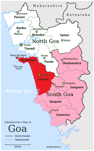
South Goa district is one of two districts that compose the state of Goa, India, within the region known as the Konkan. It is bounded by North Goa district to the north, the Uttara Kannada district of Karnataka state to the east and south, while the Arabian Sea forms its western coast.
Sattari is a taluka of North Goa district in the state of Goa, India. There are 77 villages and 2 towns in Sattari Taluka. The headquarters of Sattari taluka is Valpoi municipal council. It lies in the north-eastern region of Goa where it is known for its greenery and dense forest. Part of the Western Ghats forms the eastern part of the Sattari Taluka. The Mandovi River is considered to be the lifeline of Sattari. It has a geographical area of 490 km2; the Mhadei Wildlife Sanctuary covers 208 km2 of this area.

Pondataluka is a subdivision of the district of South Goa, Goa state, India. Its administrative headquarters is the township of Ponda.
Surla is a village in the Bicholim taluka (sub-district) of Goa, India, situated 27 km (17 mi) from the state capital at Panaji. It is bordered by Ponda taluka in its south, by the rest of Bicholim taluka on its west, by Tiswadi taluka to part of its west, and by another village of Bicholim taluka, Navelim towards its northern side.
Usgao is a village in Ponda taluka, North Goa district, India.
Volvoi is a village in Ponda taluka, Goa, India.
Velinga or Veling is a village in Ponda taluka, Goa. The panchayat area it is part of consists of famous temples, including the Lord Manguesh Temple. The main occupation in the area is agriculture, horticulture, and homestead system of gardening (kulagars). In the village panchayat, there are some 35 water springs.
Betqui or Betki is a village in the Ponda taluka (sub-district) of Goa.
Betora or Bethora is a village in the Ponda taluka (sub-district) of Goa. It is part of the Betora-Nirancal village panchayat and is surrounded by Khandepar and Kurti villages. This area is a predominantly agricultural area of Goa.
Boma is a village in the Ponda taluka (sub-district) of Goa. It is located in the northern part of Ponda taluka. It is on the road connecting state capital Panjim with the taluka headquarters of Ponda town.
Conxem is a village in the Ponda taluka (sub-district) of Goa, India.
Cundaim (Kundaim) is a village in the Ponda taluka (sub-district) of Goa.
Durbhat is a village in the Ponda taluka (sub-district) of Goa.
Nirancal is a village in the Ponda taluka (sub-district) of Goa, India.
Ponchavadi (Panchwadi) is a village in the Ponda taluka (sub-district) of Goa. It is located between Five (Panch) Water Stream Valleys (Wadi). The Five Wadis are at 1) Vazangal-Ximer, 2) Miraxiwado-Amblai, 3) Posrebhat-Muxer, 4) Bhimtoli-Vizor, 5) Badegal-Mapa. It is bordered between Shiroda in the west, Curchorem in the east, River Zuari in the South and hills in the north. It is famous for the Moisal Dam
Telaulim is a village in the Ponda taluka (sub-district) of Goa.
Tivrem is a village in the Ponda taluka (sub-district) of Goa, India.
Vagurbem is a village in the Ponda taluka (sub-district) of Goa, India.
Vadi is a village in the Ponda taluka (sub-district) of Goa.