Antigua and Barbuda is a sovereign archipelagic country in the Caribbean. It lies at the conjuncture of the Caribbean Sea and the Atlantic Ocean in the Leeward Islands part of the Lesser Antilles.

Barbuda is an island and dependency located in the eastern Caribbean forming part of the twin-island state of Antigua and Barbuda as an autonomous entity. Barbuda is located approximately 30 miles (48 km) north of Antigua. The only settlements on the island are Codrington and its surrounding localities. Barbuda is a flat island with the western portion being dominated by Codrington Lagoon, and the eastern portion being dominated by the elevated plateau of the Barbuda Highlands, with salty ponds and scrubland spread throughout the island. The climate is classified as tropical marine.

The Caroni Swamp is the largest mangrove wetland in Trinidad and Tobago. It is located on the west coast of Trinidad, south of Port of Spain and northwest of Chaguanas, where the Caroni River meets the Gulf of Paria.

Codrington is the only village on the island of Barbuda, which is part of the country of Antigua and Barbuda. Codrington coincides with the Codrington major division, one of the two major divisions on Barbuda. Situated on the Codrington Lagoon, Codrington is the country's northernmost settlement. The population of Codrington was 796 in 2011.

The least tern is a species of tern that breeds in North America and locally in northern South America. It is closely related to, and was formerly often considered conspecific with, the little tern of the Old World. Other close relatives include the yellow-billed tern and Peruvian tern, both from South America.

The Barbuda warbler is a species of bird in the family Parulidae. It is endemic to the island of Barbuda in Antigua and Barbuda. Its natural habitat is tropical dry shrubland near wetland areas. It is threatened by habitat loss. It once was considered a subspecies of the Adelaide's warbler. In September 2017, the warbler's habitat was massively damaged by Hurricane Irma. Despite this, the species was found to have survived the storm and its aftermath, and later surveys have indicated that the species was not significantly affected by the hurricane. However, it is still threatened by unplanned housing development, garbage dumping, and poor land-use practices.
Whooping Crane Summer Range is a 16,895-km2 wetland complex in the boreal forests of northern Alberta and southwestern Northwest Territories in Canada. It is the only natural nesting habitat for the endangered whooping crane. On May 24, 1982, it was designated a Ramsar wetland of international importance, one of two such sites in Wood Buffalo National Park. It is owned by the government of Canada, and is administered by Parks Canada with some input from Indian and Northern Affairs Canada. Encompassing the northeastern portion of Wood Buffalo National Park, about 2,300 km2 (14%) of the wetland is external to the park, on Crown land in the Northwest Territories. It is also classified an Important Bird Area.

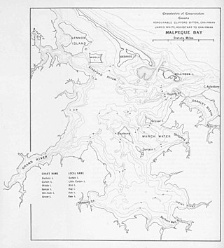
Malpeque Bay is a 204 km2 (79 sq mi) estuarine bay on the north shore of Prince Edward Island, Canada.

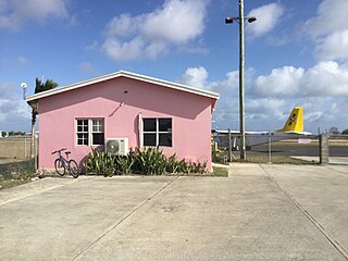
Barbuda Codrington Airport was a public airport serving the village of Codrington, on the island of Barbuda. Its runway is only 500 metres long, only sufficient for STOL or very light aeroplanes.

Antigua and Barbuda lie in the eastern arc of the Leeward Islands of the Lesser Antilles, separating the Atlantic Ocean from the Caribbean Sea. Antigua is 650 km (400 mi) southeast of Puerto Rico; Barbuda lies 48 km (30 mi) due north of Antigua, and the uninhabited island of Redonda is 56 km (35 mi) southwest of Antigua.
Akyatan Lagoon is a 14700-hectare wetland ecosystem that is designated as Wetland of International Importance by Ramsar Convention. A major stopover for migrating birds, Akyatan is recognized as an Important Bird Area by BirdLife International. It is the single largest green turtle rookery at the Mediterranean, holding 43% of the Mediterranean nesting population.
Crooked Tree Wild Life Sanctuary (CTWS) is a protected area in Belize. The main goal of the sanctuary is to protect the area for the thousands of waterbirds that migrate to and through it every year.

Logan Lagoon is a 2172 ha wetland Conservation Area on Flinders Island, the largest of the Furneaux Group at the eastern end of Bass Strait, which is part of the Australian state of Tasmania.

Booby Pond Nature Reserve is a protected wetland on Little Cayman, one of the Cayman Islands, a British Overseas Territory in the Caribbean Sea.

Hurricane Irma was an extremely powerful and devastating tropical cyclone that was the first Category 5 hurricane to strike the Leeward Islands on record, followed by Maria two weeks later. At the time, it was considered the most powerful hurricane on record in the open Atlantic region, outside of the Caribbean Sea and Gulf of Mexico, until it was surpassed by Hurricane Dorian two years later. It was also the third-strongest Atlantic hurricane at landfall ever recorded, just behind the 1935 Labor Day Hurricane and Dorian. The ninth named storm, fourth hurricane, second major hurricane, and first Category 5 hurricane of the extremely active 2017 Atlantic hurricane season, Irma caused widespread and catastrophic damage throughout its long lifetime, particularly in the northeastern Caribbean and the Florida Keys. It was also the most intense hurricane to strike the continental United States since Katrina in 2005, the first major hurricane to make landfall in Florida since Wilma in the same year, and the first Category 4 hurricane to strike the state since Charley in 2004. The word Irmageddon was coined soon after the hurricane to describe the damage caused by the hurricane.

The Albanian Adriatic Sea Coast stretches in the south-eastern Adriatic Sea beginning at the Gulf of Drin in the north, across the port cities of Shëngjin, Durrës, and Vlorë, to the Bay of Vlorë in the south, where the Albanian Riviera and the Albanian Ionian Sea Coast begin.

Yum Balam Flora and Fauna Protection Area is a Mexican Flora and Fauna Protection Area located in the state of Quintana Roo in southeastern Mexico. Established in 1994, the nature reserve was the first protected area in Mexico to be created at the request of local communities. The reserve includes wetlands along the north shore of the Yucatán Peninsula and adjacent Isla Holbox and has been designated as a protected Ramsar site since 2004.

Lower Dniester National Nature Park covers a large portion of the Dniester River Estuary where it enters the Black Sea in southwestern Ukraine. The floodplains and waterways are important to nesting and wintering waterfowl. They are also important for spawning fish: over 70 species of fish in 20 groups are recorded in the park. The boundaries include two Ramsar wetland sites of international importance. The park is about 30 km west of the city of Odesa, in Bilhorod-Dnistrovskyi and Odesa Raions in Odesa Oblast.

Squatting in the island country of Antigua and Barbuda in the West Indies is the occupation of unused land or derelict buildings without the permission of the owner. Historically, native Barbudans were seen as squatters and after Hurricane Irma in 2017, Prime Minister Gaston Browne offered people he termed squatters the chance to buy their land.

Hurricane Irma caused severe damage and destruction in the Lesser Antilles.


