
The Brienzer Rothorn is a mountain of the Emmental Alps, in Switzerland. With an elevation of 2,350 metres (7,710 ft) above sea level, the Brienzer Rothorn is the highest summit of the range. To its west lies the Tannhorn, whilst to its east are Arnihaaggen, Höch Gumme and the Brünig Pass. On its south side it overlooks Lake Brienz, whilst to the north it looks out over the Waldemme valley.
Jaun Pass is a high mountain pass in the Swiss Alps linking Charmey and Jaun in the canton of Fribourg with Reidenbach in the canton of Bern. The pass itself is located within the canton of Berne.

Col du Pillon is a mountain pass in the western Swiss Alps, linking Aigle, Le Sépey and Les Diablerets in the canton of Vaud with Gstaad in the canton of Berne. The pass itself is located within the canton of Vaud, approximately one kilometre from the border with Berne. Col du Pillon is overlooked by the Diablerets and at the pass is located the lower station of the Scex Rouge cable car.

Col des Mosses is a mountain pass in the western Bernese Alps of Switzerland. The pass is located in the municipality of Ormont-Dessous in the canton of Vaud. It links Aigle, to the south in the valley of the Rhone, with Château-d'Œx, to the north in the valley of the Sarine, and is flanked to the west by the Mont d'Or and to the east by the Pic Chaussy.

Col de l'Aiguillon is a Swiss pass in the Jura Mountains in the canton of Vaud.

Col des Montets is a mountain pass in the French Alps in the Haute-Savoie department of France. It is on the road between Chamonix, the Swiss Col de la Forclaz and Martigny in the canton of Valais, Switzerland.

Col de la Givrine is a high mountain pass in the Jura Mountains in the canton of Vaud in Switzerland, near the border with France.

Col des Roches is a mountain pass in the Jura Mountains on the border between the canton of Neuchâtel in Switzerland and France.

Col du Marchairuz is a high mountain pass in the Jura Mountains in the canton of Vaud in Switzerland.

The Dammastock is the highest mountain in the Urner Alps in Switzerland and is part of the Winterberg massif. Its summit ridge forms the border between the cantons of Uri and the Valais. It is the highest summit in the canton of Uri. The tripoint between the cantons of Bern, Valais and Uri lies near the Eggstock, north of the Dammastock. Politically, the Dammastock is split between the municipalities of Göschenen (Uri) and Obergoms (Valais).

Piz Segnas is a mountain in the Glarus Alps, located on the border between the cantons of Glarus and Graubünden. Piz Sardona is on the same ridge to the north, from where the Trinserhorn or Piz Dolf lies to the southeast. The Tschingelhoerner with the famous Martinsloch lies to the west, with the Pass dil Segnas between the two mountains.

The Gummfluh is a mountain in the western Bernese Alps, located on the border between the Swiss cantons of Vaud and Berne. It is the highest peak in the chain of mountains on the south side of the Pays d'Enhaut and it lies approximately halfway between Château d'Oex and Gstaad. The northern slopes form part of the large nature reserve of La Pierreuse.
The Wittenberghorn is a mountain of the Bernese Alps, located on the border between the Swiss cantons of Vaud and Bern. It lies approximately halfway between L'Etivaz (Vaud) and Feutersoey (Bern), south of the Col de Jable.

Val Ferret is the name shared by two valleys separated by the Col Ferret, a pass on the border between Italy and Switzerland. The valleys lie southeast of Mont Blanc Massif. The Swiss valley drains northeast towards Orsières and on into the Rhône basin; whereas the Italian valley drains southwest towards Courmayeur and on into the Po basin.

The Pas de Cheville is a high mountain pass across the Vaud Alps, connecting Gryon in the canton of Vaud in Switzerland and Derborence in the canton of Valais.

Sanetsch Pass is a high mountain pass in Switzerland across the western Bernese Alps, connecting Gsteig in the canton of Bern and Sion in the canton of Valais. Although a road leads to the pass from Sion and goes further to the Lac de Sanetsch, it can not be completely traversed by car. In the summer season the pass is accessible by PostBus and can also be traversed by cable car. The highest point of the road is at 2,252 metres.
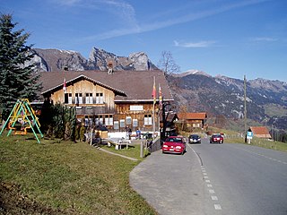
The Col de Jaman is a mountain pass in the western Swiss Alps, connecting Montreux in the canton of Vaud to Montbovon in the canton of Fribourg. The pass itself, overlooked by the Dent de Jaman, is located within the canton of Vaud, the border with the canton of Fribourg running one kilometre east.

The Col de Balme is a high mountain pass of the Alps, located on the border between Switzerland and France. It connects Trient in the Swiss canton of Valais to Argentière in the French department of Haute-Savoie. The pass lies between the summits of Tête de Balme and Les Grandes Otanes.
The Col de Crête Sèche is a mountain pass in the Alps, located between Switzerland and Italy. It lies at a height of 2,896 metres (9,501 ft) above sea level, between the massifs of Mont Gelé and Bec d'Epicoune, in the Pennine Alps. It connects Fionnay in the Swiss canton of Valais on its northern side to Bionaz in the Italian region of the Aosta Valley on its southern side. The Col de Crête Sèche is the second-lowest pass between the valleys of Bagnes and Valpelline, after the Fenêtre de Durand which lies about one hundred metres lower west of Mont Gelé.
