Savoie is a department in the Auvergne-Rhône-Alpes region, Southeastern France. Located in the French Alps, its prefecture is Chambéry. In 2019, Savoie had a population of 436,434.

The French Alps are the portions of the Alps mountain range that stand within France, located in the Auvergne-Rhône-Alpes and Provence-Alpes-Côte d'Azur regions. While some of the ranges of the French Alps are entirely in France, others, such as the Mont Blanc massif, are shared with Switzerland and Italy.
L'Étape du Tour de France is an organised mass participation cyclosportive that allows amateur cyclists to race over the same route as a Tour de France stage. First held in 1993, and now organised by the Amaury Sport Organisation (ASO), it takes place each July, normally on a Tour rest day.

Mont Cenis is a massif in Savoie (France), which forms the limit between the Cottian and Graian Alps.

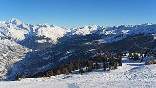
The Aravis is a mountain range in Savoie and Haute-Savoie, eastern France. It is part of the French Prealps, a lower chain of mountain ranges west of the main chain of the Alps. Its highest summit is the Pointe Percée, at 2753m. The orientation of the Aravis is north–south, and it stretches from Cluses in the north, to Ugine in the south. The Bornes massif, sometimes considered part of the Aravis, lies to its west. The Aravis is separated from the Chablais mountains in the north-east by the Arve river valley, and from the Graian Alps in the south-east by the Arly river valley.

Col du Glandon is a high mountain pass in the Dauphiné Alps in Savoie, France, linking Le Bourg-d'Oisans to La Chambre. It is situated between the Belledonne, Grandes Rousses and Arvan-Villards mountain ranges, west of the Col de la Croix de Fer. The road over the Col du Glandon was opened in 1898, although it was not linked to the Col de la Croix de Fer until 1912.
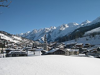
La Clusaz is a commune in the Haute-Savoie department in the Auvergne-Rhône-Alpes region in south-eastern France.

Col des Montets is a mountain pass in the French Alps in the Haute-Savoie department of France. It is on the road between Chamonix, the Swiss Col de la Forclaz and Martigny in the canton of Valais, Switzerland.

Col de la Colombière is a mountain pass in the Alps in the department of Haute-Savoie in France.

Col de la Madeleine is a high mountain pass in the Alps in the department of Savoie in France which connects La Chambre in Maurienne with La Léchère in Tarentaise. The pass is closed from November to the beginning of June. It has been described as "beautiful, but heartbreaking".

Col de la Ramaz is a high mountain pass in the Alps in the department of Haute-Savoie in France through which the Tour de France passed during 2003, 2010, 2016 and the 2023 race). The road through the pass culminates slightly higher, at 1619m.

Col des Saisies is a mountain pass in the Alps in the department of Savoie in France.

Le Grand-Bornand is a commune in the eastern French department of Haute-Savoie. The commune is a ski resort and takes its name from the river that runs through it. The inhabitants of Le Grand-Bornand are called Bornandins.

Corbel is a commune in the Savoie department in the Auvergne-Rhône-Alpes region in south-eastern France. It borders the department of Isère.

Saint-Sorlin-d'Arves is a commune in the Savoie department in the Auvergne-Rhône-Alpes region in south-eastern France.

Le Reposoir is a commune in the Haute-Savoie department in the Auvergne-Rhône-Alpes region in south-eastern France.
The Bornes massif are a mountainous massif in the north French Prealps in the department of Haute-Savoie. It has 20 peaks higher than 2000 m and is a popular destination for winter sports. The Massif is the source of the celebrated cheese Reblochon.

The Col de la Croix Fry is a mountain pass located in the Chaîne des Aravis, between Manigod and La Clusaz in the Haute-Savoie department of France. The road over the col is used occasionally by the Tour de France cycle race with the tour crossing the pass on Stage 19 of the 2013 Tour. At the summit is the village of La Croix Fry.

Col de l'Épine is a paved mountain pass in the Aravis range in the Alps. Located in the department of the Haute-Savoie, it connects Marlens to Serraval. It is reached and crossed by the route départementale D16 local road.


