Saint-Jean-de-Maurienne (French pronunciation: [sɛ̃ʒɑ̃dəmɔʁjɛn] ; Arpitan : Sent-Jian-de-Môrièna or Sant-Jian-de-Môrièna; Italian : San Giovanni di Moriana) is a subprefecture of the Savoie department, in the region of Auvergne-Rhône-Alpes (formerly Rhône-Alpes), in southeastern France.
It lies in the Maurienne, the valley of the river Arc. It was also an Episcopal See of Savoy during the Ancien Régime and again from 1825 to 1966. Its original name was simply Maurienne, or Moriana in Italian and Latin.
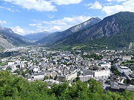
Saint-Jean-de-Maurienne is located at the confluence of the Arc, a river which has shaped the Maurienne Valley, and the Arvan which descends the Arves Valley (Col de la Croix de Fer).
The neighbouring communes of Saint-Jean-de-Maurienne are Saint-Julien-Mont-Denis, Jarrier, Hermillon, Villargondran, Albiez-le-Jeune, Albiez-Montrond, Saint-Pancrace and Pontamafrey-Montpascal.
Saint-Jean-de-Maurienne is close to Albertville (59 km), Chambery (72 km), Grenoble (103 km), Turin (137 km) and Lyon (174 km).
The climate is the alpine type because of the presence of the Alpine Massif.
City | Sunshine | Rain | Snow | Storm | Fog |
---|---|---|---|---|---|
Paris | 1797 hrs/yr | 642 mm (25.3 in)/yr | 15 days/yr | 19 days/yr | 13 days/yr |
Nice | 2694 hrs/yr | 767 mm (30.2 in)/yr | 1 day/yr | 31 days/yr | 1 day/yr |
Strasbourg | 1637 hrs/yr | 610 mm (24 in)/yr | 30 days/yr | 29 days/yr | 65 days/yr |
Saint-Jean-de-Maurienne | 1970 hrs/yr | 960 mm (38 in)/yr | ... days/yr | ... days/yr | ... days/yr |
National average | 1973 hrs/yr | 770 mm (30 in)/yr | 14 days/yr | 22 days/yr | 40 days/yr |
Climate data for Saint-Jean-de-Maurienne (1991−2020 normals, extremes 1983−2020) | |||||||||||||
---|---|---|---|---|---|---|---|---|---|---|---|---|---|
Month | Jan | Feb | Mar | Apr | May | Jun | Jul | Aug | Sep | Oct | Nov | Dec | Year |
Record high °C (°F) | 19.1 (66.4) | 22.2 (72.0) | 25.8 (78.4) | 30.0 (86.0) | 33.2 (91.8) | 37.0 (98.6) | 39.5 (103.1) | 39.0 (102.2) | 32.1 (89.8) | 29.9 (85.8) | 23.9 (75.0) | 21.1 (70.0) | 39.5 (103.1) |
Mean daily maximum °C (°F) | 5.9 (42.6) | 8.2 (46.8) | 13.8 (56.8) | 17.7 (63.9) | 21.4 (70.5) | 25.0 (77.0) | 27.4 (81.3) | 27.0 (80.6) | 22.1 (71.8) | 16.9 (62.4) | 10.4 (50.7) | 6.1 (43.0) | 16.8 (62.2) |
Daily mean °C (°F) | 2.0 (35.6) | 3.6 (38.5) | 8.2 (46.8) | 11.7 (53.1) | 15.4 (59.7) | 19.0 (66.2) | 21.1 (70.0) | 20.7 (69.3) | 16.5 (61.7) | 11.9 (53.4) | 6.3 (43.3) | 2.5 (36.5) | 11.6 (52.9) |
Mean daily minimum °C (°F) | −1.9 (28.6) | −1.1 (30.0) | 2.5 (36.5) | 5.7 (42.3) | 9.5 (49.1) | 12.9 (55.2) | 14.8 (58.6) | 14.5 (58.1) | 10.9 (51.6) | 7.0 (44.6) | 2.2 (36.0) | −1.1 (30.0) | 6.3 (43.3) |
Record low °C (°F) | −18.2 (−0.8) | −14.4 (6.1) | −10.0 (14.0) | −4.7 (23.5) | −0.2 (31.6) | 1.2 (34.2) | 6.0 (42.8) | 3.7 (38.7) | 1.0 (33.8) | −3.9 (25.0) | −9.3 (15.3) | −13.2 (8.2) | −18.2 (−0.8) |
Average precipitation mm (inches) | 91.1 (3.59) | 66.4 (2.61) | 70.3 (2.77) | 61.0 (2.40) | 81.0 (3.19) | 69.7 (2.74) | 67.5 (2.66) | 75.1 (2.96) | 62.9 (2.48) | 76.8 (3.02) | 87.6 (3.45) | 101.5 (4.00) | 910.9 (35.86) |
Average precipitation days (≥ 1.0 mm) | 8.9 | 8.0 | 8.4 | 9.0 | 11.8 | 10.8 | 9.1 | 9.4 | 8.3 | 9.8 | 9.7 | 9.9 | 113.1 |
Source: Météo-France [3] |
Saint-Jean-de-Maurienne is on the route of the future Lyon-Turin rail link. Homes, businesses, the current railway station and the rescue centre are affected by the project. The Lyon Turin Railway company (LTF) which manages the construction projects plans to build new railway station in the Sous-le-Bourg neighborhood, serving both the historic line and the new Lyon-Turin line. Geological and topographical investigations are underway. The project promises to be even more complex than that of the Channel Tunnel.
The town of Saint-Jean-de-Maurienne is equipped with a network of public transport run by the Communauté de communes Cœur de Maurienne . [4]
A heliport is available for the helicopter of the gendarmerie whose base is located in Modane.
La Bastille, Les Chaudannes and Les Clapeys are the three main quarters.
The total number of dwellings in the commune is 4,240. [5] Among such housing, 87.9% are principal residences, 5.4% are secondary homes and 6.7% are vacant dwellings. These accommodations have a share of 17.5% as individual houses, 79.3% as apartments and finally only 3.2% as dwellings of another type. The number of residents who own their homes is 37.9%. [5] This is lower than the national average which adds up to nearly 55.3%. The number of tenants is 56.7% throughout the housing which is higher than the national average of 39.8%. [5] It may be noted also that 5.4% of the inhabitants of the commune are people who are housed for free while at the level of the whole of the France the percentage is 4.9%. Still on all of the municipality housing, 3.5% are studios, 11.5% are two-room housing, 28.4% have three, 34.5% of dwellings have four rooms, and 22.1% of dwellings have five rooms or more. [5]
This section needs expansion. You can help by adding to it. (May 2015) |
The locality named is after John the Baptist, the precursor, son of Zechariah and Saint Elizabeth, cousin of Jesus, beheaded in 31 AD at the request of the Princess Salome.
The Latin name is Mauriana.
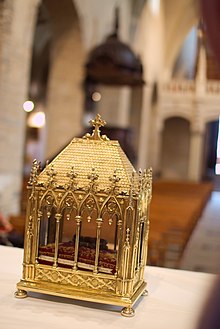
Saint-Jean-de-Maurienne has been the capital of the Maurienne Valley since the 6th century. After Saint Thècle reported from Alexandria (Egypt) the relics of St. John the Baptist, which are the three fingers represented on the arms of the city, as well as on the Opinel knife blades, the town was raised to the rank of diocese by Guntram, grandson of Clovis I.
In 753, Grifo went to Italy to join the King of the Lombards, Aistulf, the most powerful opponent of his half-brother, the King of the Franks, Pepin the Short, but he was killed at Saint-Jean-de-Maurienne by the men of Pepin.
The oldest possessions of the Counts of Savoy were the counties of Maurienne, Savoy proper (the district between Arc, Isère, and the middle course of the Rhone), and Belley, with Bugey as its chief town.
The Duchy of Savoy, which had been a French-speaking province under the sovereignty of the Kingdom of Sardinia-Piedmont, was invaded by Revolutionary France, but restored to Piedmont in 1815. It became part of France in 1859, after the Second Italian War of Independence.
The Aix-les-Bains—Saint-Jean-de-Maurienne railway opened in 1857. [6]
In the early 1900s, the technological advances of Swiss hydroelectric power were originally the subject of intense stock market speculation on hydroelectric companies, which benefitted the Maurienne Valley with industrial facilities, and tourism took off.
The city of Saint-Jean-de-Maurienne is a sub-prefecture of Savoie. It is the seat of the arrondissement of Saint-Jean-de-Maurienne, the canton of Saint-Jean-de-Maurienne and the Communauté de communes Cœur de Maurienne Arvan . [7] [8]
The city of Saint-Jean-de-Maurienne is part of Savoie's 3rd constituency.
Traditionally, Saint-Jean-de-Maurienne has been a stronghold of the Socialist left from the 1930s because of the importance of its worker labor pool. Thus, Roland Merloz was the Socialist mayor from 1977 to 2008. But since the 1990s and sociological changes in the Maurienne (departure of factories, multiplication of tourist resorts, decrease of the population with an increase in representation of the elderly), the right-wing vote has increased. A UMP Councillor General, Pierre-Marie Charvoz, was elected in 2001, Nicolas Sarkozy was in the lead in the two rounds of the presidential elections of 2007, with respectively 33.5% and 56.62%, and in 2008, Pierre-Marie Charvoz won the communal elections.
The city council of Saint-Jean-de-Maurienne has 29 members. It is composed of a mayor, seven assistants, four delegate councillors and seventeen councillors.
Roland Merloz, mayor of the city since 1977, announced his desire not to stand in 2008.
The following is the share of seats in the municipal council of Saint Jean de Maurienne:
Party | Main candidate | Seats | Status | ||
---|---|---|---|---|---|
UMP | Pierre-Marie Charvoz | 23 | Majority | ||
Union of the Left | Hervé Bottino | 6 | Opposition |
In the municipal elections of March 2008, turnout of the first round was 65.46% with a total of 5,310 people registered to vote in the commune. The number of voters amounted to 3,476 voters which 3,393 expressed themselves. In the first round, the presidential majority list of Ensemble pour Saint Jean [Together for Sain Jean] with its head, Pierre-Marie Charvoz collected 46.95% of the vote or 1,593 votes. Followed by the list of "Saint Jean 10,000" led by Hervé Bottino, having received 34.39% of the vote or 1,169 votes. In third position, Saint Jean à venir [Saint Jean to come] list, headed by Christine Merlin got 13.26% of the votes or 450 votes. Finally the list Vivons Saint Jean [Live Saint Jean], led by Florence Arnoux Le Bras got 5.39% or 183 votes.
In the second round, the turnout was 68.57%. The number of voters amounted to 3,642 voters with 3,509 expressing themselves. In the second round, the presidential majority list of Ensemble pour Saint Jean with its head, Pierre-Marie Charvoz collected 55.40% of the vote or 1,944 votes and won 23 seats. The list of "Saint Jean 10 000" conducted by Hervé Bottino, received 44.60% of the vote or 1,565 votes and was therefore awarded 6 seats. The other lists were not present in the second round.
Start | End | Name | Party | Other details |
---|---|---|---|---|
1860 | 1862 | Cyrille Richard | ... | Mayor |
1862 | 1865 | Antoine Mottard | ... | Mayor |
1865 | 1870 | Cyrille Richard | ... | Mayor |
1870 | 1870 | Alexis Magnin | ... | Provisional mayor |
1870 | 1874 | Maurice Petit | ... | Mayor |
1874 | 1876 | Cyrille Richard | ... | Mayor |
1876 | 1881 | Ignace Deleglise | ... | Mayor |
1881 | 1904 | Florimond Truchet | ... | Mayor |
1904 | 1911 | Joseph Vuillermet | ... | Mayor |
1911 | 1912 | Charles Bonnivard | ... | Mayor |
1912 | 1935 | Henri Falcoz | ... | Mayor, député |
1935 | 1938 | Alphonse Thibieroz | ... | Mayor |
1938 | 1943 | Jean-Pierre Bouttaz | ... | Mayor |
1943 | 1944 | Guido Fodéré | ... | Mayor |
1944 | 1945 | Georges Beaufils | ... | Mayor |
1945 | 1953 | Florimond Girard | UNR | Conseiller général, député |
1953 | 1971 | Samuel Pasquier | UNR | Mayor |
1971 | 1977 | Charles Gubian | UNR | Mayor |
1977 | 2008 | Roland Merloz | PS | Conseiller général |
2008 | 2020 | Pierre-Marie Charvoz | UMP then UDI | Mayor/Conseiller général |
2020 | In progress | Philippe Rollet | ... | Mayor |
Saint-Jean-de-Maurienne is twinned with: [9]
|
|
| ||||||||||||||||||||||||||||||||||||||||||||||||||||||||||||||||||||||||||||||||||||||||||||||||||||||||||||
From 1962 to 1999: Population without double counting; for the years following: municipal population. Source: EHESS [10] and INSEE [11] |
The population structure of the commune of Saint-Jean-de-Maurienne in 2017: [12]
Population by age group and gender | |||||||||||||||||||||||||||||||||||||||||||||||||||||||||||||||||||||||||||||||||||||||
| Total: 7744
| ||||||||||||||||||||||||||||||||||||||||||||||||||||||||||||||||||||||||||||||||||||||
Source: INSEE |
The total number of households in Saint-Jean-de-Maurienne is 3,729. These households are not all equal in numbers of individuals. Some of these households contain one, others two, three, four, five or even more than six people. Here, below, is the data as a percentage of the distribution of these households, compared to the total number of households.
Households of: | 1 person | 2 people | 3 people | 4 people | 5 people | 6+ people |
---|---|---|---|---|---|---|
Saint-Jean-de-Maurienne | 32.9% | 31.8% | 16.8% | 13.4% | 3.5% | 1.6% |
National average | 31% | 31.1% | 16.2% | 13.8% | 5.5% | 2.4% |
Data sources: INSEE [13] |
Kindergartens:
Primary schools:
Collèges:
High schools:
This section needs expansion. You can help by adding to it. (May 2015) |
Saint-Jean-de-Maurienne is located close to some of the major Alpine passes, and of the Les Sybelles ski area and the Vanoise National Park. Activities are available for nature and sports enthusiasts, both hikers and cyclists, as well as skiers. Saint-Jean-de-Maurienne provides access to the Croix-de-Fer, the Télégraphe, the Lautaret, the Grand Cucheron, the Madeleine, the Glandon, the Iseran, Mont Cenis and the Galibier mountain passes. The city regularly hosts major cycling races such as the Tour de France or the Critérium du Dauphiné. The Tour de France came to the commune during the 2006, 2010, and 2012 races. The 2015 Tour de France had a stage finish in the commune on 23 July, at the end of stage 18. The following day, it was the departure point for stage 19. Saint-Jean-de-Maurienne was last visited for the Tour in the 2019 Tour de France
Local television:
Local radio:
This section needs expansion. You can help by adding to it. (May 2015) |
The unemployment rate for the commune, in 1999, amounted to 8.8%, [16] with a total number of 359 unemployed. The workforce between 20 and 59 years stood at 84%, which is higher than the national average at 82.2%. There were 46% of people employed versus 19.1% of retirees, whose number is slightly higher than the average national (18.2%). There were 21.9% of people of school age and 13% of people without activity. [16]
Agriculture | Artisans, merchants, business leaders | Executives, intellectual professions | Associate professionals | Employees | Manual workers | |
---|---|---|---|---|---|---|
Saint-Jean-de-Maurienne | 0% | 6.9% | 7.5% | 20.2% | 28.7% | 36.8% |
National average | 2.4% | 6.4% | 12.1% | 22.1% | 29.9% | 27.1% |
Data sources: INSEE [17] |
Alcan (ex-Pechiney): Currently, an important activity of production of aluminium by electrolysis of alumina still exists thanks to a Trimet France factory. The factory celebrated its 100th anniversary in 2007.
With tourism growing through the winter sport resorts and the proximity of the major passes of the Alps and of the Vanoise National Park, local commerce is a new dynamic.[ citation needed ]
The Clos Carloz and the recreation area of the Combe are the main green spaces in the city. There is also the Garden of Europe and the Saint Ayrald Garden.
This section needs expansion. You can help by adding to it. (May 2015) |
The commune has several museums:
Notable cultural associations:
In 2014, the commune of Saint-Jean-de-Maurienne has the "Floral City" label with "three flowers" awarded by the National Council of floral cities and villages of France in the Concours des villes et villages fleuris. [19]
Born in the commune:
Other personalities:
The arms of Saint-Jean-de-Maurienne are blazoned: Of azure a hand blessing of argent, dressed of same. This coat of arms was firstly that of the chapter of the cathedral, before becoming that of the city. There originated the relics of Saint John the Baptist, made in the 6th century: Three fingers of the hand which baptised Christ, hence the hand blessing symbol. This coat of arms is now widespread in much of the world, on the Opinel knife blade: The "crowned hand". The hand blessing recalls the origin of the knife, near Saint-Jean-de-Maurienne, and the ducal crown means that it is now produced in Chambéry, the capital of the Dukes of Savoy. |
Albertville is a subprefecture of the Savoie department in the Auvergne-Rhône-Alpes region in Southeastern France. It is best known for hosting the 1992 Winter Olympics and Paralympics. In 2018, the commune had a population of 19,214; its urban area had 39,780 inhabitants.
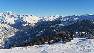
Savoie is a department in the Auvergne-Rhône-Alpes region, Southeastern France. Located in the French Alps, its prefecture is Chambéry. In 2019, Savoie had a population of 436,434.
Aix-les-Bains, known locally and simply as Aix, is a commune in the southeastern French department of Savoie.
Annecy is the prefecture and largest city of the Haute-Savoie department in the Auvergne-Rhône-Alpes region of Southeastern France. It lies on the northern tip of Lake Annecy, 35 kilometres (22 mi) south of Geneva, Switzerland.
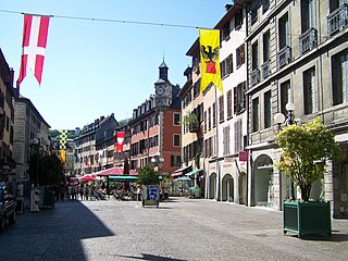
Chambéry is the prefecture and largest city of the Savoie department in the Auvergne-Rhône-Alpes region of southeastern France. The population of the commune of Chambéry was 59,172 as of 2020, while the population of the Chambéry metropolitan area was 255,790. The city is located at the foot of the French Alps between Bauges and Chartreuse mountains, making Chambéry an important railway and highway crossroads.
Moûtiers, historically also called Tarentaise, is a commune in the Savoie department in the Auvergne-Rhône-Alpes region in Southeastern France.
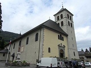
Sallanches is a commune in the Haute-Savoie department of the Auvergne-Rhône-Alpes region of France. Located close to the Mont Blanc massif, many visitors pass through the town en route to well-known alpine resorts such as Chamonix, Megève and Saint-Gervais-les-Bains. In 2018, the commune had a population of 16,508, and its urban area had 46,128 inhabitants.
The arrondissement of Saint-Jean-de-Maurienne is an arrondissement of France in the Savoie department in the Auvergne-Rhône-Alpes region. It has 53 communes. Its population is 43,091 (2016), and its area is 1,976.0 km2 (762.9 sq mi). The area corresponds to the former province of Maurienne.
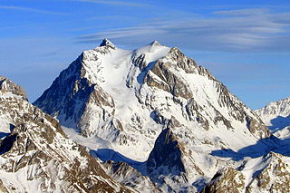
Maurienne is one of the provinces of Savoy, corresponding to the arrondissement of Saint-Jean-de-Maurienne in France. It is also the original name of the capital of the province, now Saint-Jean-de-Maurienne.
Modane is a commune in the Savoie department in the Auvergne-Rhône-Alpes region in southeastern France.
Aiton is a commune in the Savoie department in the Auvergne-Rhône-Alpes region in south-eastern France.
The French Roman Catholic diocese of Saint-Jean-de-Maurienne has since 1966 been effectively suppressed, formally united with the archdiocese of Chambéry. While it has not been suppressed, and is supposed to be on a par with Chambéry and the diocese of Tarentaise, it no longer has a separate bishop or existence.
Bessans is a commune in the Savoie department in the Auvergne-Rhône-Alpes region in south-eastern France. It is located in the valley of Maurienne and crossed by the Arc river. Nestled in the center of a former glacial through, it is renowned for its large Nordic skiing domain in the winter and for its trekking and mountain climbing opportunities in the Summer. Surrounded by lush fauna and flora, the village is characterised by its rich heritage, where wall paintings, Baroque chapels, engraved stones and artisan sculptors are inextricably linked. The legend of the Devil of Bessans admirably describes the originality of this traditional culture that is still very much alive today.
The Culoz–Modane railway is a 135 kilometres long railway running from Culoz, near Chambéry, through Saint-Jean-de-Maurienne to Modane in France. Together with the Italian Turin–Modane railway it is often called "Fréjus Railway" or "Mont Cenis Railway".
The Fortified Section of Savoy(Secteur fortifié de la Savoie) was the French military organization that in 1940 controlled the section of the Alpine Line portion of the Maginot Line facing Italy in the Savoy region. The sector constituted part of the Alpine Line portion of the Maginot Line, between the Defensive Sector of the Rhône to the north, and the Fortified Sector of the Dauphiné to the south. The works combined a number of pre-1914 fortifications with Maginot-style ouvrages, with many forward-positioned cavern-style frontier stations or avant-postes that proved effective in holding invading forces near the order.
The Château de Saint-Michel-de-Maurienne is a 13th-century castle in the commune of Saint-Michel-de-Maurienne Savoie département of France.
The history of Savoy presents a synthesis of the various periods, from prehistory to the present day, of the geographical and historical entity known as Savoy, a territory whose definition has varied over the course of historical periods, until it was defined by the two French departments of Savoie and Haute-Savoie.
The Mont-Cenis Lake is a lake located in the Mont-Cenis massif at an altitude of 1,974 meters in the municipality of Val-Cenis in France. It is situated at the top of the Cenise valley, on the Italian side of the Mont-Cenis pass, the most frequented passage on the Lyon-Turin-Milan axis during the Middle Ages between Western Europe and the Italian peninsula. This was while the Montgenèvre pass required an initial crossing, followed by the Lautaret pass, and the Petit-Saint-Bernard pass was 107 meters higher.
The Arves massif are a massif in the French Alps located in the departments of Savoie, Isère and Hautes-Alpes. Oisans covers part of the massif.
The Savoie region, which encompasses the French departments of Savoie and Haute-Savoie, has a thriving tourism industry. The Savoie Mont Blanc brand represents the region in this sector.