Aussois

Last updated
Aussois
Aussois (Savoie).JPG
Aussois seen from La Norma ski resort in February 2011.
Location of Aussois
Aussois
France location map-Regions and departements-2016.svg
Red pog.svg
Aussois
Auvergne-Rhone-Alpes region location map.svg
Red pog.svg
Aussois
Coordinates: 45°13′38″N6°44′32″E / 45.2272°N 06.7423°E / 45.2272; 06.7423
Country France
Region Auvergne-Rhône-Alpes
Department Savoie
Arrondissement Saint-Jean-de-Maurienne
Canton Modane
Intercommunality CC Haute Maurienne Vanoise
Government
  Mayor (20202026) Stéphane Boyer [1]
Area
1
41.94 km2 (16.19 sq mi)
Population
 (2021) [2]
687
  Density16/km2 (42/sq mi)
Demonym Aussoyens / Aussoyennes
Time zone UTC+01:00 (CET)
  Summer (DST) UTC+02:00 (CEST)
INSEE/Postal code
73023 /73500
Elevation1,120–3,600 m (3,670–11,810 ft)
Website www.aussois.com
1 French Land Register data, which excludes lakes, ponds, glaciers > 1 km2 (0.386 sq mi or 247 acres) and river estuaries.

Aussois (French pronunciation: [oswa] ) is a commune in the Vanoise massif, in the Savoie department in the Auvergne-Rhône-Alpes region in south-eastern France. The village is on the border of France's first National Park, the Vanoise National Park.
Although not as well known as other resorts right on the other side of the mountain like Val Thorens, it is popular with the French as ski resort in winter and as mountain destination in summer.
At 8 km (5.0 mi) from Modane, it is ideally located in the Maurienne region with good transport links in and out of Lyon, Geneva, Grenoble and Chambéry. Aussois can also be reached from Turin via the Fréjus Road Tunnel, linking Bardonecchia in Italy and Modane. [3]
Nearby Gare de Modane is a large railway station with a high-speed service (TGV) Paris - Chambéry - Turin - Milan.
The resort offers 55 km (34 mi) of slopes, 21 slopes (6 Green, 5 Blue, 8 Red, 2 Black). [4]

Contents

Geography

Climate

Aussois has a humid continental climate (Köppen climate classification Dfb) closely bordering on an oceanic climate (Cfb). The average annual temperature in Aussois is 7.3 °C (45.1 °F). The average annual rainfall is 771.0 mm (30.35 in) with November as the wettest month. The temperatures are highest on average in July, at around 16.1 °C (61.0 °F), and lowest in January, at around −0.5 °C (31.1 °F). The highest temperature ever recorded in Aussois was 32.8 °C (91.0 °F) on 5 July 2015; the coldest temperature ever recorded was −22.5 °C (−8.5 °F) on 12 January 1987.

Climate data for Aussois (1991−2020 normals, extremes 1986−present)
MonthJanFebMarAprMayJunJulAugSepOctNovDecYear
Record high °C (°F)16.2
(61.2)
18.1
(64.6)
20.0
(68.0)
23.5
(74.3)
28.4
(83.1)
32.6
(90.7)
32.8
(91.0)
30.9
(87.6)
27.4
(81.3)
25.0
(77.0)
21.9
(71.4)
15.5
(59.9)
32.8
(91.0)
Mean daily maximum °C (°F)3.6
(38.5)
4.2
(39.6)
7.6
(45.7)
10.9
(51.6)
15.3
(59.5)
19.4
(66.9)
21.7
(71.1)
21.4
(70.5)
17.2
(63.0)
13.0
(55.4)
7.2
(45.0)
4.0
(39.2)
12.1
(53.8)
Daily mean °C (°F)−0.5
(31.1)
−0.4
(31.3)
2.8
(37.0)
5.9
(42.6)
10.1
(50.2)
13.9
(57.0)
16.1
(61.0)
16.0
(60.8)
12.1
(53.8)
8.4
(47.1)
3.2
(37.8)
0.0
(32.0)
7.3
(45.1)
Mean daily minimum °C (°F)−4.7
(23.5)
−4.9
(23.2)
−2.0
(28.4)
0.9
(33.6)
4.9
(40.8)
8.4
(47.1)
10.4
(50.7)
10.5
(50.9)
7.1
(44.8)
3.7
(38.7)
−0.9
(30.4)
−4.0
(24.8)
2.4
(36.3)
Record low °C (°F)−22.5
(−8.5)
−20.7
(−5.3)
−16.3
(2.7)
−9.4
(15.1)
−5.6
(21.9)
−2.3
(27.9)
2.4
(36.3)
1.6
(34.9)
−3.6
(25.5)
−7.1
(19.2)
−14.8
(5.4)
−17.4
(0.7)
−22.5
(−8.5)
Average precipitation mm (inches)74.0
(2.91)
55.0
(2.17)
55.5
(2.19)
52.7
(2.07)
71.7
(2.82)
62.8
(2.47)
50.8
(2.00)
58.1
(2.29)
56.0
(2.20)
70.9
(2.79)
83.0
(3.27)
80.5
(3.17)
771.0
(30.35)
Average precipitation days (≥ 1.0 mm)8.88.07.48.19.49.48.18.67.57.99.29.3101.6
Source: Météo-France [5]

See also

Related Research Articles

<span class="mw-page-title-main">Savoie</span> Department in Auvergne-Rhône-Alpes, France

Savoie is a department in the Auvergne-Rhône-Alpes region, Southeastern France. Located in the French Alps, its prefecture is Chambéry. In 2019, Savoie had a population of 436,434.

<span class="mw-page-title-main">Val-d'Isère</span> Commune in Auvergne-Rhône-Alpes, France

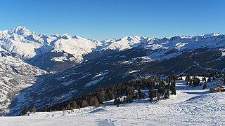
Val-d'Isère is a commune of the Tarentaise Valley, in the Savoie department in southeastern France. It lies 5 km (3 mi) from the border with Italy. It is on the border of the Vanoise National Park created in 1963, with good transport links in and out of Lyon, Geneva and Chambéry.

<span class="mw-page-title-main">Chambéry</span> Prefecture of Savoie, Auvergne-Rhône-Alpes, France

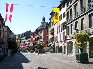
Chambéry is the prefecture and largest city of the Savoie department in the Auvergne-Rhône-Alpes region of southeastern France. The population of the commune of Chambéry was 59,172 as of 2020, while the population of the Chambéry metropolitan area was 255,790. The city is located at the foot of the French Alps between Bauges and Chartreuse mountains, making Chambéry an important railway and highway crossroads.

<span class="mw-page-title-main">French Alps</span> Portion of the Alps mountain range within France

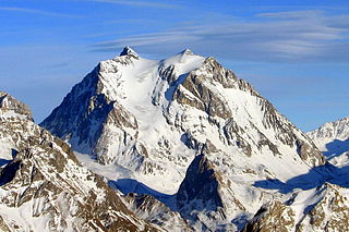
The French Alps are the portions of the Alps mountain range that stand within France, located in the Auvergne-Rhône-Alpes and Provence-Alpes-Côte d'Azur regions. While some of the ranges of the French Alps are entirely in France, others, such as the Mont Blanc massif, are shared with Switzerland and Italy.

<span class="mw-page-title-main">Tignes</span> Commune in Auvergne-Rhône-Alpes, France

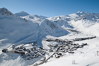
Tignes is a commune in the Tarentaise Valley, in the Savoie department in the Rhône-Alpes region in south-eastern France, known for the highest skiable area and the longest ski season in Europe. It is located in the Savoie region with good transport links in and out of Lyon, Geneva and Chambéry.

<span class="mw-page-title-main">Moûtiers</span> Commune in Auvergne-Rhône-Alpes, France

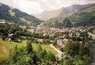
Moûtiers, historically also called Tarentaise, is a commune in the Savoie department in the Auvergne-Rhône-Alpes region in Southeastern France.

<span class="mw-page-title-main">Fréjus Rail Tunnel</span> Railway tunnel through the Alps

The Fréjus Rail Tunnel is a rail tunnel of 13.7 km (8.5 mi) length in the European Alps, carrying the Turin–Modane railway through Mont Cenis to an end-on connection with the Culoz–Modane railway and linking Bardonecchia in Italy to Modane in France. Its mean altitude is 1,123 metres (3,684 ft) and it passes beneath the Pointe du Fréjus and the Col du Fréjus.

<span class="mw-page-title-main">Mont Cenis</span> Mountain in France

Mont Cenis is a massif in Savoie (France), which forms the limit between the Cottian and Graian Alps.

<span class="mw-page-title-main">Maurienne</span> Former Savoy province

Maurienne is one of the provinces of Savoy, corresponding to the arrondissement of Saint-Jean-de-Maurienne in France. It is also the original name of the capital of the province, now Saint-Jean-de-Maurienne.

<span class="mw-page-title-main">Modane</span> Commune in Auvergne-Rhône-Alpes, France

Modane is a commune in the Savoie department in the Auvergne-Rhône-Alpes region in southeastern France.

<span class="mw-page-title-main">Montmélian</span> Commune in Auvergne-Rhône-Alpes, France

Montmélian is a commune in the Savoie department in the Auvergne-Rhône-Alpes region in south-eastern France. Montmélian station has rail connections to Grenoble, Modane, Bourg-Saint-Maurice and Chambéry.

<span class="mw-page-title-main">Montgenèvre</span> Commune in Provence-Alpes-Côte dAzur, France

Montgenèvre is a commune on the Italian border in the Hautes-Alpes department in the Provence-Alpes-Côte d'Azur region in Southeastern France.

<span class="mw-page-title-main">Valloire</span> Commune in Auvergne-Rhône-Alpes, France

Valloire is a commune in the Savoie department in the Auvergne-Rhône-Alpes region in south-eastern France.

<span class="mw-page-title-main">La Motte-Servolex</span> Commune in Auvergne-Rhône-Alpes, France

La Motte-Servolex is a commune in the Savoie department in the Auvergne-Rhône-Alpes region in south-eastern France. It is part of the urban area of Chambéry.

<span class="mw-page-title-main">Pralognan-la-Vanoise</span> Alpine commune in France

Pralognan-la-Vanoise or simply Pralognan is an alpine commune in the Savoie department in the Auvergne-Rhône-Alpes region in Southeastern France. In 2019, it had a population of 715. The commune is located within Vanoise National Park.

<span class="mw-page-title-main">Challes-les-Eaux</span> Commune in Auvergne-Rhône-Alpes, France

Challes-les-Eaux, known as Triviers until 1872, is a commune in the Savoie department in the Auvergne-Rhône-Alpes region in Southeastern France. Chambéry Aerodrome is located in the commune.

<span class="mw-page-title-main">Termignon</span> Part of Val-Cenis in Auvergne-Rhône-Alpes, France

Termignon is a former commune in the Savoie department in the Auvergne-Rhône-Alpes region in south-eastern France. On 1 January 2017, it was merged into the new commune Val-Cenis. It is ideally located in the Maurienne region with good transport links in and out of Modane, Lyon, Geneva and Chambéry.

Trévignin is a commune in the Savoie department in the Auvergne-Rhône-Alpes region in south-eastern France. It is part of the urban area of Chambéry.

<span class="mw-page-title-main">Culoz–Modane railway</span> Railway in France

The Culoz–Modane railway is a 135 kilometres long railway running from Culoz, near Chambéry, through Saint-Jean-de-Maurienne to Modane in France. Together with the Italian Turin–Modane railway it is often called "Fréjus Railway" or "Mont Cenis Railway".

<span class="mw-page-title-main">Val-Cenis</span> Commune in Auvergne-Rhône-Alpes, France

Val-Cenis is a commune in the department of Savoie, southeastern France. The municipality was established on 1 January 2017 by merger of the former communes of Termignon, Bramans, Lanslebourg-Mont-Cenis, Lanslevillard and Sollières-Sardières.

References

  1. "Répertoire national des élus: les maires" (in French). data.gouv.fr, Plateforme ouverte des données publiques françaises. 13 September 2022.
  2. "Populations légales 2021" (in French). The National Institute of Statistics and Economic Studies. 28 December 2023.
  3. "French-Italian Fréjus road tunnel - Website". Archived from the original on 2016-10-12. Retrieved 2016-10-09.
  4. "Aussois". Peak Retreats Winter. Retrieved 2012-09-09.
  5. "Fiche Climatologique Statistiques 1991-2020 et records" (PDF) (in French). Météo-France . Retrieved September 4, 2022.