Related Research Articles

Fairfield is a fell in the English Lake District. It is the highest of a group of hills in the Eastern Fells, standing to the south of the Helvellyn range.

Grasmoor is a mountain in the north-western part of the Lake District, northern England. It is the highest peak in a group of hills between the villages of Lorton, Braithwaite and Buttermere, and overlooks Crummock Water.

St Sunday Crag is a fell in the English Lake District, part of the Fairfield group in the Eastern Fells. It is a prominent feature in the Patterdale skyline, with a distinctive rounded shape. Indeed, it figures so finely in views from the upper reach of the lake that it is sometimes referred to as ‘the Ullswater Fell’.
Crag Hill is a mountain in the North Western part of the English Lake District. It was formerly known as Eel Crag; however, the Ordnance Survey now marks Eel Crag as referring to the northern crags of the fell. It is not to be confused with another Crag Hill lying on the border of North Yorkshire.

Causey Pike is a fell in the English Lake District. It is situated in the Newlands Valley, 5 kilometres south-west of the town of Keswick. Even though it has a modest height of 637 metres (2,090 ft) it is one of the most distinctive fells when viewed from the Derwent Water and Keswick area due to its distinguishing summit "knobble" which catches the eye. The fell is one of 214 fells described by Alfred Wainwright in his series of Pictorial Guides to the Lakeland Fells: Causey Pike features in Book Six, The North Western Fells.
Fairfield Horseshoe is a classic circular hillwalking ridge walk route starting from Rydal or Ambleside in the English Lake District that takes in all the fells that surround the valley of the Rydal Beck.

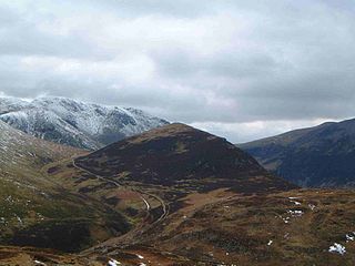
Ard Crags is a fell in the Lake District in Cumbria, England, it is situated in the Newlands Valley just off the minor road between Keswick and Buttermere. The Ordnance Survey officially records the fell's altitude at 581 metres (1,906 ft), considerably more than the approximate 1,860 feet (570 m) that Alfred Wainwright attributed to it in his Pictorial Guide to the North Western Fells, published in 1964 well before the advent of satellite mapping. Ard Crags is situated close to other higher fells such as Causey Pike and Eel Crag and can be easily overlooked. However, viewed from certain points in the Rigg Beck or Newlands valley area it presents a clearly defined and pyramidal shape which catches the eye.

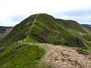
Grisedale Pike is a fell in the Lake District, Cumbria, England, situated 4+1⁄2 miles west of the town of Keswick in the north-western sector of the national park. At a height of 791 metres it is the 40th-highest Wainwright in the Lake District; it also qualifies as a Hewitt, Marilyn and Nuttall. Grisedale Pike presents a striking appearance when viewed from the east, particularly from the vicinity of Keswick. It possesses two subsidiary summits: one unnamed ; the other Hobcarton End.
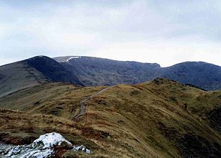
Outerside is a fell in the Lake District in Cumbria, England. It is located 6 kilometres west of Keswick in the north western part of the national park and is a smaller member of the Coledale group of fells with a height of 568 metres. The fell is part of a ridge on the southern side of Coledale which descends from the higher fell of Scar Crags and continues over the neighbouring smaller fell of Barrow before reaching the valley at the village of Braithwaite.

Coledale is a valley in the northwestern region of the Lake District in Cumbria, England.

Scar Crags is a fell in the north western part of the English Lake District in the county of Cumbria. It is one of the Coledale group of fells situated seven kilometres south west of Keswick and reaches a height of 672 metres (2,205 ft).

Hopegill Head is a fell in the English Lake District in Cumbria. It is located nine kilometres west of the town of Keswick and is well seen from the B5292 road which crosses the Whinlatter Pass.
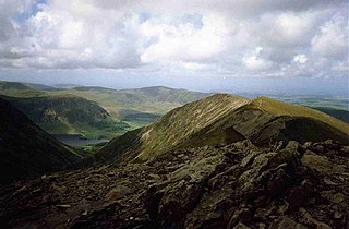
Whiteside is a fell in the north-western area of the English Lake District. It stands at the western end of the Grisedale Pike- Hopegill Head ridge overlooking Crummock Water.

Sail is a hill in the English Lake District, lying between Derwentwater and Crummock Water.

The Eastern Fells are a part of the Cumbrian Mountains in the Lake District of England. Centred on Helvellyn they primarily comprise a north–south ridge running between Ullswater and Lakeland's Central Valley.

The Far Eastern Fells are a part of the Cumbrian Mountains in the Lake District of England. Reaching their highest point at High Street, they occupy a broad area to the east of Ullswater and Kirkstone Pass. Much quieter than the central areas of Lakeland they offer in general easier walking as the fells merge mainly into the surrounding moorlands.
The North Western Fells are a part of the Cumbrian Mountains in the Lake District of England. Including such favourites as Catbells and Grisedale Pike, they occupy an oval area beneath the Buttermere and Borrowdale valley systems. The North Western Fells are characterised by soaring east-west ridges and an absence of mountain tarns.

Coledale Beck is a minor river running through Cumbria in England.
The Newlands horseshoe is a circular walk in the Lake District, incorporating the main peaks surrounding the Newlands Valley.
References
- 1 2 3 4 Coledale Horseshoe
- ↑ A Wainwright, The North-Western Fells (Kendall 1964) Outerside 2
- ↑ "Coledale Horseshoe 2021". Ellenborough AC. Retrieved 12 September 2021.
- ↑ S Marshall, Walking the Wainwrights (2000) p. 72-4
- ↑ A Wainwright, The North-Western Fells (Kendall 1964) Eel Crag 6
- ↑ H Davies, A Walk around the Lakes (London 1989) p. 320-1
- ↑ "The Coledale Horseshoe". Treks and Tours.
- ↑ "The Coledale Horseshoe with extras". Brians Walks. Retrieved 12 September 2021.