
Dale Head is a fell in the north-western sector of the Lake District, in northern England. It is 753 metres above sea level and stands immediately north of Honister Pass, the road between Borrowdale and Buttermere.

Grasmoor is a mountain in the north-western part of the Lake District, northern England. It is the highest peak in a group of hills between the villages of Lorton, Braithwaite and Buttermere, and overlooks Crummock Water.
Crag Hill is a mountain in the North Western part of the English Lake District. It was formerly known as Eel Crag; however, the Ordnance Survey now marks Eel Crag as referring to the northern crags of the fell. It is not to be confused with another Crag Hill lying on the border of North Yorkshire.

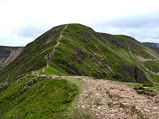
Causey Pike is a fell in the English Lake District. It is situated in the Newlands Valley, 5 kilometres south-west of the town of Keswick. Even though it has a modest height of 637 metres (2,090 ft) it is one of the most distinctive fells when viewed from the Derwent Water and Keswick area due to its distinguishing summit "knobble" which catches the eye. The fell is one of 214 fells described by Alfred Wainwright in his series of Pictorial Guides to the Lakeland Fells: Causey Pike features in Book Six, The North Western Fells.
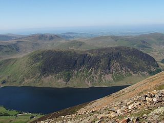
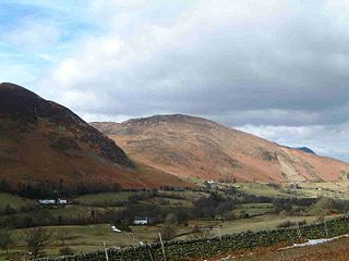
Mellbreak is a hill in the Western part of the English Lake District. Despite being surrounded on all sides by higher fells, it stands in isolation. It is surrounded on three sides by a "moat" of deep marshy land, and on the east side by the lake of Crummock Water. The fell forms a partnership with the lake, running parallel to it, falling sheer into it, and regularly providing the backdrop for pictures of it.

Rannerdale Knotts is a fell in the Lake District of Cumbria, England. Rising from the Buttermere valley, it is one of the smaller Cumbrian hills and is overlooked by a number of surrounding fells, such as Grasmoor, Whiteless Pike and, across Crummock Water, Mellbreak and the High Stile ridge. Rannerdale Knotts is said to be the site of a battle between the native Cumbrians and Norsemen and the invading Normans in the late 11th or early 12th century.
Barrow is a small fell in the English Lake District in the county of Cumbria which reaches a height of 455 metres (1,494 feet). It is in the Newlands Valley 2.5 miles (4 km) south-west of Keswick. Although comparatively small in height, Barrow commands an all-round view, with the vales of Keswick and Newlands being visible. The name of the fell originates from the Anglo Saxon language meaning a hill or long ridge.

Ard Crags is a fell in the Lake District in Cumbria, England, it is situated in the Newlands Valley just off the minor road between Keswick and Buttermere. The Ordnance Survey officially records the fell's altitude at 581 metres (1,906 ft), considerably more than the approximate 1,860 feet (570 m) that Alfred Wainwright attributed to it in his Pictorial Guide to the North Western Fells, published in 1964 well before the advent of satellite mapping. Ard Crags is situated close to other higher fells such as Causey Pike and Eel Crag and can be easily overlooked. However, viewed from certain points in the Rigg Beck or Newlands valley area it presents a clearly defined and pyramidal shape which catches the eye.

Grisedale Pike is a fell in the Lake District, Cumbria, England, situated 4+1⁄2 miles west of the town of Keswick in the north-western sector of the national park. At a height of 791 metres it is the 40th-highest Wainwright in the Lake District; it also qualifies as a Hewitt, Marilyn and Nuttall. Grisedale Pike presents a striking appearance when viewed from the east, particularly from the vicinity of Keswick. It possesses two subsidiary summits: one unnamed ; the other Hobcarton End.
Outerside is a fell in the Lake District in Cumbria, England. It is located 6 kilometres west of Keswick in the north western part of the national park and is a smaller member of the Coledale group of fells with a height of 568 metres. The fell is part of a ridge on the southern side of Coledale which descends from the higher fell of Scar Crags and continues over the neighbouring smaller fell of Barrow before reaching the valley at the village of Braithwaite.

Scar Crags is a fell in the north western part of the English Lake District in the county of Cumbria. It is one of the Coledale group of fells situated seven kilometres south west of Keswick and reaches a height of 672 metres (2,205 ft).

Red Pike is a fell in the High Stile range in the western English Lake District, which separates Ennerdale from the valley of Buttermere and Crummock Water. It is 2,476 ft (755 m) high. The direct ascent of Red Pike from Buttermere is very popular and the ridge walk from Red Pike to Haystacks is regarded as one of the finest in the area, with excellent views of the Scafells, Great Gable and Pillar.

Hopegill Head is a fell in the English Lake District in Cumbria. It is located nine kilometres west of the town of Keswick and is well seen from the B5292 road which crosses the Whinlatter Pass.
Whiteside is a fell in the north-western area of the English Lake District. It stands at the western end of the Grisedale Pike- Hopegill Head ridge overlooking Crummock Water.

Wandope (also known as Wanlope is a fell in the north-western area of the English Lake District. It lies to the east of Crummock Water and south of Crag Hill. From the summit there are excellent panoramas of the Sca Fell and High Stile ranges.
Whiteless Pike, 660 metres (2,170 ft) high, is a fell in the north-western English Lake District. It stands immediately east of Crummock Water and forms a pyramid shape when viewed from Rannerdale. In his celebrated guide to the Lakeland fells, A Wainwright called it "the Weisshorn of Buttermere". There are good views of Great Gable and the Scafells from the summit.

Knott Rigg is a fell at the head of the Newlands Valley in the English Lake District. It is situated some 8+1⁄2 kilometres south west of Keswick and has a modest height of 556 metres. Its name is derived from the Old English language and means “hill on a knobbly ridge”. Despite its modest height, the fell is listed on a number of hill lists, including the Birketts and TuMPs, and also has its own chapter in Alfred Wainwright’s Pictorial Guide to the Lakeland Fells.

Starling Dodd is a fell in the western part of the English Lake District, located between the valleys of Ennerdale and Buttermere, on the ridge between Great Borne to its west and Red Pike to its east. Not visible from Buttermere and rounded in profile, Starling Dodd is a relatively unfrequented top.
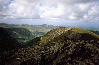
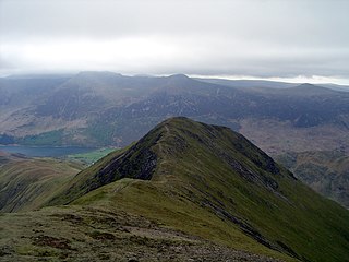
The North Western Fells are a part of the Cumbrian Mountains in the Lake District of England. Including such favourites as Catbells and Grisedale Pike, they occupy an oval area beneath the Buttermere and Borrowdale valley systems. The North Western Fells are characterised by soaring east-west ridges and an absence of mountain tarns.
The Coledale horseshoe, or Coledale Round, is a semi-circle of fells surrounding Coledale in the Lake District, England.


