The Lake District, also known as the Lakes or Lakeland, is a mountainous region and national park in Cumbria, North West England. It is famous for its landscape, including its lakes, coast, and the Cumbrian mountains; and for its literary associations with Beatrix Potter, John Ruskin, and the Lake Poets.

Derwentwater, or Derwent Water, is a lake in the Lake District in North West England, immediately south of Keswick. It is in the unitary authority of Cumberland within the ceremonial county of Cumbria. It is the third largest lake by area, after Windermere and Ullswater. It has a length of 4.6 kilometres (2.9 mi), a maximum width of 1.91 kilometres (1.19 mi), and an area of 5.4 square kilometres (2.1 sq mi). Its primary inflow and outflow is the River Derwent, which also flows through Bassenthwaite Lake before reaching the Irish Sea at Workington. There are several islands within the lake, one of which is inhabited. Derwentwater is a place of considerable scenic value. It is surrounded by hills, and many of the slopes facing Derwentwater are extensively wooded. A regular passenger launch operates on the lake, taking passengers between various landing stages. There are seven lakeside marinas, the most popular stops being Keswick, Portinscale and the Lodore Falls, from which boats may be hired. Recreational walking is a major tourist activity in the area and there is an extensive network of footpaths in the hills and woods surrounding the lake.

Bassenthwaite Lake is a body of water in the Lake District in North West England, near the town of Keswick. It has an area of 5.3 km2 (2.0 sq mi), making the fourth largest of the lakes in the region. The lake has a length of approximately 4 miles (6.4 km) long and maximum width of 0.75 miles (1 km), a maximum depth of 19 m (62 ft), and a surface elevation of 68 m (223 ft) above sea level. Its primary inflow and outflow is the River Derwent, which drains into the Irish Sea at Workington. The lake is in the unitary authority of Cumberland, and the ceremonial county of Cumbria.

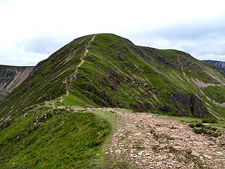
Dale Head is a fell in the north-western sector of the Lake District, in northern England. It is 753 metres or 2,470 foot above sea level and stands immediately north of Honister Pass, the road between Borrowdale and Buttermere.

Crag Hill is a mountain in the North Western part of the English Lake District. It was formerly known as Eel Crag; however, the Ordnance Survey now marks Eel Crag as referring to the northern crags of the fell. It is not to be confused with another Crag Hill lying on the border of North Yorkshire.

The B5289 is a road in the Lake District, England. It lies in the county of Cumbria, and is an important traffic artery in the Lake District.

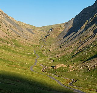
Honister Pass is a mountain pass in the Lake District in Cumbria, England. It is located on the B5289 road, linking Seatoller, in the valley of Borrowdale, to Gatesgarth at the southern end of Buttermere. The pass reaches an altitude of 1,167 feet (356 m), making it one of the highest in the region, and also one of the steepest, with gradients of up to 1-in-4 (25%). The saddle at the watershed is known as Honister Hause, using the Cumbrian word hause for such a feature.

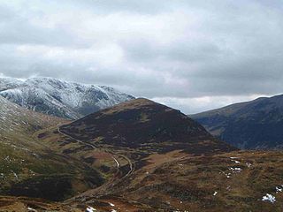
Causey Pike is a fell in the English Lake District. It is situated in the Newlands Valley, 5 kilometres south-west of the town of Keswick. Even though it has a modest height of 637 metres (2,090 ft) it is one of the most distinctive fells when viewed from the Derwent Water and Keswick area due to its distinguishing summit "knobble" which catches the eye. The fell is one of 214 fells described by Alfred Wainwright in his series of Pictorial Guides to the Lakeland Fells: Causey Pike features in Book Six, The North Western Fells.

Above Derwent is a civil parish in Cumbria, England, to the west of Derwentwater and Keswick. It lies entirely within the Lake District National Park.

Outerside is a fell in the Lake District in Cumbria, England. It is located 6 kilometres west of Keswick in the north western part of the national park and is a smaller member of the Coledale group of fells with a height of 568 metres. The fell is part of a ridge on the southern side of Coledale which descends from the higher fell of Scar Crags and continues over the neighbouring smaller fell of Barrow before reaching the valley at the village of Braithwaite.

The Newlands Valley is in the Lake District National Park in Cumbria, England. It is regarded as one of the most picturesque and quiet valleys in the national park, even though it is situated very close to the popular tourist town of Keswick and the busy A66 road.

The Whinlatter Pass is a mountain pass in the Lake District in Cumbria, England. It is located on the B5292 road linking Braithwaite, to the west of Keswick, with High Lorton to the south of Cockermouth.

The North Western Fells are a part of the Cumbrian Mountains in the Lake District of England. Including such favourites as Catbells and Grisedale Pike, they occupy an oval area beneath the Buttermere and Borrowdale valley systems. The North Western Fells are characterised by soaring east-west ridges and an absence of mountain tarns.

Seathwaite is a small hamlet in the Borrowdale civil parish of Cumberland, Cumbria, North West England. It is in the Lake District near Scafell Pike and 8 miles (13 km) southwest of Keswick at the end of a minor road that heads southwest from the hamlet of Seatoller, which is where the B5289 road begins its steep climb up the pass to Honister Hause on the boundary between Borrowdale civil parish and Buttermere civil parish.
The Fred Whitton Challenge is a charity cyclosportive event held annually in the English Lake District, in aid of Macmillan Cancer Support, Cumbria's air ambulances, the mountain rescue service and various youth cycling projects. It is held in memory of Fred Whitton, racing secretary of the Lakes Road Club, who died of cancer at the age of 50 in 1998. The event started in 1999 and has been held every year since, except for 2001 and 2020 when it was cancelled due to the foot-and-mouth epidemic and the international COVID-19 pandemic respectively.

Newlands Church is a 16th-century church situated less than 500 metres west of the hamlet of Little Town, Cumbria, England in the Newlands Valley of the Lake District. Its exact date of origin is unknown, but a map of 1576 shows a "Newlande Chap." on the site.

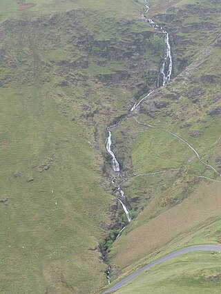
Moss Force is a waterfall situated within the Lake District National Park in the English county of Cumbria. It is located 10 km SW of the town of Keswick at Newlands Hause, the pass between the Newlands Valley and the Buttermere Valley. It is part of Alfred Wainwright's famous "Wainwright Memorial Walk," and its beauty was celebrated by Samuel Taylor Coleridge.

Buttermere is a village and civil parish in the county of Cumbria, England.

Little Town is a hamlet in the civil parish of Above Derwent, in the Allerdale district of Cumbria, England. It is in the Workington constituency of the United Kingdom Parliament. Prior to Brexit in 2020 it was part of the North West England constituency of the European Parliament.

Braithwaite is a village in the northern Lake District, in Cumbria, England. Historically in Cumberland, it lies just to the west of Keswick and to the east of the Grisedale Pike ridge. It forms part of the civil parish of Above Derwent.


