Hindscarth

Last updated

Hindscarth
Hindscarth.jpg
Hindscarth and Robinson from Catbells
Highest point
Elevation 727 m (2,385 ft)
Prominence 71 m (233 ft)
Parent peak Dale Head
Listing Hewitt, Wainwright, Nuttall
Coordinates 54°32′16″N3°12′53″W / 54.53766°N 3.21476°W / 54.53766; -3.21476 Coordinates: 54°32′16″N3°12′53″W / 54.53766°N 3.21476°W / 54.53766; -3.21476
Naming
English translationpass used by the red deer
Language of name Norse
Geography
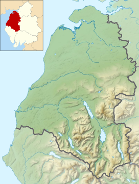
Lake District National Park UK relief location map.png
Red triangle with thick white border.svg
Hindscarth
Location relief map United Kingdom Allerdale.svg
Red triangle with thick white border.svg
Hindscarth
Location in Allerdale, Cumbria
Location Cumbria, England
Parent range Lake District, North Western Fells
OS grid NY215165
Topo map OS Landrangers 89, 90, Explorer OL4

Hindscarth is a mountain between the valleys of Buttermere and Newlands, in the north-western part of the English Lake District. The fell's name is derived from two words from the Old Norse language, Hind and Skarth, and means the pass used by the red deer.

Contents

Topography

The North Western Fells occupy the area between the rivers Derwent and Cocker, a broadly oval swathe of hilly country, elongated on a north-south axis. Two roads cross from east to west, dividing the fells into three convenient groups. Hindscarth stands in the southern sector. The principal ridge in this group of fells runs east from Buttermere, climbing over Robinson, Hindscarth and Dale Head. It then turns north, descending gradually toward Derwentwater, the main tops being High Spy, Maiden Moor and Catbells.

The ridge from Robinson to Dale Head forms the heads of Little Dale and Newlands, bypassing the intervening summit of Hindscarth. This stands off to the north, forming the dividing wall between the two valleys. The long north-west ridge steps down over several tiers of crag to the confluence of its bordering streams. The southern face of Hindscarth looks down over Honister Pass.

Ascents

A popular ascent starts from a parking area nearby Newlands Church and passes over the Scope End ridge before continuing up crags to the summit. Due to their proximity, Hindscarth and Robinson are often combined into a single walk starting from Newlands. The fell is also part of a longer walk including Catbells, High Spy, Dale Head and along the Littledale Edge ridge to Robinson — the Newlands horseshoe.

Geology

Hindscarth is an example of the Buttermere Formation, an olistostrome of disrupted, sheared and folded mudstone, siltstone and sandstone. [1]

Mining

The northern ridge of Hindscarth which falls away to the Newlands valley has at its foot (at Scope End) one of the most famous former mines in the Lake District. The Goldscope mine has been designated as a major national important site by English Heritage who have stated that it should receive priority treatment for its protection and preservation. The mine was opened in 1564 and developed in its early days by German miners, who worked its rich veins of lead and copper. The mine was considered so important in its early days that it was requisitioned for the Crown by Elizabeth I from its then-owner, the Earl of Northumberland. There are considerable spoil heaps on the Newlands Beck side of Scope End and the shaft inside the hillside was sunk to such a considerable depth that it became uneconomical to pump out the water, leading to the closure of the mine at the end of the 19th century.

Looking down the north ridge from the summit shelter to the Newlands Valley Newlands Valley from Hindscarth.jpg
Looking down the north ridge from the summit shelter to the Newlands Valley

Summit

The summit carries an untidy cairn amid some embedded rocks. Elsewhere there are patches of grass and gravel. A hundred yards south is a larger cairn, marked as a Shelter on Ordnance Survey maps. The view north into the Newlands Valley is excellent, backed by Skiddaw. All of the major fell groups with the exception of High Street can be seen.

Related Research Articles

Dale Head

Dale Head is a fell in the north-western sector of the Lake District, in northern England. It is 753 metres or 2,470 feet above sea level and stands immediately north of Honister Pass, the road between Borrowdale and Buttermere.

Robinson (Lake District)

Robinson is a fell in the English Lake District, its southern slopes descending to Buttermere, while its northern side is set in the Newlands Valley. Paths lead to the summit from the village of Buttermere, from the nearby summit Dale Head and from various locations in the valleys to the north.

Grasmoor

Grasmoor is a mountain in the north-western part of the Lake District, northern England. It is the highest peak in a group of hills between the villages of Lorton, Braithwaite and Buttermere, and overlooks Crummock Water.

Cat Bells

Cat Bells is a fell in the English Lake District in the county of Cumbria. It has a height of 451 metres (1,480 ft) and is one of the most popular fells in the area. It is situated on the western shore of Derwentwater within three miles of the busy tourist town of Keswick. Its distinctive shape catches the attention of many visitors to the Lakes who feel compelled to climb to the summit after seeing it from the viewpoint of Friars' Crag on the opposite side of Derwentwater. The Lake District writer and walker Alfred Wainwright acknowledges the popularity of Cat Bells among fellwalkers of all abilities by saying:

"It is one of the great favourites, a family fell where grandmothers and infants can climb the heights together, a place beloved. Its popularity is well deserved: its shapely topknott attracts the eye offering a steep but obviously simple scramble."

Crag Hill

Crag Hill is a mountain in the North Western part of the English Lake District. It was formerly known as Eel Crag; however, the Ordnance Survey now marks Eel Crag as referring to the northern crags of the fell. It is not to be confused with another Crag Hill lying on the border of North Yorkshire.

Causey Pike

Causey Pike is a fell in the English Lake District. It is situated in the Newlands Valley, 5 km south-west of the town of Keswick. Even though it has a modest height of 637 metres (2,090 ft) it is one of the most distinctive fells when viewed from the Derwent Water and Keswick area due to its distinguishing summit "knobble" which catches the eye. The fell is one of 214 fells described by Alfred Wainwright in his series of Pictorial Guides to the Lakeland Fells: Causey Pike features in Book Six, The North Western Fells.

Ard Crags

Ard Crags is a fell in the Lake District in Cumbria, England, it is situated in the Newlands Valley just off the minor road between Keswick and Buttermere. The Ordnance Survey officially records the fell's altitude at 581 metres (1,906 feet), considerably more than the approximate 1,860 feet that Alfred Wainwright attributed to it in his Pictorial Guide to the North Western Fells, published in 1964 well before the advent of satellite mapping. Ard Crags is situated close to other higher fells such as Causey Pike and Eel Crag and can be easily overlooked. However, viewed from certain points in the Rigg Beck or Newlands valley area it presents a clearly defined and pyramidal shape which catches the eye.

Outerside

Outerside is a fell in the Lake District in Cumbria, England. It is located 6 kilometres west of Keswick in the north western part of the national park and is a smaller member of the Coledale group of fells with a height of 568 metres (1863 feet). The fell is part of a ridge on the southern side of Coledale which descends from the higher fell of Scar Crags and continues over the neighbouring smaller fell of Barrow before reaching the valley at the village of Braithwaite.

Newlands Valley

The Newlands Valley is in the Lake District National Park in Cumbria, England. It is regarded as one of the most picturesque and quiet valleys in the national park, even though it is situated very close to the popular tourist town of Keswick and the busy A66 road.

Wandope

Wandope is a fell in the north-western area of the English Lake District. It lies to the east of Crummock Water and south of Crag Hill. From the summit there are excellent panoramas of the Sca Fell and High Stile ranges.

Whiteless Pike Fell in England

Whiteless Pike is a fell in the north-western English Lake District. It stands immediately east of Crummock Water and forms a pyramid shape when viewed from Rannerdale. In his celebrated guide to the Lakeland fells, Alfred Wainwright called it "the Weisshorn of Buttermere". There are good views of Great Gable and the Scafells from the summit.

High Crag

High Crag stands at the southern end of the High Stile ridge which divides the valleys of Ennerdale and Buttermere in the west of the English Lake District. It is often climbed as part of a popular ridge walk, from Black Sail youth hostel, or from Buttermere via Scarth Gap. Panoramas of the Great Gable and the Scafells are visible.

Green Gable

Green Gable is a fell in the English Lake District often traversed by walkers en route to its more famous neighbour Great Gable. It can be ascended from Honister Pass, Seathwaite in Borrowdale, or Ennerdale. There are good views of Gable Crag, Scafell Pike and the Buttermere valley from the summit.

Maiden Moor

Maiden Moor is a fell in the English Lake District, it stands 6 km (3.7 mi) south of the town of Keswick and is part of the high ground that separates the Newlands Valley and Borrowdale, it has a modest height of 576 m (1,890 ft) and so fails to be mentioned on many UK mountain lists but it does have a separate chapter in Alfred Wainwright’s Pictorial Guide to the Lakeland Fells.

High Spy

High Spy is a fell in the English Lake District it is situated on the ridge that separates the Newlands Valley from Borrowdale, eight kilometres south of Keswick.

Sail (Lake District)

Sail is a hill in the English Lake District, lying between Derwentwater and Crummock Water.

Knott Rigg

Knott Rigg is a fell at the head of the Newlands Valley in the English Lake District. It is situated some 8.5 kilometres south west of Keswick and has a modest height of 556 metres (1825 feet). Its name is derived from the Old English language and means “hill on a knobbly ridge”. Because of its moderate height, the fell fails to be listed on any significant hill lists but it does merit a separate chapter in Alfred Wainwright’s Pictorial Guide to the Lakeland Fells.

Starling Dodd

Starling Dodd is a fell in the western part of the English Lake District, located between the valleys of Ennerdale and Buttermere, on the ridge between Great Borne to its west and Red Pike to its east. Not visible from Buttermere and rounded in profile, Starling Dodd is a relatively unfrequented top.

North Western Fells

The North Western Fells are a group of hills in the English Lake District. Including such favourites as Catbells and Grisedale Pike, they occupy an oval area beneath the Buttermere and Borrowdale valley systems. The North Western Fells are characterised by soaring east-west ridges and an absence of mountain tarns.

The Newlands horseshoe is a circular walk in the Lake District, incorporating the main peaks surrounding the Newlands Valley.

References

  1. British Geological Survey: 1:50,000 series maps, England & Wales Sheet 29: BGS (1999)