


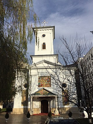
Colentina is a neighbourhood in Bucharest's Sector 2. It is located on the north-east of the city and is named after the nearby Colentina River.
Colentina is a neighbourhood in Bucharest's Sector 2. It is located on the north-east of the city and is named after the nearby Colentina River.
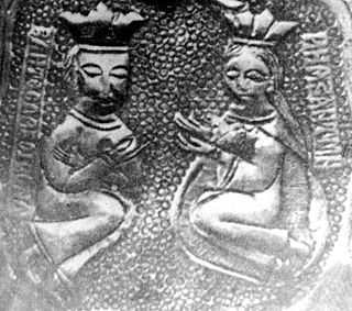
A local folk etymology says that the name is derived from "colea-n-tină" (there, in the mud), this being the answer given by a spătar to Matei Basarab, who asked the former where he had defeated the Ottoman army.
Until the second half of the 18th century, the area of today's Colentina was forested, as it was on the map of Stolnic Constantin Cantacuzino. [1] Nevertheless, archeologists found traces of small settlements in Colentina, dated from the 6th-7th century; in one of such settlements, archeologists found a Justinian-era Byzantine bronze coin dated 539. [2]

The village of Colentina located near the Plumbuita Monastery was first mentioned on the map of H. C. Schütz of 1780 and on I. F. Schmidt's 1788 map. An Austrian map of 1791 shows the village as being located at the crossroad of the routes leading to Fundeni, Afumați, Ștefănești, and Pipera, with the high road bound for Bucharest. [1] The earliest houses were built at the crossroad and around the Cârstienești Bridge across the Colentina river, close to the gate of the monastery. [1]
Soon after, the Plumbuita Monastery, which owned the land in Colentina built and rented ( embatic ) grocer's shops, pubs, inns, as well as agricultural land. [3] In the early 19th century, among the renters was the Paharnic Andronache Teohari, whose name was given to the Andronache estate in Northern Colentina, the name being still in use today. [3]
The houses were built especially along the road towards Bucharest, while the houses on the island of the monastery were still spread out. Due to this, in 1837, the ocârmuitor of Ilfov County asked the hegumen of the monastery to donate plots for the peasants on the domains to build their houses according to a plan. [3] The people who settled in Colentina were a heterogenous mix: some were Romanians from across Wallachia, others were Greeks, Bulgarians or Serbs. [3]
During the 1821 revolts that preceded the Greek War of Independence, Alexander Ypsilantis and the Filiki Eteria, coming from Moldavia settled on the field on the Bucharest-ward bank of Colentina. [4] The same place was used for the consecration of the flags of the first national militia in 1830 and the place where the first soldiers of the National Army took their oath of allegiance in 1834. After this, for a long time, the same field was used for military exercises. [4]
The 1863 law on the secularization of monastery estates in Romania made the Colentina estate property of the state and in March 1864, the rural commune of Colentina-Fundeni was created, which had three component villages: Plumbuita, Colentina and Fundeni. It was around this time that a primary school was built in the city. [4]
Toward the end of the 19th century, Colentina continued to keep its agricultural economy, much of the land being owned by the large landowners, while the inhabitants owned only a sixth of the agricultural land. [5] The commune had six abattoirs, three in Colentina and three in Plumbuita, killing around 12000 cows each year, the meat being then sold in Bucharest and to the 26 pubs and 5 inns that Colentina had at the time. [5]
In the 1890s, the village of Colentina had a population of 254, the village of Plumbuita 288 and the village of Fundeni 279. The 1899 Romanian Census shows that three more villages were created in the commune: Andronache and Boldu, on the northern part of the former Plumbuita estate, while the Tei village was created around the Ghica Palace, the commune having a population of 1048, of which 46 foreign citizens, most of which Transylvanian refugees. [5]
In 1939, Colentina, together with Pipera, Tei, Plumbuita, Andronache, and Fundeni were made part of Bucharest. [5] The neighbourhood suffered a lot of modifications in the mid 1970s and 1980s when houses were replaced with 8-to-10-storey apartment blocks, like in Tei, Obor, and Calea Moșilor and has been recently the home of Arab and Chinese immigrants to Romania.

Bucharest is the capital and largest city of Romania. The metropolis stands on the River Dâmbovița in south-eastern Romania. Its population is officially estimated at 1.76 million residents within a greater metropolitan area of 2.3 million residents, which makes Bucharest the 8th most-populous city in the European Union. The city area measures 240 km2 and comprises 6 districts (Sectoare), while the metropolitan area covers 1,811 km2. Bucharest is a beta global city, a major cultural, political and economic hub, and the country's seat of government.

Mircea the Elder was the Voivode of Wallachia from 1386 until his death in 1418. He was the son of Radu I of Wallachia and brother of Dan I of Wallachia, after whose death he inherited the throne.

Constantin Brâncoveanu was Prince of Wallachia between 1688 and 1714.
Vladislav II was a voivode of the principality of Wallachia, from 1447 to 1448, and again from 1448 to 1456. The way Vladislav II came to the throne is debatable. The most accepted view is that Vladislav assassinated Vlad II Dracul, ruler of Wallachia, and was subsequently placed on the throne by John Hunyadi, on the other, Vladislav II was helped by the Ottomans to replace Dan III which was assigned by the Hungarians.
The Dâmbovița is a river in Romania. It has its sources on the Curmătura Oticului, a mountain pass that separates the Iezer Mountains from the Făgăraș Mountains proper. It passes through Bucharest and flows into the river Argeș near Budești, in Călărași County. Its length is 286 km (178 mi) and its basin size is 2,824 km2 (1,090 sq mi). Dâmbovița County is named after the river.

The history of Bucharest covers the time from the early settlements on the locality's territory until its modern existence as a city, capital of Wallachia, and present-day capital of Romania.

King Michael I Park, formerly Herăstrău Park, is a large park on the northern side of Bucharest, Romania, around Lake Herăstrău, one of the lakes formed by the Colentina River.
Vlad VI of Wallachia was the voivode (prince) who ruled Wallachia between June 1530 and September 1532. He has been historically referenced as Vlad Înecatul, as a description of the manner of his death.

Dealul Spirii is a hill in Bucharest, Romania, the location of the Palace of the Parliament, initially built by Ceauşescu as the House of the People.
Văcărești is a neighbourhood in south-eastern Bucharest, located near Dâmbovița River and the Văcărești Lake. Nearby neighbourhoods include Vitan, Olteniței, and Berceni. Originally a village, it was incorporated into Bucharest as it expanded. Its name is related to the Wallachian aristocratic Văcărescu family, with an etymology leading back to the Romanian văcar, "cow-herder," and the suffix -ești.

The Municipality of Bucharest is divided into 6 administrative units, named sectors, each of which has their own mayor and council, and has responsibility over local affairs, such as secondary streets, parks, schools and the cleaning services.

Tei is a neighborhood in Sector 2 of Bucharest, Romania. The name comes from the name of a lake in this area: Lacul Tei. The name of the lake comes from the linden woods that existed around it in the past.

The Colentina is a left tributary of the river Dâmbovița in Romania. It discharges into the Dâmbovița near Bălăceanca. It passes through the city of Bucharest and the villages and towns Călugăreni, Bălănești, Ghimpați, Ciocănești, Crevedia, Buftea, Mogoșoaia, Pantelimon and Cernica. Its length is 101 km (63 mi) and its basin size is 643 km2 (248 sq mi).

Fundeni is a district in Sector 2 of Bucharest, Romania. It is situated in the northeastern outskirts of the city, on the left bank of the Colentina River, downstream of Plumbuita Monastery, and near the Fundeni Lake that was formed on the river. On its west and north-west are located the Colentina and Andronache neighbourhoods, on its north the town of Voluntari and on its east the commune of Dobroești.
Michael's bond was a decree enacted by Michael the Brave that bonded the Wallachian serfs to the estate where they were living at that time.
The Zlătari Church is a Romanian Orthodox church located at 12 Calea Victoriei in the Lipscani district of Bucharest, Romania. It is dedicated to the Nativity of Mary.

St. Catherine's Church is a Romanian Orthodox church located at 5 Sfânta Ecaterina Street in Bucharest, Romania. It is dedicated to Saint Catherine of Alexandria.
The St. Elijah–Rahova Church is a Romanian Orthodox church located at 79 Constantin Silvestru Street in Bucharest, Romania. It is dedicated to the Prophet Elijah.
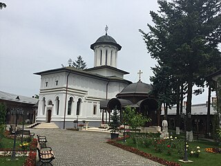
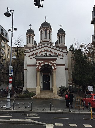
The Plumbuita Monastery is a Romanian Orthodox monastery located at 58 Plumbuita Street in Bucharest, Romania. Its church is dedicated to Saint John the Baptist.
| Sectors of Bucharest |  | |
|---|---|---|
| Districts (quarters) |
| |
| Squares | ||
| Major streets | ||
| Hills | ||
| Rivers | ||
| Lakes | ||
| Parks and forests | ||
| See also | ||
44°28′N26°09′E / 44.467°N 26.150°E