College Hill (Beaver Falls)

Last updated

College Hill
Neighborhood
Geneva Old Main.jpg
Geneva College, the neighborhood's namesak
PAMap-doton-College Hill-Beaver Falls.png
Location of College Hill in Pennsylvania
Coordinates: 40°46′40″N80°19′26″W / 40.77778°N 80.32389°W / 40.77778; -80.32389
CountryUnited States
State Pennsylvania
County Beaver County
City Beaver Falls
Population
 (2000)
  Total
3,562

College Hill is a neighborhood located in the northern section of Beaver Falls, Pennsylvania, United States. Geneva College is located in the community, and is the namesake of College Hill.

Contents

History

Geneva College was founded in Northwood, Ohio in 1848, [1] but it moved to northern Beaver County in 1880 after being offered free land by the Harmony Society, which was highly influential in Beaver Falls. After the college was established on land just north of Beaver Falls, a community grew up around it, and in 1892, it was incorporated as the borough of College Hill. In 1932, forty years after its incorporation, it merged with Beaver Falls. [2]

As of the 1900 census, College Hill had a population of about 900. [3] Since the 1960s, College Hill has become less of an industrial community than previously; the owner of the former Armstrong Cork factory donated the property to the college, which has since built an athletics complex on the site. [4]

At the 2000 census, College Hill had a population of 3,562 residents, [5] more than one-third of the city's total population of 9,920. [6] Although the population had declined by 78 residents since the 1990 census, or about 2.14% of its total, [7] College Hill fared better than the rest of the city, which lost 767 residents, or about 7.18% of its population, during the same time. [8]

Geography

College Hill is centered at 40°46′40″N80°19′26″W / 40.77778°N 80.32389°W / 40.77778; -80.32389 (40.7778426, -80.3239521), at an altitude of 899 feet (274 m). [9] It is about 1.5 minutes north of and 98 feet (30 m) higher than central Beaver Falls. [10]

Transportation

Pennsylvania Route 18 is the main road through College Hill and provides access to the rest of Beaver Falls in the south and to the Pennsylvania Turnpike in the north. Pennsylvania Routes 251 and 551 also pass through the community. [11] Between 1910 and 1985, the College Hill Station provided rail transportation for the residents, but is now abandoned.[ citation needed ]

Related Research Articles

<span class="mw-page-title-main">Monongalia County, West Virginia</span> County in West Virginia, United States

Monongalia County, known locally as Mon County, is a county located in the U.S. state of West Virginia. As of the 2020 census, the population was 105,822, making it West Virginia's third-most populous county. Its county seat is Morgantown. The county was founded in 1776. Monongalia County is included in the Morgantown, WV Metropolitan Statistical Area, and is the largest county in North-Central West Virginia. It is part of the Pittsburgh media market.

<span class="mw-page-title-main">Beaver County, Pennsylvania</span> County in Pennsylvania, United States

Beaver County is a county in the Commonwealth of Pennsylvania. As of the 2020 census, the population was 168,215. Its county seat is Beaver, and its largest city is Aliquippa. The county is part of the Greater Pittsburgh region of the state.

<span class="mw-page-title-main">Franklin Park, Pennsylvania</span> Borough in Pennsylvania, United States

Franklin Park is a borough in Allegheny County, Pennsylvania, United States. The population was 15,479 at the 2020 census. It is a suburb of the Pittsburgh metropolitan area.

<span class="mw-page-title-main">Beaver Falls, Pennsylvania</span> City in Pennsylvania, United States

Beaver Falls is a city in Beaver County, Pennsylvania, United States. The population was 9,005 at the 2020 census. Located 31 miles (50 km) northwest of Pittsburgh, the city lies along the Beaver River, six miles (9 km) north of its confluence with the Ohio River. It is a part of the Pittsburgh metropolitan area.

<span class="mw-page-title-main">Big Beaver, Pennsylvania</span> Borough in Pennsylvania, United States

Big Beaver is a borough in northern Beaver County, Pennsylvania, United States. The population was 1,852 at the 2020 census. It is a part of the Pittsburgh metropolitan area. The area was originally incorporated as Big Beaver Township in 1802, and was reincorporated as a borough in 1958.

<span class="mw-page-title-main">Bridgewater, Pennsylvania</span> Borough in Pennsylvania, United States

Bridgewater is a borough in central Beaver County, Pennsylvania, United States, at the confluence of the Beaver and Ohio rivers. The population was 745 at the 2020 census. It is part of the Pittsburgh metropolitan area. The borough is best known as the home of the Bruster's Ice Cream chain. A few scenes in the 1986 movie Gung Ho were also shot in Bridgewater. Much of Bridgewater, including its two major streets, are included in the Bridgewater Historic District.

<span class="mw-page-title-main">Center Township, Beaver County, Pennsylvania</span> Township in Pennsylvania, United States

Center Township is a township in Beaver County, Pennsylvania, United States. As of the 2020 census, it had a population of 11,649. It is a suburban community located approximately 25 miles (40 km) northwest of Pittsburgh. It is home to two colleges, Penn State Beaver and Community College of Beaver County. Center Township is also a retail center for Beaver County, home to the Beaver Valley Mall.

<span class="mw-page-title-main">Eastvale, Pennsylvania</span> Borough in Pennsylvania, United States

Eastvale is a borough in Beaver County, Pennsylvania, United States, along the Beaver River. The population was 183 at the 2020 census. It is part of the Pittsburgh metropolitan area.

<span class="mw-page-title-main">Fallston, Pennsylvania</span> Borough in Pennsylvania, United States

Fallston is a borough in Beaver County, Pennsylvania, United States, along the Beaver River. The population was 259 at the 2020 census. It is a part of the Pittsburgh metropolitan area.

<span class="mw-page-title-main">Homewood, Pennsylvania</span> Borough in Pennsylvania, United States

Homewood is a borough that is located in northern Beaver County, Pennsylvania, United States. The population was 104 at the time of the 2020 census.
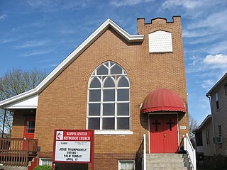
<span class="mw-page-title-main">Koppel, Pennsylvania</span> Borough in Pennsylvania, United States

Koppel is a borough in northern Beaver County, Pennsylvania, United States. The population was 712 at the 2020 census. It is part of the Pittsburgh metropolitan area.

<span class="mw-page-title-main">Midland, Pennsylvania</span> Borough in Pennsylvania, United States

Midland is a borough located along the Ohio River in western Beaver County, Pennsylvania, United States. As of the 2020 census, the population was 2,433. It is part of the Pittsburgh metropolitan area. Founded in 1906, it was initially a company town surrounding the Crucible Steel Company's Midland Works.

<span class="mw-page-title-main">Potter Township, Beaver County, Pennsylvania</span> Township in Pennsylvania, United States

Potter Township is a township in Beaver County, Pennsylvania. It is States and is part of the Greater Pittsburgh metropolitan area. The population was 522 at the 2020 census. It is home to the Shell Pennsylvania Petrochemicals Complex.

<span class="mw-page-title-main">West Mayfield, Pennsylvania</span> Borough in Pennsylvania, United States

West Mayfield is a borough in northern Beaver County, Pennsylvania, United States. The population was 1,195 at the 2020 census. It is a part of the Pittsburgh metropolitan area.

<span class="mw-page-title-main">Little Beaver Township, Lawrence County, Pennsylvania</span> Township in Pennsylvania, United States

Little Beaver Township is a township in Lawrence County, Pennsylvania, United States. The population was 1,227 at the time of the 2020 census, a decline from the figure of 1,411 tabulated in 2010.

<span class="mw-page-title-main">New Beaver, Pennsylvania</span> Borough in Pennsylvania, United States

New Beaver is a borough in southern Lawrence County, Pennsylvania, United States. The population was 1,370 at the 2020 census. It is part of the Pittsburgh metropolitan area.

<span class="mw-page-title-main">North Beaver Township, Pennsylvania</span> Township in Pennsylvania, United States

North Beaver Township is a township in Lawrence County, Pennsylvania, United States. The population was 3,959 at the 2020 census, a decline from the figure of 4,121 tabulated in 2010.

<span class="mw-page-title-main">Northwood, Logan County, Ohio</span> Unincorporated community in Ohio, United States

Northwood is a small, unincorporated community crossroads village in northern Logan County, Ohio, United States. It lies along the line between Richland Township and McArthur Township, approximately two miles south of the village of Belle Center and near the South Fork of the Great Miami River. Northwood was founded in the early 19th century, during the early years of settlement in Logan County. Its primary significance lies in its being the original site of Geneva College.

<span class="mw-page-title-main">Western Beaver County School District</span> School district in Pennsylvania, U.S.

The Western Beaver County School District is a diminutive, rural, public school district serving the boroughs of Industry, Glasgow and Ohioville, Pennsylvania. Western Beaver County School District encompasses approximately 34.5 square miles (89 km2). According to 2000 federal census data, it served a resident population of 5,743. By 2010, the district's population declined to 5,429 people. The educational attainment levels for the Western Beaver County School District population were 92.5% high school graduates and 14.4% college graduates. The district is one of the 500 public school districts of Pennsylvania.

<span class="mw-page-title-main">Chewton, Pennsylvania</span> Census-designated place in Pennsylvania, United States

Chewton is an unincorporated community and census-designated place (CDP) in Lawrence County, Pennsylvania, United States. The population was 488 at the 2010 census.

References

  1. Glasgow, W. Melancthon. A History of the Reformed Presbyterian Church in America Archived 2010-11-28 at the Wayback Machine . Baltimore: Hill and Harvey, 1888. 758.
  2. "Beaver Falls Archived 2012-07-23 at archive.today ". Beaver County Bicentennial Commission. Beaver County Bicentennial Atlas. Beaver: Beaver County Bicentennial Commission, 1976.
  3. "Beaver Falls, Pennsylvania", Encyclopædia Britannica Eleventh Edition .
  4. From Cork to Turf..., Geneva College press release, 1997-05-26. Cached version accessed 2009-02-24.
  5. Census Tract 6011, Beaver County, Pennsylvania Archived 2009-04-15 at the Wayback Machine , United States Census Bureau, 2000. Accessed 2009-04-19.
  6. "U.S. Census website". United States Census Bureau . Retrieved January 31, 2008.
  7. Tract 6011, Beaver County, Pennsylvania, United States Census Bureau, 1990. Accessed 2009-04-19.
  8. Beaver Falls city, Beaver County, Pennsylvania, United States Census Bureau, 1990. Accessed 2009-04-19.
  9. U.S. Geological Survey Geographic Names Information System: College Hill (Beaver Falls)
  10. U.S. Geological Survey Geographic Names Information System: Beaver Falls
  11. DeLorme. Pennsylvania Atlas & Gazetteer. 8th ed. Yarmouth: DeLorme, 2003, p. 56. ISBN   0-89933-280-3.