
Oklahoma City, officially the City of Oklahoma City, and often shortened to OKC, is the capital and most populous city of the U.S. state of Oklahoma. The county seat of Oklahoma County, its population ranks 20th among United States cities and 8th in the Southern United States. The population grew following the 2010 census and reached 681,054 in the 2020 census. The Oklahoma City metropolitan area had a population of 1,396,445, and the Oklahoma City–Shawnee Combined Statistical Area had a population of 1,469,124, making it Oklahoma's largest municipality and metropolitan area by population.

Ottawa County is a county located in the northeastern corner of the U.S. state of Oklahoma. As of the 2020 census, the population was 30,285. Its county seat is Miami. The county was named for the Ottawa Tribe of Oklahoma. It is also the location of the federally recognized Modoc Nation and the Quapaw Nation, which is based in Quapaw.

Treece is a ghost town in Cherokee County, Kansas, United States, and part of the historic Tri-State Mining District. As of the 2010 census, the city population was 138. As of May 2012 the city was abandoned and most buildings and other facilities demolished due to pervasive problems with lead pollution resulting from past mining. Two people who had refused an Environmental Protection Agency (EPA) buyout remained in 2012, one of whom died in 2016.
Wilburton is a city in Latimer County, Oklahoma, United States. It is the county seat of Latimer County. The city had a population of 2,285 as of the 2020 Census. Robbers Cave State Park is 5 miles (8.0 km) north of Wilburton.

Cardin is a former town in Ottawa County, Oklahoma, United States. The population was 150 at the 2000 census, but declined all the way to a population of 3 at the 2010 census in April 2010. By November of 2010, the population of the town was listed as zero.

Miami is a city in and the county seat of Ottawa County, Oklahoma, United States, founded in 1891. Lead and zinc mining were established by 1918, causing the area's economy to boom.

North Miami is a town in Ottawa County, Oklahoma, United States. The population was 290 at the 2020 census. The town is primarily a bedroom community for several larger towns in the county.

Picher is a ghost town and former city in Ottawa County, northeastern Oklahoma, United States. It was a major national center of lead and zinc mining for more than 100 years in the heart of the Tri-State Mining District.
Seminole is a city in Seminole County, Oklahoma, United States. The population was 7,488 at the 2010 census. Seminole experienced a large population growth in the 1920s due to an oil boom.

Broken Arrow is a city in Tulsa and Wagoner counties in the U.S. state of Oklahoma. It is the largest suburb of Tulsa. According to the 2020 census, Broken Arrow has a population of 113,540 residents and is the 4th most populous city in the state. The city is part of the Tulsa Metropolitan Area, which has a population of 1,023,988 residents.

Area codes 918 and 539 are telephone area codes serving Tulsa and northeast Oklahoma. Besides Tulsa, these area codes cover cities such as Bartlesville, Broken Arrow, Claremore, Gore, Jenks, McAlester, Muskogee, Okmulgee, Pryor, Sapulpa, Tahlequah, and northeastern Oklahoma.

The Joplin, Missouri-Kansas, Metropolitan Statistical Area (MSA), as defined by the United States Census Bureau, is an area consisting of Jasper, Newton, and Cherokee counties in southwest Missouri and southeast Kansas anchored by the city of Joplin. The estimated 2023 population of the Joplin, MO-KS (MSA) is 204,787. As of March 2023, The U.S. Census Bureau MSA delineation report added Cherokee County, Kansas to the Joplin, MO MSA making it the Joplin, MO-KS MSA.
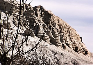
Tar Creek Superfund site is a United States Superfund site, declared in 1983, located in the cities of Picher, Douthat and Cardin, Ottawa County, in northeastern Oklahoma. From 1900 to the 1960s lead mining and zinc mining companies left behind huge open chat piles that were heavily contaminated by these metals, cadmium, and others. Metals from the mining waste leached into the soil, and seeped into groundwater, ponds, and lakes. Because of the contamination, Picher children have suffered elevated lead, zinc and manganese levels, resulting in learning disabilities and a variety of other health problems. The EPA declared Picher to be one of the most toxic areas in the United States.

Merlyn Mantle was an American author and widow of New York Yankees outfielder Mickey Mantle.

Hockerville is a ghost town in northern Ottawa County, Oklahoma, United States. Hockerville was a mining community near the Kansas-Oklahoma border; it once had more than 500 residents. At least 18 mines operated in the Hockerville area in 1918 alone.
Picher-Cardin Public Schools was a school district headquartered in Picher, Oklahoma.
Quapaw Public Schools is a school district headquartered in Quapaw, Oklahoma. Its area includes, in addition to Quapaw, Cardin, Peoria, Picher, and Hockerville.
Miami Public Schools (MPS) is a school district headquartered in Miami, Oklahoma. Its attendance area includes most of the city; the northern portion is instead in Commerce Public Schools. MPS also includes the Dotyville census-designated place.

The Miami Mineral Belt Railroad (MMBR) served the Miami and Picher lead mining areas in that portion of the Tri-state mining district located in far northeastern Oklahoma. It was closely associated with the St. Louis-San Francisco Railway (Frisco) for its entire history, and was eventually absorbed into the Frisco.
The predecessor rail lines which eventually came together as the Northeast Oklahoma Railroad (“NEO”) started as early as 1906, with some routes continuing until NEO was merged into the St. Louis-San Francisco Railroad (“Frisco”) in 1967. At its maximum, NEO ran approximately 34 miles of track in the area of the Tri-state mining district of southeast Kansas, northeast Oklahoma and southwest Missouri, although NEO itself only had operations in Kansas and Oklahoma.
