
The Cotswolds is a region in central-southwest England, along a range of rolling hills that rise from the meadows of the upper River Thames to an escarpment above the Severn Valley and Evesham Vale.

Gloucestershire is a ceremonial county in South West England. It is bordered by Herefordshire to the north-west, Worcestershire to the north, Warwickshire to the north-east, Oxfordshire to the east, Wiltshire to the south, Bristol and Somerset to the south-west, and the Welsh county of Monmouthshire to the west. The city of Gloucester is the largest settlement and the county town.

Cirencester is a market town in Gloucestershire, England, 80 miles (130 km) west of London. Cirencester lies on the River Churn, a tributary of the River Thames. It is the eighth largest settlement in Gloucestershire and the largest town within the Cotswolds. It is the home of the Royal Agricultural University, the oldest agricultural college in the English-speaking world, founded in 1840. The town had a population of 20,229 in 2021.

The region now known as Gloucestershire was originally inhabited by Brythonic peoples in the Iron Age and Roman periods. After the Romans left Britain in the early 5th century, the Brythons re-established control but the territorial divisions for the post-Roman period are uncertain. The city of Caerloyw was one centre and Cirencester may have continued as a tribal centre as well. The only reliably attested kingdom is the minor south-east Wales kingdom of Ergyng, which may have included a portion of the area. In the final quarter of the 6th century, the Saxons of Wessex began to establish control over the area.

The River Leach is a river tributary to the River Thames, in England which runs mostly in Gloucestershire. It is approximately 18 miles (29 km) long, springing from the limestone uplands of the Cotswolds. In parts of its course it becomes a seasonal bourn, only running above ground when there is sufficient rainfall. Despite its small size it gives its name to two towns and a pair of villages.

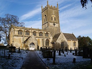
Northleach is a market town and former civil parish, now in parish Northleach with Eastington, in the Cotswold district, in Gloucestershire, England. The town is in the valley of the River Leach in the Cotswolds, about 10 miles (16 km) northeast of Cirencester and 11 miles (18 km) east-southeast of Cheltenham. The 2011 Census recorded the parish's population as 1,854, the same as Northleach built-up-area.

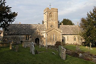
Aldsworth is a village and civil parish in the Cotswold district of Gloucestershire, about ten miles north-east of Cirencester. In 2010 its population was 236. Aldsworth is a large parish, slightly north of the River Leach, located in the South West of the United Kingdom.

The Diocese of Gloucester is a Church of England diocese based in Gloucester, covering the non-metropolitan county of Gloucestershire. The cathedral is Gloucester Cathedral and the bishop is the Bishop of Gloucester. It is part of the Province of Canterbury.

Minety (/'maɪn.tiː/) is a village in north Wiltshire, England, between Malmesbury – 6 miles (9.7 km) to the west – and Swindon. It takes its name from the water mint plant found growing in ditches around the village, and has previously been known as Myntey. It has a primary school and a successful rugby club.

Daglingworth is a Gloucestershire village in the valley of the River Dunt, near the A417 road connecting Gloucester and Cirencester. As with many smaller villages in the Cotswolds, most of the buildings are now private houses. Other properties are the church, the village hall, a stable & horse riding centre and Bridge Farm. The Church of the Holy Rood in the village is an Anglo-Saxon church with well-preserved stone carvings, including an Anglo-Saxon crucifixion tablet dating to 1015. There is also a canonical sundial on the south wall.
Withington is a Cotswold village and civil parish in Gloucestershire, England, about 7 miles (11 km) southeast of Cheltenham and 8 miles (13 km) north of Cirencester. The River Coln runs through the village. The parish includes the hamlets of Hilcot, Foxcote and Cassey Compton. The parish population taken at the 2011 census was 532.
Sevenhampton is a village and civil parish in Cotswold District, Gloucestershire. The parish is located in the Cotswolds in an area designated as an Area of Outstanding Natural Beauty. Most of the parish population reside in the two main settlements of Sevenhampton village and Brockhampton village, both are located in the valley of the River Coln.

Frocester is a village and civil parish in Stroud District, Gloucestershire, England. It lies below the Cotswold escarpment, 10 miles south of Gloucester and 4 miles west of Stroud. In the 2001 census the parish had a population of 194, decreasing to 155 at the 2011 Census.
Sherborne is a village and civil parish almost 3.5 miles (5.6 km) east of Northleach in Gloucestershire. Sherborne is a linear village, extending more than a mile along the valley of Sherborne Brook, a tributary of the River Windrush.

Gloucestershire Victoria County History is an encyclopaedic history of the county of Gloucestershire in England. It forms part of the overall Victoria County History of England founded in 1899 in honour of Queen Victoria. With twelve volumes published in the series A History of the County of Gloucestershire, the Gloucestershire Victoria County History is about halfway through its history of all the parishes in the county. Ten volumes have been published to date, and a further four volumes are in preparation.

Syde, often in the past spelt Side, is a small village and civil parish in Gloucestershire, England. It lies in the Cotswolds, near the source of the River Frome, some six miles north west of Cirencester and seven miles east of Painswick.

Hampnett is a small village and civil parish in Gloucestershire, England, just west of the Fosse Way. It is situated west of the junction of the A40 and A429 roads in the Cotswolds Area of Outstanding Natural Beauty. A number of springs in the village form the source of the River Leach.

Colesbourne is a village and civil parish in the Cotswold district of Gloucestershire, England. The village and parish lies within the Cotswolds, a designated Area of Outstanding Natural Beauty.

