Route 175 is a short, 2.95-mile (4.75 km) long state highway in Mercer County, New Jersey, United States. The route runs along a former alignment of Route 29 before the construction of the John Fitch Parkway in the 1960s. The route begins at Route 29 in the capital city of Trenton, running along Sanhican Road, River Road, and West Upper Ferry Road into Ewing Township. The route serves primarily as a frontage road for Route 29. The northernmost portion of Route 175 is parallel to the Delaware and Raritan Canal until coming to an end at a merge with Route 29 in Ewing Township.

New York State Route 199 is a 30.91-mile-long (49.74 km) state highway located in the Hudson Valley of the U.S. state of New York. Its western end is in Ulster County, where it begins as the continuation of the short U.S. Route 209 freeway east of its interchange with U.S. Route 9W; after crossing the Kingston–Rhinecliff Bridge over the Hudson River the rest of the highway crosses northern Dutchess County. As it does it passes through downtown Red Hook and Pine Plains, reaching its eastern end at U.S. Route 44 and State Route 22 southwest of Millerton in the upper Harlem Valley.

New York State Route 22 (NY 22) is a north–south state highway that parallels the eastern border of the U.S. state of New York, from the outskirts of New York City to the hamlet of Mooers in Clinton County near the Canadian border. At 337 miles (542 km), it is the state's longest north–south route and the third longest state route overall, after NY 5 and NY 17. Many of the state's major east–west roads intersect with, and often join, NY 22 just before crossing into the neighboring New England states, where U.S. Route 7 (US 7), which originally partially followed NY 22's alignment, similarly parallels the New York state line.

Route 4 is an east–west primary state highway connecting rural Litchfield County to the Greater Hartford area of the U.S. state of Connecticut. It runs 46.72 miles (75.19 km) from the town of Sharon to the town of West Hartford.

New York State Route 115 (NY 115) is a 12.45-mile (20.04 km) long state highway located entirely within Dutchess County, New York. The route runs from an intersection with U.S. Route 44 (US 44) and NY 55 in the city of Poughkeepsie along the former Salt Point Turnpike to an interchange with the Taconic State Parkway in Clinton. Throughout its length NY 115 is maintained by the city of Poughkeepsie, Dutchess County, and the New York State Department of Transportation. When NY 115 terminates at the Taconic State Parkway, the Salt Point Turnpike continues as County Route 17 (CR 17) for another four miles to NY 82 in Stanford. NY 115 was designated on April 1, 1980 as part of a maintenance swap by the New York State Department of Transportation, which took over the portion from Smith Street to the Taconic Parkway that was originally CR 75. The portion of the turnpike from the Poughkeepsie city line to Innis Avenue was re-designated New York State Route 984A.

New York State Route 82 (NY 82) is a state highway in the eastern Hudson Valley of New York in the United States. It begins at an junction with NY 52 northeast of the village of Fishkill, bends eastward towards Millbrook, and then returns westward to end at a junction with U.S. Route 9, NY 9H, and NY 23 at Bell Pond, near Claverack. NY 82 meets the Taconic State Parkway twice; it is the only state highway that has more than one exit with the parkway. The road spans two counties: Dutchess and Columbia.

New York State Route 343 (NY 343) is a state highway located entirely within central Dutchess County, in the Hudson Valley region of the U.S. state of New York. It runs east–west from the intersection of NY 82 in the village of Millbrook to the town of Amenia, where it crosses the Connecticut state line and continues eastward as Route 343, a Connecticut state highway located entirely within the town of Sharon. Along the way, it has a 7.3-mile (11.7 km) concurrency with NY 22 from vicinity of the hamlet of Dover Plains to the hamlet of Amenia.
New York State Route 292 (NY 292) is a short 7.58-mile-long (12.20 km) state highway in the Hudson Valley of New York in the United States, bridging Putnam and Dutchess counties. The southern terminus of the route is at an intersection with NY 311 in the town of Patterson, and the northern terminus is at a junction with NY 55 in the town of Pawling. NY 292 traverses mostly rural areas as it heads northwestward through Patterson and Pawling. Along the way, NY 292 passes along the southern and western edges of Whaley Lake.

New York State Route 341 (NY 341) was an east–west state highway located in Dutchess County, New York, in the United States. It extended for 4.71 miles (7.58 km) from an intersection with NY 22 and NY 55 in the village of Pawling to the Connecticut state line in the town of Pawling. At the state line, NY 341 continued eastward into Sherman, Connecticut, as a town road named Wakeman Road. The route crossed a largely undeveloped section of the county, utilizing parts of Quaker Hill Road, Mizzentop Road, and Kirby Hill Road.
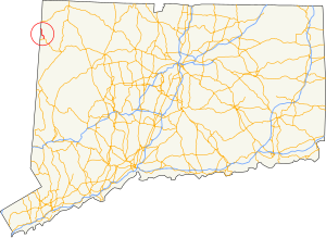
Route 41 is a 17.86-mile (28.74 km) scenic state highway in rural Northwestern Connecticut. It extends from the New York state line in Sharon to the Massachusetts state line in Salisbury and is the only state-numbered route in Connecticut that has both its ends at a state border.

New York State Route 361 (NY 361) was a state highway located in Dutchess County, New York, in the United States. The southern terminus of the route was at the Connecticut state line, where it continued to Sharon, Connecticut, as Route 361. The northern terminus was at U.S. Route 44 (US 44) in Millerton. NY 361 was designated in April 1935 and removed from the state highway system and replaced with County Route 62 (CR 62) in 1980 as part of a large-scale highway maintenance swap between the New York State Department of Transportation and the Dutchess County highway department.

New York State Route 123 (NY 123) is a 4.68-mile (7.53 km) north–south state highway in the northern part of Westchester County, New York, in the United States. The route, named Smith Ridge Road, is a northward continuation of Route 123 from New Canaan, Connecticut.

New York State Route 137 (NY 137) is a 5.51-mile (8.87 km) long state highway in Westchester County, New York, in the United States. The route is a continuation of Connecticut's Route 137, which links NY 137 to Stamford, Connecticut. NY 137 goes through the hamlet of Pound Ridge and ends at NY 121 north of the hamlet of Bedford, locally known as Bedford Village.
New York State Route 305 (NY 305) is a north–south route in the Southern Tier that runs from the Pennsylvania state line in Cattaraugus County to the hamlet of Belfast in Allegany County, where it ends at NY 19. It intersects the Southern Tier Expressway in Cuba.

Pennsylvania Route 118 (PA 118) is a 42.248-mile-long (67.992 km) state route located in northeastern Pennsylvania. The western terminus of the route is at PA 405 in Hughesville. The eastern terminus is at PA 415 in Dallas. The road is known briefly as East Water Street from its western terminus to its intersection with 6th Street in Hughesville, where it becomes Lairdsville Road for 12 miles (19 km) until crossing PA 42 near Unityville. It joins PA 487 for one mile (1.6 km) in Red Rock, where it passes through the southern part of Ricketts Glen State Park. In 1928, the road between Hughesville and Unityville was designated as part of PA 642 while the portion between Red Rock and Lehman was designated as a portion of PA 115. PA 642 was extended from PA 42 in Unityville to PA 539 in the 1940s. During the 1950s, PA 115 was rerouted from Red Rock to head west and replace PA 642 to Hughesville. PA 115 was also realigned to run between Lehman and Dallas. In 1961, PA 118 replaced the portion of PA 115 between Hughesville and Dallas.

Pennsylvania Route 328 is a 13.2-mile-long (21.2 km) state highway located in Tioga and Bradford counties in Pennsylvania. The western terminus is at PA 287 in Tioga Junction. The eastern terminus is at New York State Route 328 (NY 328) at the New York state line near Millerton.
Pennsylvania Route 370 is a 16.73-mile-long (26.92 km) state highway located in Susquehanna and Wayne counties in Pennsylvania. The western terminus is at PA 171 in East Ararat. The eastern terminus is at PA 191 in Buckingham Township near Hancock, New York. PA 370 was first designated by the Pennsylvania Department of Highways in 1928 from the intersection with then PA 70 in East Ararat to an intersection with PA 570 in the hamlet of Preston Park. The route was extended to an intersection with PA 90 in 1946, when the 23-mile-long (37 km) PA 570 was decommissioned.
County Route 149 (CR 149) is a 8.69-mile (13.99 km) county route in northern Sullivan County, New York, in the United States. The route runs from an intersection with New York State Route 52 (NY 52) in the Callicoon community of Youngsville to an intersection with CR 178 in the Rockland community of Livingston Manor. CR 149 was originally designated as New York State Route 284 in 1930.
Pennsylvania Route 958 is an 8.63-mile-long (13.89 km) state highway located in Warren County, Pennsylvania. The designation's southern terminus is at an intersection with U.S. Route 6 (US 6) in Pittsfield Township. The route heads through several small communities, including Lottsville, where it goes on a short concurrency with PA 957. The northern terminus is at the New York state line at Freehold Township, just east of Bear Lake. There, the route continues through New York as Chautauqua County Route 33 (CR 33). PA 958 was designated in 1928 as a connector from US 6 to the community of Wrightsville, where the designation terminated. The route was extended northward along its current alignment in 1936 and has remained unchanged since.
U.S. Route 44 (US 44) is an east–west United States Numbered Highway that runs for 237 miles (381 km) through four states in the Northeastern United States. The western terminus is at US 209 and New York State Route 55 (NY 55) in Kerhonkson, New York, a hamlet in the Hudson Valley region. The eastern terminus is at Route 3A in Plymouth, Massachusetts.
