Related Research Articles

Westchester County is located in the U.S. state of New York. It is the seventh most populous county in the State of New York and the most populous north of New York City. According to the 2020 United States Census, the county had a population of 1,004,456, its highest decennial count ever and an increase of 55,344 (5.8%) from the 949,113 counted in 2010. Located in the Hudson Valley, Westchester covers an area of 450 square miles (1,200 km2), consisting of six cities, 19 towns, and 23 villages. Established in 1683, Westchester was named after the city of Chester, England. The county seat is the city of White Plains, while the most populous municipality in the county is the city of Yonkers, with 211,569 residents per the 2020 U.S. Census.
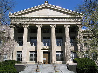
New Rochelle is a city in Westchester County, New York, United States, in the southeastern portion of the state. In 2020, the city had a population of 79,726, making it the 7th-largest city and 22nd-largest municipality in the state of New York. Some residents refer to the city as New Ro. A well known destination within New Rochelle is “New Roc City,” which has restaurants and entertainment venues.

Eastchester is a town in southern Westchester County, New York, United States. The population was over 34,641 at the 2020 United States census over 32,363 at the 2010 census. There are two villages within the town: Bronxville and Tuckahoe. The town contains a census-designated place also named Eastchester, which is the whole town of Eastchester excluding Bronxville and Tuckahoe.

Pelham is a suburban town in Westchester County, approximately 10 miles northeast of Midtown Manhattan. As of the 2020 census, it had a population of 13,078, an increase from the 2010 census. Historically, Pelham was composed of five villages and became known as "the Pelhams". Pelham currently contains two independently incorporated villages: the Villages of Pelham and Pelham Manor.

The Hutchinson River Parkway is a north–south parkway in southern New York in the United States. It extends for 18.71 miles (30.11 km) from the Bruckner Interchange in the Throggs Neck section of the Bronx to the New York–Connecticut state line at Rye Brook. The parkway continues south from the Bruckner Interchange as the Whitestone Expressway (Interstate 678) and north into Greenwich, Connecticut, as the Merritt Parkway. The roadway is named for the Hutchinson River, a 10-mile-long (16 km) stream in southern Westchester County that the road follows alongside. The river, in turn, was named for English colonial religious leader Anne Hutchinson.

Wakefield is a working-class and middle-class section of the northern borough of the Bronx in New York City. It is bounded by the city's border with Westchester County to the north, East 222nd Street to the south, and the Bronx River Parkway to the west.

The Hutchinson River is a 10 mile-long (16 km) freshwater stream located in the New York City borough of the Bronx and Southern Westchester County, New York, United States. It forms on the New Rochelle–Scarsdale municipal line off Brookline Road in the latter community and flows south, draining a 19.4-square-mile (50 km2) area. It continues to serve as New Rochelle's city line with Eastchester; further downstream; its lower reaches divide Mount Vernon and Pelham until it enters the Bronx and empties into Long Island Sound's Eastchester Bay.

Eastchester is a working-class neighborhood in the northeast Bronx in New York City. Its boundaries, starting from the north and moving clockwise are the Bronx-Westchester County border to the north, the New England Thruway to the east, Baychester Avenue to the south, and the intersection of 233rd Street and Baychester Avenue to the west. Boston Road is the primary thoroughfare through Eastchester and Dyre Avenue is the main commercial street. Eastchester includes the sub-neighborhood of Edenwald.
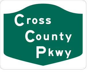
The Cross County Parkway (CCP) is a 4.46-mile-long (7.18 km) parkway in lower Westchester County, New York, in the United States. The parkway is a critical east–west connection throughout Westchester, having full interchanges with every major north–south highway in southern Westchester with the exception of Interstate 95. Among its junctions, it has access to the New York State Thruway mainline. The western terminus is at the Saw Mill Parkway in Yonkers. The eastern terminus is at the Hutchinson River Parkway in New Rochelle.
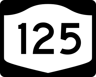
New York State Route 125 (NY 125) is a 7.50-mile (12.07 km) north–south state highway located within Westchester County, New York, in the United States. The route begins at an intersection with U.S. Route 1 (US 1) in the Town of Mamaroneck and ends at a junction with NY 22 in the city of White Plains. A section of the route in the city of White Plains is maintained by Westchester County and co-designated as County Route 26 (CR 26). A second county-owned segment exists along the New Rochelle–Scarsdale line as County Route 129. Both numbers are unsigned. NY 125 was assigned as part of the 1930 renumbering of state highways in New York, initially extending from US 1 to Mamaroneck Avenue in White Plains. It was extended north to NY 22 in the mid-1930s.

U.S. Route 1 (US 1) is a part of the U.S. Highway System that extends from Key West, Florida, to the Canada–United States border at Fort Kent, Maine. In the U.S. state of New York, US 1 extends 21.54 miles (34.67 km) from the George Washington Bridge in Manhattan to the Connecticut state line at Port Chester. It closely parallels Interstate 95 (I-95) for much of its course and does not serve as a major trunk road within the state. It is not concurrent with any other highways besides I-95 and (briefly) US 9, and few other state highways intersect it.
Westchester Creek is a tidal inlet of the East River located in the south eastern portion of the Bronx in New York City. It is 2.1 miles (3.39 km) in length. The creek formerly traveled further inland, to what is now Pelham Parkway, extending almost to Eastchester Bay and making Throggs Neck into an island during heavy storms. However, much of the route has been filled in, replaced by such structures as the New York City Subway's Westchester Yard and the Hutchinson Metro Center. Westchester Creek's present-day head is at Herbert H. Lehman High School; the remaining portion is largely inaccessible and surrounded by industrial enterprises or empty lots. Westchester Creek is traversed by the Bruckner Interchange at about its midpoint.

The New York, Westchester and Boston Railway Company, was an electric commuter railroad in the Bronx and Westchester County, New York from 1912 to 1937. It ran from the southernmost part of the South Bronx, near the Harlem River, to Mount Vernon with branches north to White Plains and east to Port Chester. From 1906, construction and operation was under the control of the New York, New Haven & Hartford Railroad (NH) until its bankruptcy in 1935.
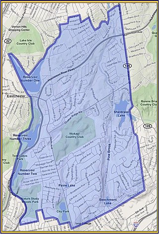
Wykagyl is a suburban community in New Rochelle, Westchester County, New York, United States. It is conterminous with ZIP code 10804, encompassing much of the city's 'North End'. According to Forbes, in 2010 Wykagyl's 10804 ZIP code, with a median home price of $806,264, ranked 333rd on its list of the 500 most expensive ZIP codes in the U.S. The Washington Post ranks Wykagyl among the nation's 650 Super Zips, or those with the highest percentile rankings for median household income and the share of adults with college degrees or higher.

St. John's Wilmot Church is an Episcopal parish in New Rochelle, New York. Located at the intersection of North Avenue, Mill Road and Wilmot Road, the church anchors the 17th - 19th century satellite hamlet of Cooper's Corners.
Middletown is a former hamlet of the Town of New Rochelle in Westchester County, New York. The hamlet took shape in the central portion of New Rochelle, extended along North Avenue from the vicinity of Rochelle Park to the southerly boundary of the Wykagyl Country Club grounds. The origin of the name is traceable to a division of the town road districts. As early as 1747, there were two main districts: "upper" and "below". An increase in population after the Revolutionary War warranted the further subdivision of the town into five road districts in 1787. One was named "Middle" to distinguish it from the "Upper", "Waterside" and "Town" districts. By this time the district had become quite well built up so as to make the term "town" appropriate. Hence it became "Middletown". The name was so appropriate to the hamlet that it was indicated on road maps beginning in 1789.
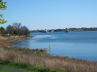
Reservoir 2 is located in the northern portion of the city of New Rochelle along the New Rochelle - Eastchester boundary in Westchester County, New York. Built in 1892, the reservoir is impounded by the "Reservoir 2 dam" on the Hutchinson River. The dam is masonry and of earthen construction, with a height of 25 feet (7.6 m) and a length of 550 feet (170 m). It has a water area of about 18.3 acres (7.4 ha) and a capacity of about 37 million US gallons (140,000 m3). Maximum discharge is 800 cubic feet (23 m3) per second. The reservoir is owned by the City Of New Rochelle.
Reservoir 3 is a man-made reservoir located in the northern portion of the city of New Rochelle along the New Rochelle - Eastchester boundary in Westchester County, New York. Constructed in 1908, the reservoir is impounded by the New Rochelle "Reservoir 3 dam" on the Hutchinson River. The dam is of earthen construction, with a height of 30 feet (9.1 m) and a length of 450 feet (140 m). It has an area of about 30 acres (12 ha), and a capacity of about 128 million US gallons (480,000 m3). Maximum discharge is 1,815 cubic feet (51.4 m3) per second. Its capacity is 498 acre-feet (614,000 m3). Normal storage is 220 acre-feet (270,000 m3). It drains an area of 2.85 square miles (7.4 km2). The reservoir is currently owned by the Westchester County Department of Parks and Recreation.

Givans Creek Woods is a 10.73-acre (4.34 ha) wooded area near Co-op City in The Bronx, New York City.
References
- ↑ Lederer, Richard M. (1978). The Place Names of Westchester County New York. Harrison, NY: Harbor Hill Books. p. 32.
- ↑ "The Preserver – Fall 2004". Archived from the original on March 3, 2016. Retrieved January 9, 2015.
- ↑ "Westchester Historical Society – St.Johns Wilmot Church". Archived from the original on January 10, 2015. Retrieved January 9, 2015.
- ↑ Davis, Barbara (2009). Images of America – New Rochelle, NY. Chicago, IL: Arcadia Books. p. 30.
- ↑ Nichols, Herbert B. (1859). Historic New Rochelle. The Board of Education, New Rochelle. p. 135.
