Middletown is a former hamlet of the Town of New Rochelle in Westchester County, New York. [1]

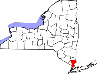
Middletown is a former hamlet of the Town of New Rochelle in Westchester County, New York. [1]
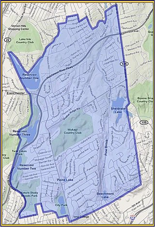
The hamlet took shape in the central portion of New Rochelle, extended along North Avenue from the vicinity of Rochelle Park to the southerly boundary of the Wykagyl Country Club grounds. The origin of the name is traceable to a division of the town road districts. As early as 1747, there were two main districts: "upper" and "below". An increase in population after the Revolutionary War warranted the further subdivision of the town into five road districts in 1787. [2] One was named "Middle" to distinguish it from the "Upper", "Waterside" and "Town" districts. By this time the district had become quite well built up so as to make the term "town" appropriate. Hence it became "Middletown". [3] The name was so appropriate to the hamlet that it was indicated on road maps beginning in 1789. [4]
There was at least one tavern in the hamlet, the Bayeux Tavern, which was located opposite the entrance to present day Paine Avenue. The tavern was of considerable importance to the community at the time. Just across the road was the farm and cottage of Thomas Paine. There were several minor industries in the hamlet as well. Jacob Coutant had a chair factory located west of North Avenue which was powered by water from Stephenson Brook which flowed into Huguenot Lake. [5] A number of mechanics operated shops on their small farms, and in the vicinity of the present Fifth Avenue where the houses were quite close together. [4]
A school had been established just above the present Paine Avenue before the Revolution, and in 1809 it was removed to the junction of Eastchester Road. There being no public school law in the State of New York in force at the time, this new "Middle School" was erected by popular subscription pursuant to a resolution adopted by the citizens living within the hamlet, many of whom contributed the necessary labor, materials and financing. Upon the enactment of a new school law by the State in 1812 it was appropriated for a legalized public school for the hamlet. By 1815 the' Middle School District' boundaries were laid out, significantly extending the town limits of "Middletown". [6]
The school was removed out of the hamlet in 1829 to a new building on Mechanic Street, and, from that point on, the growth of the Village of New Rochelle along the Turnpike Road (now Main Street) came at the expense of other parts of the town. "Middletown" gradually lapsed back into a farming district. [7]

New Rochelle is a city in Westchester County, New York, United States. It is a suburb of New York City, located approximately 17 miles (27 km) from Midtown Manhattan. In 2020, the city had a population of 79,726, making it the 7th-largest city and 22nd-most populous municipality in New York.

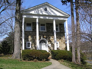
The Thomas Paine Cottage in New Rochelle, New York, in the United States, was the home from 1802 to 1806 of Thomas Paine, author of Common Sense, U.S. Founding Father, and Revolutionary War hero. Paine was buried near the cottage from his death in 1809 until his body was disinterred in 1819. It was one of a number of buildings located on the 300 acre farm given to Paine by the State of New York in 1784, in recognition of his services in the cause of Independence. It was here in August 1805 that he wrote his last pamphlet, which was addressed to the citizens of Philadelphia on "Constitutional Reform".

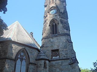
Trinity-St. Paul's Episcopal Church in New Rochelle in Westchester County, New York was added to the National Register of Historic Places in 2006. It is located at the northwest corner of Huguenot Street and Division Street. This church represents the body of the majority group of New Rochelle's founding Huguenot French Calvinistic congregation that conformed to the liturgy of the established Church of England in June 1709. King George III gave Trinity its first charter in 1762. After the American Revolutionary War, Trinity became a parish of the Protestant Episcopal Church of America.

Wykagyl is a suburban community in New Rochelle, Westchester County, New York, United States. It is conterminous with ZIP code 10804, encompassing much of the city's 'North End'. According to Forbes, in 2010 Wykagyl's 10804 ZIP code, with a median home price of $806,264, ranked 333rd on its list of the 500 most expensive ZIP codes in the U.S. The Washington Post ranks Wykagyl among the nation's 650 Super Zips, or those with the highest percentile rankings for median household income and the share of adults with college degrees or higher.

The Thomas Paine Historical Association is an organization based in New Rochelle, New York, that is dedicated to perpetuating the legacy of Founding Father Thomas Paine. It was organized on the anniversary of Paine's birthday, January 29, 1884, and is one of the oldest historical associations in the United States. It is one of two Thomas Paine legacy organizations based in New Rochelle, the other being the Thomas Paine Cottage Museum of the Huguenot and New Rochelle Historical Society, founded in 1886, which owns and maintains the Thomas Paine Cottage.

The Lispenard–Rodman–Davenport House is a historic residence dating back to the early 18th century located on the Davenport Neck peninsula in New Rochelle, New York. The house is the oldest residential structure in New Rochelle. It was listed on the National Register of Historic Places in 1986.
New Rochelle is a city in Westchester County, New York, United States, in the southeastern portion of the state. The town was settled by Huguenots in 1688 who fled France following their failed rebellions. Many of the settlers were wealthy merchants, artisans and craftsmen from the city of La Rochelle, France, thus influencing the choice of the name of "New Rochelle".

271 North Avenue is a 13-story art-deco office tower located in the downtown section of New Rochelle in Westchester County, New York.

This is a list of the National Register of Historic Places listings in southern Westchester County, New York, excluding the cities of New Rochelle and Yonkers, which have separate lists of their own.
Sutton Manor is a distinctive early 20th century suburban residential district in the city of New Rochelle in Westchester County, New York. The neighborhood is located off the northern shore of Long Island Sound on Echo Bay. It was developed as an upper middle class enclave for families with heads of households employed in New York City and served as a model for the ideal suburban setting; harmonious architecture and exclusive amenities. The development appears to have been modeled on neighboring Larchmont Manor in the Town of Mamaroneck, yet on a smaller scale. That subdivision was conceived originally as an exclusive and convenient seasonal playground for New York’s wealthy upper classes, with its 6-acre waterfront park.
Mahlstedt's Ice Pond, commonly referred to as Huguenot Lake, is a man-made lake located in central New Rochelle in Westchester County, New York. Constructed in 1885, the lake is impounded by the Mahlstedt Reservoir Dam on a tributary of Pine Brook. The dam is of earthen construction and rock fill, with a height of 15 feet (4.6 m) and a length of 7,000 feet (2,100 m). It has a normal surface area of 14 acres (5.7 ha), a capacity of 70 acre-feet (86,000 m3), and normal storage of 56 acre-feet (69,000 m3).
Cooper's Corners is a historic section of the city of New Rochelle in Westchester County, New York. For over two centuries Cooper's Corners served as an outpost for residents who lived in rural 'Upper New Rochelle', an area miles from the business center of town.

Titus Mill Pond & New York State Tidal Wetlands is located at the northeastern end of New Rochelle Harbor in the city of New Rochelle in Westchester, New York. The waters in the harbor and pond flow from Long Island Sound, with tides up to eight feet in the inlet and with no fresh water stream entering into it.

Davenport Neck is a peninsula in New Rochelle, New York, extending southwesterly from the mainland into Long Island Sound, and running parallel to the main shore. It divides the city's waterfront into two, with New Rochelle Harbor to the south and southwest, and Echo Bay, to the north and northeast. Glen Island and Neptune Island lie just to the west of the Neck, and Davids and Huckleberry islands lie to the south.
The Churchland or Church is a cultivar of the European pear, it was developed in New Rochelle, New York in northeastern United States. It is believed to have originated as a seedling raised by one of the early Huguenot settlers of the village in the late 17th century. The original tree stood on land which was owned by the Trinity St. Paul's Church of New Rochelle, hence the naming of the fruit "Church". The fruit was so luscious that it was universally liked and, by grafting, the tree soon had extensive propagation throughout the country. An early account of the tree appeared in the proceedings of the American Pomological Society in 1856.
Crystal Lake was located in the village of New Rochelle in Westchester County, New York. It originally supplied early colonial mills with water power. It was fed by Stephenson Brook, which rises just north of Paine Lake and drains the large watershed adjacent to North Avenue from beyond Quaker Ridge Road.
Pelham Road, known as Shore Road within the Bronx, is a historic 4.1-mile (6.6 km) north–south road that runs along the Long Island Sound shoreline from Pelham Bay Park in the Bronx through the southern Westchester County, New York communities of New Rochelle and Pelham Manor. The thoroughfare had its beginning as a Native American trail linking the important villages on Davenport Neck to those on Pelham Neck in Pelham. Between these points along the shore line there was an almost continuous chain of small Indian villages and camps. This waterfront area was especially advantageous, with many small coves in secure harbors and protected by adjacent islands and many small streams of water and abundant springs.

The Church of the Blessed Sacrament is a Roman Catholic parish located in New Rochelle, New York. Blessed Sacrament was founded in 1874, and its present-day church building was constructed in 1897. Its predecessor, St. Matthew's Church, was founded in 1848. Blessed Sacrament Church is listed as a New Rochelle Historic Site.
Seacord Cemetery is a historic cemetery located in the Wykagyl section the city of New Rochelle in Westchester County, New York. The cemetery is located to the south of the First Methodist Episcopal Church building at 1228 North Avenue. By the year 1787 the group which formed this church had become strong enough to buy a piece of property and erect a church. The graveyard adjoining the church on the south and west dates from the purchase of the church lot. The burial plot north of the church building is a family burying ground founded by Israel Seacord, owner of the farm.