
St Abb's Head is a rocky promontory by the village of St Abbs in Scottish Borders, Scotland, and a national nature reserve administered by the National Trust for Scotland. St Abb's Head Lighthouse was designed and built by the brothers David Stevenson and Thomas Stevenson and began service on 24 February 1862.
Crag Hill is a mountain in the North Western part of the English Lake District. It was formerly known as Eel Crag; however, the Ordnance Survey now marks Eel Crag as referring to the northern crags of the fell. It is not to be confused with another Crag Hill lying on the border of North Yorkshire.
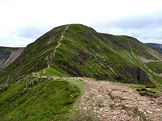
Armboth Fell is a fell in the English Lake District, regarded by Alfred Wainwright as the centre of Lakeland. It is named for the former settlement of Armboth. The fell is a domed plateau, three-quarters of a mile across, jutting out to the east of the Derwentwater-Thirlmere watershed, in the Borough of Allerdale. The fell is wet underfoot, with large areas clad in heather. The eastern slopes above Thirlmere have been planted with conifers.

The Cheviot Hills, or sometimes The Cheviots, are a range of uplands straddling the Anglo-Scottish border between Northumberland and the Scottish Borders. The English section is within the Northumberland National Park. The range includes The Cheviot, plus Hedgehope Hill to the east, Windy Gyle to the west, and Cushat Law and Bloodybush Edge to the south.

The Exmoor Group is a late Devonian to early Carboniferous lithostratigraphic group in southwest England whose outcrop extends from Croyde in north Devon east across Exmoor to Minehead in west Somerset. The group comprises the following formations :
The geology of Northumberland in northeast England includes a mix of sedimentary, intrusive and extrusive igneous rocks from the Palaeozoic and Cenozoic eras. Devonian age volcanic rocks and a granite pluton form the Cheviot massif. The geology of the rest of the county is characterised largely by a thick sequence of sedimentary rocks of Carboniferous age. These are intruded by both Permian and Palaeogene dykes and sills and the whole is overlain by unconsolidated sediments from the last ice age and the post-glacial period. The Whin Sill makes a significant impact on Northumberland's character and the former working of the Northumberland Coalfield significantly influenced the development of the county's economy. The county's geology contributes to a series of significant landscape features around which the Northumberland National Park was designated.
The geology of Northumberland National Park in northeast England includes a mix of sedimentary, intrusive and extrusive igneous rocks from the Palaeozoic and Cenozoic eras. Devonian age volcanic rocks and a granite pluton form the Cheviot massif. The geology of the rest of the national park is characterised largely by a thick sequence of sedimentary rocks of Carboniferous age. These are intruded by Permian dykes and sills, of which the Whin Sill makes a significant impact in the south of the park. Further dykes were intruded during the Palaeogene period. The whole is overlain by unconsolidated sediments from the last ice age and the post-glacial period.

Harbottle Moors is a Site of Special Scientific Interest (SSSI) within Northumberland National Park, in Northumberland, England. It is located near the village of Alwinton. The River Coquet forms the northern border of this protected area.
Otterburn Mires is a Site of Special Scientific Interest made up of eight separate patches of land. It is located within Northumberland National Park, in Northumberland, England, 3km east of Byrness,.
Haugh Wood is a Site of Special Scientific Interest near Woolhope in Herefordshire, England. The protected area is recognised for its diversity of its insects. The Forestry Commission has provided waymarked butterfly trails in this protected area.
Durtrees Burn Grassland is a Site of Special Scientific Interest (SSSI) in Northumberland National Park, Northumberland, England. It is located north of the village of Otterburn.
Greenleighton Quarry is a Site of Special Scientific Interest (SSSI) in Northumberland, England. It is located near the village of Rothley. This protected area is renowned for its Brachiopod fossils and is owned by the National Trust.
Holystone Burn Woods is a Site of Special Scientific Interest (SSSI) within Northumberland National Park in Northumberland, England. It is located near the village of Holystone. The protected area includes part of the valley along which flows the stream called Holystone Burn. Part of the protected area is managed by the Northumberland Wildlife Trust.
Ramsey's Burn Wood is a Site of Special Scientific Interest (SSSI) within Northumberland National Park, Northumberland, England. This protected area is a woodland dominated by alder trees located north of the village of Otterburn. The protected area is within the Otterburn Training Area that is used for military training.
Stawardpeel Woods is a Site of Special Scientific Interest (SSSI) in Northumberland, England. This protected area is located in the valley of the River Allen, near Bardon Mill. The protected area is owned by the National Trust, within the Allen Banks & Staward Gorge estate.
Holystone North Wood is a Site of Special Scientific Interest (SSSI) in Northumberland National Park, Northumberland, England. It is located near the village of Holystone. The woodland was historically an oak coppice.
Ashgill Quarry is a Site of Special Scientific Interest within Lake District National Park in Cumbria, England. It is located near Coniston Water, near the village of Torver on the slopes of the mountain called the Old Man of Coniston. This protected area is important for the Ordovician rocks exposed here. The protected area includes several quarries
Beckfoot Quarry is a Site of Special Scientific Interest (SSSI) within Lake District National Park in Cumbria, England. It is located between Beckfoot and Eskdale, near to the River Esk and near the Ravenglass & Eskdale railway.
Butterburn Flow is a Site of Special Scientific Interest (SSSI) in Cumbria, England. It is located north of Greenhead. Some of the borders of this protected area follow the River Irthing. This protected area contains important blanket bog habitat that occurs over deep peat.
