County Route 15 (Nassau County, New York)

Last updated

County Route 15

County Route 15 (Nassau County, New York)
CR 15 highlighted in red
Route information
Maintained by NCDPW
Length4.02 mi [1]  (6.47 km)
Existed1959 [2] –present
Major junctions
North endNY-101.svg NY 101 in Port Washington
South endOld Northern Boulevard (CR 7A / D71) in Roslyn
Location
Country United States
State New York
County Nassau
Highway system
County Route 15, looking southeast towards Hempstead Harbor from the hill on West Shore Road. Hempstead Harbor fr West Shore Rd hill jeh.jpg
County Route 15, looking southeast towards Hempstead Harbor from the hill on West Shore Road.

Nassau County Route 15 is a 4.02-mile (6.47 km), unsigned county road in Nassau County, New York. It travels between Port Washington Boulevard (NY 101) in Port Washington at its north end and Old Northern Boulevard (CR D71 / CR 7A) in the Village of Roslyn at its southern end. [3] [4] [5] A small portion also passes through the Village of Flower Hill. [6]

Contents

This route travels along Beacon Hill Road and West Shore Road (also known as RoslynWest Shore Road), and is maintained in its entirety by the Nassau County Department of Public Works. [3] [7]

Description

The CR 15 designation for West Shore and Beacon Hill Roads can be traced back to 1959, when the Nassau County Department of Public Works created a numbered highway system as part of their "Master Plan" for the county highway system. This plan marked CR 15 along its current alignment. [7]

County Route 15 is classified as a minor arterial highway by the New York State Department of Transportation and is eligible for federal aid. [8] [9]

Route description

The former shield for CR 15; all Nassau County routes have been unsigned since the 1970s. Nassau County 15 NY.svg
The former shield for CR 15; all Nassau County routes have been unsigned since the 1970s.

Starting from its northern end, County Route 15 starts in Port Washington at the intersection of Beacon Hill Road, Main Street, and Port Washington Boulevard (NY 101). [3] [8] [9] From there, it continues east-southeast through Port Washington, along Beacon Hill Road. It then makes a sharp turn to the south, and becomes West Shore Road. CR 15 then becomes a divided highway and passes the North Hempstead Beach Park (also known as Bar Beach) and the Harbor Links Country Club. Continuing south, the road soon becomes undivided once again and passes the Town of North Hempstead Solid Waste Center, the Hempstead Harbor Shoreline Park, and the Harbor Park Industrial Park. It then enters the Village of Flower Hill and the village's Harbor Village housing development, along with the historic George Washington Denton House. [6] [11] It then passes underneath the William Cullen Bryant Viaduct (NY 25A) and enters Roslyn. [5] Just south of the bridge, CR 15 passes Mott Avenue (CR D63), and then intersects with Old Northern Boulevard (CR D71 / CR 7A), where it terminates. [3] [8] [9]

Nassau County Route 15 is roughly four miles (6.4 km) in length. [3] [8] [9] [1]

Major intersections

Locationmi [1] [8] [9] kmDestinationsNotes
Roslyn 0.000.00Old Northern Boulevard (CR D71)Southern terminus; continues south as Old Northern Boulevard
Flower Hill 0.260.42John Bean Court
Port Washington 2.994.81Marginal Drive
3.265.25Beacon DriveTransition from West Shore Road to Beacon Hill Road
3.345.38Crest Road
3.575.75Crescent Hill
4.026.47NY-101.svg NY 101 (Port Washington Boulevard) Flower Hill, Sands Point At-grade intersection; northern terminus
1.000 mi = 1.609 km; 1.000 km = 0.621 mi
  •        Route transition

See also

Related Research Articles

<span class="mw-page-title-main">East Hills, New York</span> Village in New York, United States

East Hills is a village in Nassau County, on the North Shore of Long Island, in New York, United States. It is considered part of the Greater Roslyn area, which is anchored by the Incorporated Village of Roslyn. The population was 6,955 at the 2010 census.

<span class="mw-page-title-main">Flower Hill, New York</span> Village in New York, United States

Flower Hill is a village in Nassau County, on the North Shore of Long Island, in New York, United States. The eastern half is considered part of the Greater Roslyn area, which is anchored by the Incorporated Village of Roslyn. Western and northern parts are more closely associated with Manhasset and Port Washington. The population was 4,794 at the time of the 2020 census.

<span class="mw-page-title-main">Greenvale, New York</span> Hamlet and census-designated place in New York, United States

Greenvale is a hamlet and census-designated place (CDP) in the towns of North Hempstead and Oyster Bay in Nassau County, on the North Shore of Long Island, in New York, United States. It is considered part of the Greater Roslyn area, which is anchored by the Incorporated Village of Roslyn. The population was 1,069 at the time of the 2020 census.

<span class="mw-page-title-main">North Hempstead, New York</span> Town in New York, United States

North Hempstead is one of three towns in Nassau County, on Long Island, in New York, United States. The population was 237,639 at the 2020 census.

<span class="mw-page-title-main">Port Washington, New York</span> Hamlet and census-designated place in North Hempstead, Nassau County, New York, United States

Port Washington is a hamlet and census-designated place (CDP) on the Cow Neck Peninsula in the Town of North Hempstead, in Nassau County, on the North Shore of Long Island, in New York. The hamlet is the anchor community of the Greater Port Washington area. The population was 16,753 at the 2020 census.

<span class="mw-page-title-main">Roslyn, New York</span> Village in the United States

Roslyn is a village in the Town of North Hempstead in Nassau County, on the North Shore of Long Island, in New York, United States. It is the Greater Roslyn area's anchor community. The population was 2,988 at the 2020 census.

<span class="mw-page-title-main">Roslyn Estates, New York</span> Village in New York, United States

Roslyn Estates is a village in the Town of North Hempstead in Nassau County, on the North Shore of Long Island, in New York, United States. It is considered part of the Greater Roslyn area, which is anchored by the Incorporated Village of Roslyn. The population was 1,318 at the 2020 census.

<span class="mw-page-title-main">Roslyn Harbor, New York</span> Village in New York, United States

Roslyn Harbor is a village in Nassau County, on the North Shore of Long Island, in New York, United States. It is considered part of the Greater Roslyn area, which is anchored by the Incorporated Village of Roslyn. The population was 1,051 at the 2010 census.

<span class="mw-page-title-main">New York State Route 25A</span> Queens-Calverton highway on Long Island

New York State Route 25A (NY 25A) is a state highway on Long Island in New York, United States. It serves as the main east–west route for most of the North Shore of Long Island, running for 73 miles (117 km) from Interstate 495 (I-495) at the Queens–Midtown Tunnel in the New York City borough of Queens to NY 25 in Calverton, Suffolk County. The highway is a northern alternate route of NY 25, which follows a more inland routing along Jericho Turnpike.

<span class="mw-page-title-main">New York State Route 24</span> Highway in New York

New York State Route 24 (NY 24) is a 30.84-mile-long (49.63 km) east–west state highway on Long Island in the U.S. state of New York. The highway is split into two segments, with the longer and westernmost of the two extending 18.68 miles (30.06 km) from an interchange with Interstate 295 and NY 25 in the Queens Village section of the New York City borough of Queens to an intersection with NY 110 in East Farmingdale in the Suffolk County town of Babylon. The shorter eastern section, located in eastern Suffolk County, extends 12.16 miles (19.57 km) from an interchange with I-495 in Calverton to an intersection with County Route 80 (CR 80) in Hampton Bays.

<span class="mw-page-title-main">New York State Route 108</span> State highway in New York

New York State Route 108 (NY 108) is a 1.72-mile-long (2.77 km) north–south state highway located on the Suffolk County side of the Suffolk–Nassau county line on Long Island, New York, in the United States. It is a spur route connecting NY 25A in Cold Spring Harbor to the Cold Spring Harbor station on the Long Island Rail Road's Port Jefferson Branch via Harbor Road. Harbor Road terminates at an intersection with Woodbury Road, on the Nassau County line, which carries County Route 11 to the east and unsigned County Route 12 to the west. NY 108, assigned in the early 1930s, is the shortest state highway on Long Island.

<span class="mw-page-title-main">New York State Route 101</span> State highway in Nassau County, New York, United States

New York State Route 101 (NY 101) is a 3.58-mile (5.76 km) long state highway in northwestern Nassau County, New York, in the United States. It runs north–south as Port Washington Boulevard from NY 25A in Flower Hill, west of Roslyn and east of Manhasset, to Astor Lane in Sands Point. It becomes County Route 101 (CR 101) south along Searingtown Road to Shelter Rock Road (CR 8) and becomes Middle Neck Road north of Astor Lane, continuing north and west to a dead end at the Long Island Sound as the unsigned County Route D55 (CR D55).

Glen Cove Road is a major, 11.7-mile-long (18.8 km) north–south thoroughfare running through north-central Nassau County on Long Island, New York, in the United States.

<span class="mw-page-title-main">Hempstead Harbor</span> Bay on north coast of Long Island, New York

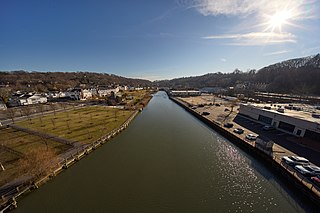
Hempstead Harbor is a bay hugging the northern coast of Long Island, New York. Located off of the Long Island Sound, it forms the northernmost portion of the political border between the Nassau County towns of Oyster Bay on the east and North Hempstead on the west, as well as the western border of the city of Glen Cove.

<span class="mw-page-title-main">Strathmore, New York</span> Hamlet in New York, United States

Strathmore is an unincorporated, Levitt & Sons-developed hamlet in the Town of North Hempstead in Nassau County, on the North Shore of Long Island, in New York, United States, within the census-designated place (CDP) of Manhasset.

<span class="mw-page-title-main">Stonytown Road</span>

Stonytown Road is a 1.32-mile road in the incorporated villages of Flower Hill, Plandome, and Plandome Manor in the Town of North Hempstead, in Nassau County, on the North Shore of Long Island, in New York, United States. It serves as a major east-west through street across the Cow Neck Peninsula, between Plandome Road and North Plandome Road to the west and Port Washington Boulevard to the east – as well as forming portions of municipal boundaries.

References

  1. 1 2 3 New York State Department of Transportation (July 1, 2020). County Roads Listing – Nassau County (PDF) (Report). p. 13. Retrieved November 20, 2020.
  2. Nassau County Department of Public Works (1959). "Master Plan for Nassau County". Nassau County Department of Public Works.
  3. 1 2 3 4 5 "Nassau County Road Jurisdiction Viewer" (Map). nassau-county.maps.arcgis.com. Retrieved October 26, 2020.
  4. "Nassau County Route 15 - West Shore Road". East Coast Roads. Retrieved October 26, 2020.
  5. 1 2 "Nassau County Route 15 - West Shore Road - Photo Gallery". East Coast Roads. Retrieved October 26, 2020.
  6. 1 2 Google (October 26, 2020). "Flower Hill" (Map). Google Maps . Google. Retrieved October 26, 2020.
  7. 1 2 Nassau County Department of Public Works (1959). "Master Plan for Nassau County". Nassau County Department of Public Works.
  8. 1 2 3 4 5 "New York State Department of Transportation Functional Class Viewer". gis.dot.ny.gov. Retrieved April 2, 2023.
  9. 1 2 3 4 5 "New York State Roadway Inventory System Viewer". gis.dot.ny.gov. Retrieved April 2, 2023.
  10. "Nassau-Suffolk County Road History". NYC Roads. Archived from the original on January 3, 2009. Retrieved October 26, 2020.
  11. "NPGallery Asset Detail". npgallery.nps.gov. Retrieved October 26, 2020.