
The Rue Victor-Hugo is a pedestrian street in the 2nd arrondissement of Lyon, in the Ainay district of the Presqu'île quarter, reputed to be one of the most known shopping area of Lyon. From north to south, it connects the Place Bellecour to the Place Carnot. Beyond the Place Bellecour, the Rue de la République is its natural extension, thus creating one of the biggest pedestrian streets in Europe. The street is served by metro stations Perrache, Bellecour and Ampère - Victor Hugo. It belongs to the zone classified as World Heritage Site by UNESCO.
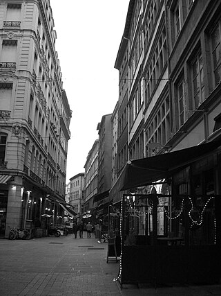
The Rue Mercière is a street of Les Cordeliers quarter in the 2nd arrondissement of Lyon. From north to south, it connects the Place des Jacobins to the Place d'Albon. This street is served by metro stations Bellecour and Cordeliers of the line and by the bus station Jacobins of the lines 91 and 99. It belongs to the zone classified as World Heritage Site by UNESCO.

The Rue des Marronniers is a street located in the Bellecour quarter, in the 2nd arrondissement of Lyon. It is a small paved pedestrian street famous for its many bouchons. It is served by the metro station Bellecour and many buses. The street belongs to a zone classified as a World Heritage Site by UNESCO.

The Place Carnot is a square located in the Perrache quarter, in the 2nd arrondissement of Lyon.

The Place des Jacobins is a square located in the 2nd arrondissement of Lyon. It was created in 1556 and a fountain was added in 1856. The square belongs to the zone classified as World Heritage Site by UNESCO. According to Jean Pelletier, this square is one of the most famous in Lyon, because of its location in the center of the 2nd arrondissement and its heavy traffic, as 12 streets lead here. The square, particularly its architecture and its features, has changed its appearance many times throughout years.

The Passage Thiaffait is an urban area located on the slopes of La Croix-Rousse, in the 1st arrondissement of Lyon. It has an entry by a portico and is a curved traboule (path) which ends with a staircase leading to the hill. The street belongs to the zone classified as World Heritage Site by UNESCO.
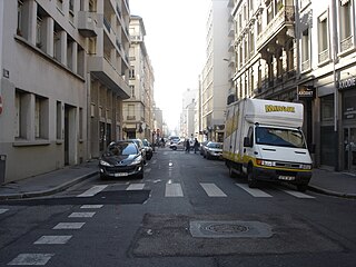
The Rue de la Poulaillerie is a street located in the 2nd arrondissement of Lyon, France. It was first named rue Vaudran, and also rue Maudite in reference to Peter Waldo, who founded what was considered a heresy at the time, the street received its current name from the fact that people exchanged poultry until 1835, when part of this trade emigrated to the covered market of La Martinière.
The Rue de Brest is a street located in the 2nd arrondissement of Lyon. It is one of the main shopping and tourist streets of the city center, parallel to the Rue Édouard-Herriot. It begins in the wake of the Rue Paul Chenavard and ends with the Place des Jacobins.
The Rue de la Bourse is a street located mainly in the 2nd arrondissement of Lyon, and also in the 1st arrondissement. It starts on the Place des Cordeliers, in the 2nd arrondissement, in front of the Église Saint-Bonaventure, and ends at right angles to the Rue du Bât-d'Argent, beyond which it is extended by the Rue du Garet.

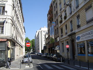
The Rue Lanterne is one of the oldest streets of Lyon, created in the Middle Ages, which is located in the 1st arrondissement of Lyon. It begins after the rue d'Algérie and ends against a facade of the rue Longue.

The Avenue du Maréchal de Saxe is a broad avenue located in the 3rd and the 6th arrondissements of Lyon. It was named after Maurice de Saxe, Marshal of France.

The Rue de Vendôme is a very long street located in Lyon. It begins with the Avenue de Grande Bretagne, along the Rhône, in the 6th arrondissement, and ends with the Cours Gambetta, in the 3rd arrondissement, after crossing the Place Guichard.
La Rue de Créqui is a very long street located in the 7th, 3rd and 6th arrondissements of Lyon. It is a long straight line along the Rue Duguesclin or the Rue de Vendôme, that begins on the Grande Rue de la Guillotière in the 7th arrondissement and ends at the north in the 6th, on the Boulevard des Belges. It follows the Place Guichard, located in the 3rd arrondissement.

The Rue Duguesclin is a long street in Lyon crossing directly wholly the 6th and the 3rd arrondissement, and ends in the 7th arrondissement. This 2,800-meter street starts at the Boulevard des Belges and ends on the Rue Rachais. The Lyon inhabitants and the telephone directory usually write the street name in a sole word (Duguesclin) and the cartographers do it in two words.

The Rue de l'Arbre-Sec is an old street located in the 1st arrondissement of Lyon, near the Place des Terreaux and the Opera Nouvel. It starts perpendicular to the Rue Édouard-Herriot and ends with the Quai Jean Moulin crossing the Rue de la République. The name dates from the 14th century and was probably chosen because of a dry tree that could be seen in this street and of an inn sign.

The Rue du Bœuf is a 188-metre cobbled pedestrian street of the Vieux Lyon quarter, located in the 5th arrondissement of Lyon. Very representative of the Renaissance architecture of the neighborhood, it is lined only with old houses from the 16th or 17th century. The street connects the Rue de Gadagne which it continues after the Place du Petit Collège and the intersection of the Rue du Chemin Neuf, the Rue de la Bombarde and the Rue Tramassac which prolongs it. The street belongs to the zone classified as World Heritage Site by UNESCO.
The Rue Tronchet is a street located in the 6th arrondissement of Lyon, named after French jurist François Denis Tronchet (1726–1804).

The Rue des Capucins is a street located in the 1st arrondissement of Lyon, between the slopes of La Croix-Rousse and the Place des Terreaux. Straight but slightly inclined, it continues the Rue du Sergent Blandan, begins with the Place des Capucins and ends on the Place Croix-Paquet. It is parallel to the Rue René Laynaud. The street belongs to the zone classified World Heritage Site by UNESCO.

The Rue du Sergent Blandan is one of the oldest streets of Lyon. It connects Saint Vincent and the slopes of the Croix-Rousse quarters, in the 1st arrondissement of Lyon. The street starts at the Rue Pareille, runs along the Place Sathonay, crosses the Rue Hippolyte Flandrin, the Rue Louis Vitet and the Rue du Terme, and becomes the Rue des Capucins just after the square of the same name. The street belongs to the zone classified World Heritage Site by UNESCO. It is named in honour of Sergent Blandan, who participated in the conquest of Algeria.

The Place Croix-Paquet is a square located in the 1st arrondissement of Lyon, in the pentes de la Croix-Rousse quarter. It is formed by the intersection of the rue du Griffon, the rue des Capucins and the montée Saint-Sébastien. The square belongs to the zone classified World Heritage Site by UNESCO.
