Place des Jacobins

Last updated
Place des Jacobins, Lyon Place Jacobins Lyon.jpg
Place des Jacobins, Lyon

The Place des Jacobins is a square located in the 2nd arrondissement of Lyon. It was created in 1556 and a fountain was added in 1856. The square belongs to the zone classified as World Heritage Site by UNESCO. According to Jean Pelletier, this square is one of the most famous in Lyon, because of its location in the center of the 2nd arrondissement and its heavy traffic, as 12 streets lead here. [1] The square, particularly its architecture and its features, has changed its appearance many times throughout years.

Contents

Successive names

In 1740, the square was called Place Confort which then absorbed the rue des Alards in 1556, [2] named after a rich family who owned buildings in the neighborhood. In 1782, it became the Place des Jacobins, then, in 1794, was renamed Place de la Fraternité. After changing its name twice — Place de la Préfecture in 1858, then Place de l'Impératrice in 1868 —, it was renamed Place des Jacobins in February 1871. [3] The current name of the square comes from the Jacobins, also named religious Preachers of the Order of St. Dominic, who occupied the building on the southern side of the square from 1296. These Dominicans were called Jacobins when Philippe Auguste gave them a building in Paris and the brothers went on pilgrimage to Santiago de Compostela (Jacobus in Latin). [4]

History

The Place des Jacobins, near 1900. In the background, the first buildings of the rue Merciere, demolished when the southern part was redeveloped. Place des Jacobins.jpeg
The Place des Jacobins, near 1900. In the background, the first buildings of the rue Mercière, demolished when the southern part was redeveloped.

Square and buildings

The square was created in 1556 [2] after a request by King Henri II who wanted to replace the monks cemetery, located at the north of the Jacobins church, with a market. [1] One year later, the walls of the old cemetery of monks disappeared [2] and the place became a public square. [5] In 1562, some buildings were destroyed by the troops of the Baron des Adrets to open the rue Saint-Dominique. [1] The square was then triangular and named Place de Confort. [6]

From 1296, the Jacobins had a convent on the place, with a garden, and Jacques Duèze was elected Pope in this convent on 7 August 1316 [7] by 23 cardinals locked in by the Count of Poitiers. Here Humbert II, the last Dauphin of Vienne (1348), made an assignment of his States to Charles, eldest son of the Duke of Normandy. In 1495, Charles VIII and his wife lived in the monastery. After the Revolution of 1789, the monastery was used as cars shed. Attempts to reestablish the cult and to create a parish named St. Pothin were unsuccessful. [8]

The Jacobins church was built over a period from 1657 to 1689 [9] and, in the same time, a big portal added by architect Antoine Lepautre allowed the building to reach great notoriety, and famous people attended the offices, including Louis XII in 1501. The convent was rebuilt in 1714 and eventually nationalized in 1793. A land contiguous to the chapel was sold in 1725 and bought by Vingtrinier in 1779, then by the State in 1822. [9] The church was demolished in 1818 and the convent housed the prefecture of the Rhone from 1812 to 1852 [6] under the leadership of prefect of Rhône Pierre de Bondy (and thus the street was renamed Place de la Préfecture at the time). [8]

Notable events that occurred on the square include executions of political opponents on 15 March 1590, a big firework to celebrate the peace in 1713, [9] and shows by a temporary theater built by Falconnet and Farge [10] in 1834, quickly destroyed by a fire. [11]

The square was enlarged twice: first in 1824, during the creation of the rue Centrale, built by the architects Benoît Poncet and Jean-Amédée Savoye; [9] then in 1860, when the square became trapezoidal as the rue Gasparin was opened and new buildings were added. [1] Some mosaics found on the square provided indications of what Roman houses looked like. [12]

In 2004, a plaque recounting its history was added to the square. [13]

Cross and well

Originally, there was a cross on the square, but it was removed in 1562 by the Protestants. Subsequently, a formal approval in 1599 allowed to rebuild a cross, and between 1603 and 1609, [9] Philippe Lalyame erected a pyramidal obelisk [14] surmounted by a cross representing the Trinity and with the God's name in at least 24 languages. [15] During the 1662 civil war, the Protestants considered this monument as a symbol of religious freedom and did not destroy it. [16] After an urgent request by all residents of the quarter, based on the fact that this monument "[was] one of the oldest in th[e] city", [17] this antiquated pyramid was rebuilt in 1739 by the consulate that also did add an inscription celebrating Louis XV. During the French Revolution, the pyramid was destroyed on 9 March 1793; [9] only the pedestal of the fountain remained until 1813.

Horace Cardon, who lived here, rebuilt the well in 1614 at his own expense. About one century later, the well was no longer sufficient for all the inhabitants of the neighborhood, especially in case of fire, and thus Antoine-Michel Perrache was entrusted to erect a new pump in 1759-60. [2] [15]

Fountain

The fountain prior to its development, on the southern facade of the square Lyon - Place des Jacobins.jpg
The fountain prior to its development, on the southern facade of the square
Eugene Delaplanche, Siren (1884), from the Fontaine des Jacobins Eugene Delaplanche, Siren from the Fontaine des Jacobins, Lyon (1). 1884. Marble. Lyon, place des Jacobins. Photo, Jamie Mulherron.jpg
Eugène Delaplanche, Siren (1884), from the Fontaine des Jacobins

A fountain was erected in 1856 by Louis Danton, a wealthy upholsterer, who bequeathed his fortune for a work designed by Lienard and melted by Barbezat. In 1866, when the rue Impériale (now rue Édouard-Herriot) was opened, this rendered obsolete the fountain which was removed. [18]

A new fountain, designed by Desjardins, was inaugurated in 1868 to commemorate Claude-Marius Vaïsse but this politician was not liked and the fountain diameter (41.75 meters) was deemed as too excessive. At the fall of the Second Empire in 1870, the statue was not yet installed and was hidden in the customs warehouse. The statue could have been recast to erect that of Claude Bernard, which was never done, but it was recast without glory in 1902. The circle of the fountain of Desjardins was disassembled and reassembled in 1877 on the Place Carnot to host the fountain of the Republic until its final destruction in 1975 during the re-development of the square and the construction of the subway of Lyon. It was decided in 1877 to build a new fountain on the Place des Jacobins : a competition was launched from 18 January to 30 June. [18]

The city council decided to "give to the Place des Jacobins and Lyon (Place de la République) a monument". Two "second prizes" were awarded, one to Gaspard André [19] for his project name "Art". He was appointed to lead the final study, and his project, presented on 28 February 1878, was approved in May. On 17 June 1878, a second competition attributed to Degeorges the creation of the four main statues : the statue of Jean-Hippolyte Flandrin was created in Paris and the other three, the statues of Gérard Audran, Guillaume Coustou and Philibert de l'Orme were carved in Lyon. The four artists are represented with their respective clothes. [20] Although the contract scheduled the completion for 1 November 1878, the statues were not completed until 1885. The works took place on 20 December 1881 and the monument was inaugurated on 14 July 1885. The fountain was included in the supplementary inventory of monument historiques (ISMH, 18/05/1992).

Architecture

Most buildings of the square are wealthy, with five decorated floors; and built circa 1850. [13] The No. 1 was built in 1860 after plans by Frédéric Ginioz. The No. 4 of the Place des Jacobins is the painter Paul Borel's house, conducted by architect Pierre Bossan in 1863. [21]

To the east, there is a large house, and in front, three small older ones. To the north, the building has slate roofs and, to the south-west, an eleven-storey building with rounded balconies. [13]

See also

Related Research Articles

<span class="mw-page-title-main">Place Bellecour</span> Public square in Lyon, France

Place Bellecour is a large square in the centre of Lyon, France, to the north of the Ainay district. Measuring 312 m by 200 m, it is one of the largest open squares in Europe, and the third biggest square in France, behind the Place des Quinconces in Bordeaux (126,000 m²) and the Place de la Concorde in Paris (86,400 m²). It is also the largest pedestrian square in Europe: vehicles are allowed on the Place de la Concorde and Place des Quinconces.

<span class="mw-page-title-main">Presqu'île</span> Part of Lyon, France

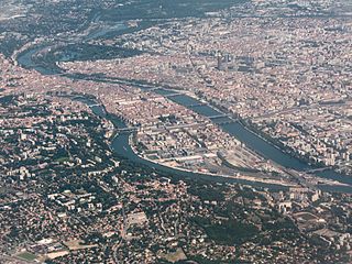
The Presqu'île is the central part of the City of Lyon, France. Extending from the foot of the Croix-Rousse hill in the north to the confluence of the Rhône and the Saône rivers in the south, it has a preponderance of cafés, restaurants, luxury shops, department stores, banks, government buildings and cultural institutions.

<span class="mw-page-title-main">Les Cordeliers</span>

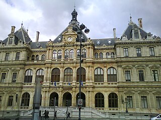
Les Cordeliers is one of the central quarters in the 2nd arrondissement of Lyon, France. It is mainly known for the Place des Cordeliers in its centre. Around the square, there are many notable monuments, including the Église Saint-Bonaventure and the Palais de la Bourse.

<span class="mw-page-title-main">Rue Mercière</span>

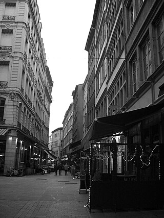
Rue Mercière is a street of Les Cordeliers quarter in the 2nd arrondissement of Lyon. From north to south, it connects the Place des Jacobins to the Place d'Albon. This street is served by metro stations Bellecour and Cordeliers of the line and by the bus station Jacobins of the lines 91 and 99. It belongs to the zone classified as World Heritage Site by UNESCO.

<span class="mw-page-title-main">Place Antonin-Poncet</span>

The Place Antonin-Poncet is a square located in the Bellecour quarter, near the Place Bellecour, in the 2nd arrondissement of Lyon, France. It is served by the metro station Bellecour of the lines A and D, and by many buses (10-12-14-15-29-30-35-53-58-88-99). The square belongs to the zone classified as World Heritage Site by UNESCO.

<span class="mw-page-title-main">Rue des Marronniers</span> Street in Lyon, France

The Rue des Marronniers is a street located in the Bellecour quarter, in the 2nd arrondissement of Lyon. It is a small paved pedestrian street famous for its many bouchons. It is served by the metro station Bellecour and many buses. The street belongs to a zone classified as a World Heritage Site by UNESCO.

<span class="mw-page-title-main">Place Sathonay</span> Square in Lyon, France

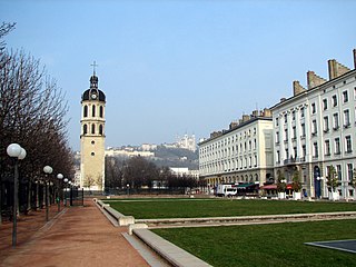
The Place Sathonay is a square located in the 1st arrondissement of Lyon, France, at the bottom of hill of La Croix-Rousse, in La Martinière quarter. It was named after Nicolas-Marie-Jean-Claude Fay de Sathonay, mayor of Lyon from 1805 to 1812, as a tribute for all the importants works undertaken under his presidency. The square is currently the third largest square in Lyon and belongs to the zone classified as World Heritage Site by UNESCO. According to Lyon geography agrégé Jean Pelletier, it is "one of the most interesting squares of Lyon", because of its harmonious proportions, its boundaries composed of buildings with beautiful 1920s facades, and its plantations, which brings "a charm tinged of poetry" and give it the appearance of a village square.

<span class="mw-page-title-main">Rue des Archers</span>

The Rue des Archers is a street located in the 2nd arrondissement of Lyon, in the Cordeliers quarter. It is near the Place Bellecour. The traffic goes from the rue Édouard-Herriot to the place des Célestins, and is regulated on the part leading to the rue de la République. The zone is served by the metro station Bellecour of the line A and the buses 91 and 99.

<span class="mw-page-title-main">Rue de la Poulaillerie</span>

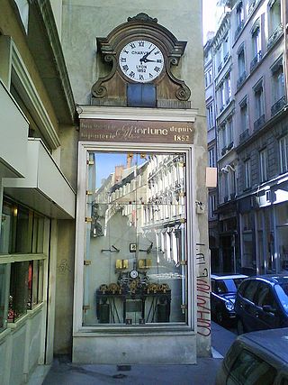
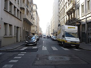
The Rue de la Poulaillerie is a street located in the 2nd arrondissement of Lyon, France. It was first named rue Vaudran, and also rue Maudite in reference to Peter Waldo, who founded what was considered a heresy at the time, the street received its current name from the fact that people exchanged poultry until 1835, when part of this trade emigrated to the covered market of La Martinière.

<span class="mw-page-title-main">Rue de Brest</span>

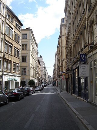
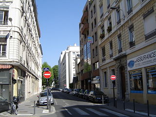
The Rue de Brest is a street located in the 2nd arrondissement of Lyon. This is one of the main shopping and tourist streets of the city center, parallel to the rue Édouard-Herriot. It begins in the wake of the rue Paul Chenavard and ends with the Place des Jacobins.

<span class="mw-page-title-main">Rue de la Bourse</span>

The Rue de la Bourse is a street located mainly in the 2nd arrondissement of Lyon, and also in the 1st arrondissement. It starts on the Place des Cordeliers, in the 2nd arrondissement, in front of the Église Saint-Bonaventure, and ends at right angles to the Rue du Bât-d'Argent, beyond which it is extended by the Rue du Garet.

The Rue Édouard-Herriot is one of the most important shopping streets of the Presqu'île in Lyon. It links the two most famous places of the city, the Place Bellecour (south) and the Place des Terreaux (north). Its northern part is located in the 1st arrondissement of Lyon, but the main part of the street is in the 2nd arrondissement. In its southern part, the street passes through the Place des Jacobins. It belongs to the zone classified as World Heritage Site by UNESCO.

<span class="mw-page-title-main">Rue du Bât-d'Argent</span>

The Rue du Bât-d'Argent is an old street which crosses perpendicularly a part of the Presqu'île quarter in the 1st arrondissement of Lyon. It begins at the rue Édouard-Herriot, in continuation of the rue du Plâtre, crosses the rue de la République and the rue du Garet, and ends on the Quai Jean Moulin. The street is famous for its college, the Collège-lycée Ampère.

<span class="mw-page-title-main">Montée des Carmélites</span>

The Montée des Carmélites is one of the oldest streets of Lyon, dating from Roman times, located in the 1st arrondissement of Lyon. It connects the Saint-Vincent quarter to the Plateau de la Croix-Rousse. It is situated between the rue de la Tourette and the rue Ray Fernand, and ends at the intersection of the rue Burdeau, rue du Jardin des Plantes and rue de l'Annonciade.

<span class="mw-page-title-main">Rue de Créqui</span>

La Rue de Créqui is a very long street located in the 7th, 3rd and 6th arrondissements of Lyon. It is a long straight line along the rue Duguesclin or the rue de Vendôme, that begins on the Grande Rue de la Guillotière in the 7th arrondissement and ends at the north in the 6th, on the Boulevard des Belges. It follows the Place Guichard, located in the 3rd arrondissement.

<span class="mw-page-title-main">Rue Burdeau</span>

The Rue Burdeau is a street located in the 1st arrondissement of Lyon, at the bottom of the slopes of La Croix-Rousse, just above the Église Saint-Polycarpe, between the Saône and the Rhône. It leads at one side to the Montée Saint-Sébastien and at the other to the Jardin des Plantes and crosses the montée de la Grande Côte which renovation is completed. The street belongs to the zone classified as World Heritage Site by UNESCO.

<span class="mw-page-title-main">Boulevard des Belges</span>

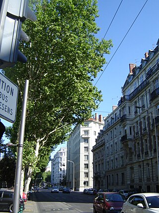
The Boulevard des Belges is a wide and posh avenue located in Les Brotteaux quarter, in the 6th arrondissement of Lyon. It begins with the Quai de Grande Bretagne, runs along the southern part of the Parc de la Tête d'Or until the Avenue Verguin and ends on the Place Jules Ferry, in front of the Gare des Brotteaux. The boulevard is lined with plane trees and is served by two velo'v stations and the line B of the metro.

<span class="mw-page-title-main">Place Benoît-Crépu</span>

The Place Benoît-Crépu is a stone-paved square, located in Saint-Georges quarter, on the banks of the Saône, in the 5th arrondissement of Lyon. It has fountains with dolphin heads, many benches and trees and a playground. The place belongs to the area classified as World Heritage Site by UNESCO.

<span class="mw-page-title-main">Rue Tronchet</span>

The Rue Tronchet is a street located in the 6th arrondissement of Lyon, named after French jurist François Denis Tronchet (1726–1804).

<span class="mw-page-title-main">Place Croix-Paquet</span>

The Place Croix-Paquet is a square located in the 1st arrondissement of Lyon, in the pentes de la Croix-Rousse quarter. It is formed by the intersection of the rue du Griffon, the rue des Capucins and the montée Saint-Sébastien. The square belongs to the zone classified World Heritage Site by UNESCO.

References

  1. 1 2 3 4 Pelletier, Jean; Delfante, Charles (2009). Places de Lyon — Portraits d'une ville (in French). Lyon: Stéphane Bachès. p. 79. ISBN   978-2-915266-64-1.
  2. 1 2 3 4 Brun De La Valette, Robert (1969). Lyon et ses rues (in French). Paris: Le Fleuve. p. 182.
  3. Vanario, Maurice (2002). Rues de Lyon à travers les siècles (in French). Lyon: ELAH. p. 160. ISBN   2-84147-126-8.
  4. Pelletier, Jean. Connaître son arrondissement, le 2e (in French). Editions lyonnaises d'art et d'histoire. p. 25.
  5. Bouchard, Gilbert (2000). L'histoire des rues de Lyon (in French). Grenoble: Glénat. p. 76. ISBN   2-7234-3442-7.
  6. 1 2 Pelletier, Jean (1986). Lyon pas à pas — son histoire à travers ses rues — Presqu'île, rive gauche du Rhône, quais et ponts du Rhône (in French). Roanne / Le Coteau: Horvath. p. 49. ISBN   2-7171-0453-4.
  7. Mollat, G. (1910). "L'élection du pape Jean XXII". Revue d'histoire de l'Église de France (in French). 1 (2): 150. doi: 10.3406/rhef.1910.1911 .
  8. 1 2 Vachet, Adolphe (1902). À travers les rues de Lyon (in French) (1982, Marseille ed.). Lyon: Laffitte reprints. pp. 266–68. ISBN   2-7348-0062-4.
  9. 1 2 3 4 5 6 Meynard, Louis (1932). Dictionnaire des lyonnaiseries — Les hommes. Le sol. Les rues. Histoires et légendes (in French). Vol. 2 (1982 ed.). Lyon: Jean Honoré. pp. 380–86.
  10. Charvet, Léon (1873). René Dardel, 1796-1871 (in French). p. 78.
  11. Chambet, Charles Joseph (1853). Nouveau guide pittoresque de l'étranger à Lyon. Panorama de la ville et d'une partie de ses environs, suivi d'un tableau de ses places, quais et rues, de ses établissements utiles, industriels, etc... (in French). p. 36. Retrieved 27 May 2010.
  12. Steyert, A. (1895). Nouvelle histoire de Lyon (in French). Vol. I. Lyon. p. 282.{{cite book}}: CS1 maint: location missing publisher (link)
  13. 1 2 3 "Place des Jacobins" (in French). Rues de Lyon. Archived from the original on 7 October 2011. Retrieved 2 December 2009.
  14. Levesque, Jean Donatien (1978). Les Frères prêcheurs de Lyon: Notre-Dame-de-Confort, 1218-1789 (in French). p. 347.
  15. 1 2 Julie Vivier. "La Place des Jacobins: Les neufs vies de la place des Jacobins, ou la place qui a longtemps cherché fontaine à son pied" (in French). Lyon Passionnément. Retrieved 27 May 2010.
  16. Société des amis de la Bibliothèque nationale et des grandes bibliothèques de France (1851). Bulletin du bibliophile et du bibliothécaire (in French). Librairie Giraud-Badin. p.  485. place des jacobins lyon.
  17. Lyon, Archives Communales de (1865). Inventaire sommaire des archives communales antérieures à 1790, série AA (in French). Vol. 1. p. 201.
  18. 1 2 Julie Vivier. "La Place des Jacobins: Les neufs vies de la place des Jacobins, ou la place qui a longtemps cherché fontaine à son pied (2è partie)" (in French). Lyon Passionnément. Retrieved 27 May 2010.
  19. Gonthier, Nicole; Schreier, Bernard (1985). Sites et monuments historiques de Lyon (in French). p. 145.
  20. Lyon: Le Beaujolais - La Dombes - Saint-Étienne (in French). Michelin. 2008. p. 101. ISBN   978-2-06-713492-8 . Retrieved 27 May 2010.
  21. Jacquet, Nicolas (September 2008). Façades lyonnaises (in French). Laurence Solnais edition. p. 154.

45°45′38″N4°50′01″E / 45.760502°N 4.833551°E / 45.760502; 4.833551