
Covedale is a census-designated place (CDP) in Green Township, Hamilton County, Ohio, United States. The population was 6,472 at the 2020 census. The CDP represents the part of the former village of Covedale that was not annexed by the city of Cincinnati in 1930.

Norwood is the third most populous city in Hamilton County, Ohio, United States, and an enclave of the larger city of Cincinnati. The population was 19,043 at the 2020 census. Originally settled as an early suburb of Cincinnati in the wooded countryside north of the city, the area is characterized by older homes and tree-lined streets.

Reading is a city in Hamilton County, Ohio, United States. The population was 10,600 at the 2020 census. It is an inner suburb of Cincinnati and is included as part of the Cincinnati metropolitan area.

Loveland is a city in Hamilton, Clermont, and Warren counties in the southwestern part of the U.S. state of Ohio. The population was 13,307 at the 2020 census. Considered part of the Cincinnati metropolitan area, Loveland is located near exit 52 off Interstate 275, about 15 miles (24 km) northeast of the Cincinnati city limits. It borders Symmes, Miami and Hamilton townships and straddles the Little Miami River. Once a busy railroad town, Loveland is now a major stop along the Little Miami Scenic Trail.

Columbia Township is one of the twelve townships of Hamilton County, Ohio, United States. The 2020 census found 4,446 people in the township. Originally one of Ohio's largest townships by area at its inception in 1791, it gradually shrank to one of the smallest by the early 1950s.

Springfield Township is one of the twelve townships of Hamilton County, Ohio, United States. The population was 35,862 as of the 2020 census. Springfield Township is home to the largest private school in Ohio, the largest lake in Hamilton County, and the Cincinnati area's annual Greek Festival.
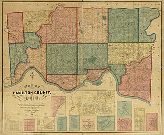
Millcreek Township is a survey township in south-central Hamilton County, Ohio, that also existed as a civil township from 1810 until 1943. Once the most important township in the county, it was largely absorbed by Cincinnati and its suburbs, nominally remaining as a paper township from 1943 until 1953. It was abolished when the rest of its unincorporated territory, consisting of Wesleyan Cemetery, became part of Cincinnati. As the original survey township covers a large portion of present-day Cincinnati, references to it are frequently encountered by genealogists.
Bond Hill is one of the 52 neighborhoods of Cincinnati, Ohio. Founded as a railroad suburb and temperance community in 1870 in northeastern Millcreek Township, it is one of a number of neighborhoods lining the Mill Creek. The population was 7,002 at the 2020 census.

Evanston is one of the 52 neighborhoods of Cincinnati, Ohio. A mostly African-American neighborhood since the 1960s, it is known as "the educating community," and is bordered by the neighborhoods of East Walnut Hills, Hyde Park, North Avondale, and Walnut Hills, as well as the City of Norwood. The population was 8,838 at the 2020 census.
The term paper township refers to a civil township under Ohio law that nominally exists for certain purposes but does not act as a functioning unit of civil government. Such townships usually exist on paper as a legal fiction due to municipal annexation.

Columbia-Tusculum is one of the 52 neighborhoods of Cincinnati, Ohio. Founded in 1788 and annexed in 1871, it is the city's oldest neighborhood. The population was 1,523 at the 2020 census.

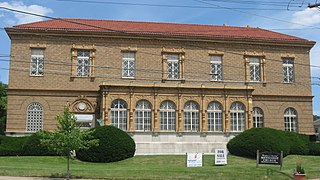
Loveland High School is a public high school located in Loveland, Ohio, United States, within Hamilton County. It is the only high school in the Loveland City School District, serving the communities of Loveland, Symmes Township, Goshen Township, and Miami Township. It offers a range of educational programs, including college preparatory and vocational.

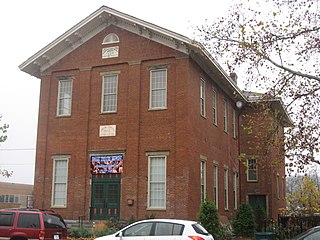
Wesleyan Cemetery is a prominent cemetery in Cincinnati, Ohio. It is the oldest continuously operating cemetery in Hamilton County, Ohio.
Westwood is one of the 52 neighborhoods of Cincinnati, Ohio. Annexed in 1896 and located in the western part of the city, it is the city's largest neighborhood in both area and population. The population was 33,774 at the 2020 census.

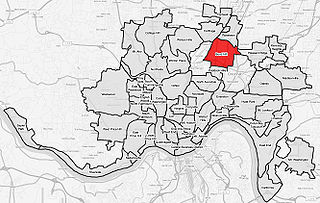
Carthage is one of the 52 neighborhoods of Cincinnati, Ohio. Established in 1791 or 1792 and annexed in 1911, it is located in the northern part of the city's Mill Creek valley. The neighborhood is predominately residential, and is center of the city's Hispanic community. It shares a border with Elmwood Place, Ohio, which, with adjacent St. Bernard, Ohio, forms an enclave in the middle of Cincinnati. The population was 2,781 at the 2020 census.

College Hill is one of the 52 neighborhoods of Cincinnati, Ohio. Established in 1813 and annexed in 1911, 1915, and 1923, it is located in the northwestern part of the city. It was originally called Pleasant Hill due to its prime location, but was later renamed College Hill because of the two colleges that were established there in the mid-nineteenth century. The neighborhood is not to be confused with North College Hill, which borders College Hill to the north but is not part of Cincinnati. The population was 16,039 at the 2020 census.
Storrs Township was a civil township in south-central Hamilton County, Ohio. It was established in 1835 and annexed to Cincinnati in 1870 but remained in nominal form until at least 1890 due to an oversight.
Spencer Township was a civil township in southeastern Hamilton County, Ohio. It was established in the early 1840s and annexed to Cincinnati in stages from 1855 to 1909.
Cincinnati Township is a paper township and former civil township in south-central Hamilton County, Ohio. Originally one of Ohio's largest townships by area at its inception in 1791, it was abolished in 1834 when the City of Cincinnati became coextensive with it through annexation. Since then, it has remained solely as a paper township.
