
The John Day River is a tributary of the Columbia River, approximately 284 miles (457 km) long, in northeastern Oregon in the United States. Undammed along its entire length, the river is the third longest free-flowing river in the contiguous United States. There is extensive use of its waters for irrigation. Its course furnishes habitat for diverse species, including wild steelhead and Chinook salmon runs. However, the steelhead populations are under federal Endangered Species Act (ESA) protections, and the Chinook salmon have been proposed for such protection.

The Lewis River is a tributary of the Columbia River, about 95 miles (153 km) long, in southwestern Washington in the United States. It drains part of the Cascade Range north of the Columbia River. The drainage basin of the Lewis River covers about 1,046 square miles (2,709 km2). The river's mean annual discharge is about 6,125 cubic feet per second (173.4 m3/s). Unlike nearby Lewis County and Fort Lewis the Lewis River was not named for Meriwether Lewis, but rather for A. Lee Lewis, an early settler who homesteaded near the mouth of the river.
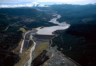
The North Fork Toutle River is a tributary of the Toutle River in southwestern Washington in the United States. The river has its headwaters near Spirit Lake, on the north side of Mount St. Helens, and flows 39 miles (63 km) to the Toutle River, about 17 miles (27 km) upstream of its confluence with the Cowlitz River. The largest tributary is the Green River, which joins near the unincorporated town of Toutle.

The Klickitat River is a tributary of the Columbia River, nearly 96 miles (154 km) long, in south-central Washington in the United States. It drains a rugged plateau area on the eastern side of the Cascade Range northeast of Portland, Oregon. In 1986, 10 miles (16 km) of the river were designated Wild and Scenic from the confluence with Wheeler Creek, near the town of Pitt, to the confluence with the Columbia River.

The Blackfoot River is a tributary of the Snake River in the U.S. state of Idaho. Formed by the confluence of Diamond Creek and Lanes Creek, it flows 135 miles (217 km) to its mouth at the Snake River. The river is part of the Columbia River Basin.
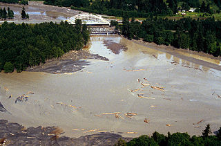
The Toutle River is a 17.2-mile (27.7 km) tributary of the Cowlitz River in the U.S. state of Washington. It rises in two forks merging near Toutle below Mount St. Helens and joins the Cowlitz near Castle Rock, 20 miles (32 km) upstream of the larger river's confluence with the Columbia River.

The Cispus River is about 54 miles (87 km) long and flows into the Cowlitz River at Lake Scanewa in the Cascade Range of Washington. Its tributaries drain most of south-central and southeastern Lewis County, extreme northeast Skamania County, and some of western Yakima County.

The White Salmon River is a 44-mile (71 km) tributary of the Columbia River in the U.S. state of Washington. Originating on the slopes of Mount Adams, it flows into the Columbia Gorge near the community of Underwood. Parts of the river have been designated Wild and Scenic. The principal tributaries of the White Salmon River include Trout Lake and Buck, Mill, Dry, Gilmer, and Rattlesnake Creeks.

The Kettle River is a 281-kilometre (175 mi) tributary of the Columbia River in southeastern British Columbia in Canada and northeastern Washington in the United States. Its drainage basin is 10,877 square kilometres (4,200 sq mi) large, of which 8,228 square kilometres (3,177 sq mi) are in Canada and 2,649 square kilometres (1,023 sq mi) in the United States. The indigenous name of the river in the Okanagan language is nxʷyaʔłpítkʷ (Ne-hoi-al-pit-kwu.)
The Colville River is a 60-mile (100 km) long tributary of the Columbia River in northeastern Washington in the United States.

The Pahsimeroi River is a 58.7-mile-long (94.5 km) river in Idaho in the United States. It is a tributary of the Salmon River, which in turn is tributary to the Snake River and Columbia River.

The Wind River is a tributary of the Columbia River, in the U.S. state of Washington. Its entire course of 30 miles (48 km) lies within Skamania County. Crusattes River is an old variant name.

The Kalama River is a 45-mile (72 km) tributary of the Columbia River, in the U.S. state of Washington. It flows entirely within Cowlitz County, Washington. Calama River is an old variant name.

The Tilton River is a tributary of the Cowlitz River, in the U.S. state of Washington. Named for territorial surveyor James Tilton, it flows for about 29 miles (47 km), entirely within Lewis County.

The Little White Salmon River is a tributary, about 19 miles (31 km) long, of the Columbia River in the U.S. state of Washington. Its headwaters are in the Monte Cristo Range in Gifford Pinchot National Forest. The river flows from this part of the Cascade Range into Drano Lake, an arm of the Bonneville Pool of the Columbia. The river drains a basin of 136 square miles (350 km2) The basin's population was an estimated 513 in 2000.
The Elochoman River is a tributary of the Columbia River, in the U.S. state of Washington. It is about 15 miles (24 km) long.

The Ohanapecosh River is a 16-mile (26 km) river in the U.S. state of Washington.

Indian Creek is a 66-mile (106 km) long tributary of the Boise River in the U.S. state of Idaho. Beginning at an elevation of 5,047 feet (1,538 m) south of Arrowrock Reservoir in western Elmore County, it flows west into Ada County and through the town of Kuna. It then flows northwest into Canyon County, through Nampa, and finally to its mouth in Caldwell, at an elevation of 2,349 feet (716.0 m). Indian Creek has a 295-square-mile (764 km2) watershed.


