Crag Hill (Yorkshire Dales)

Last updated

Crag Hill
Crag hill pic.jpg
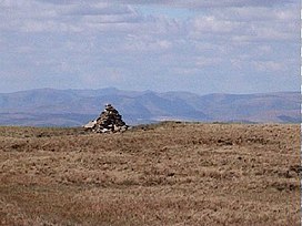
The summit triangulation point with Mickle Fell in the background
Highest point
Elevation 682 m (2,238 ft)
Coordinates 54°14′40″N2°28′27″W / 54.24446°N 2.47413°W / 54.24446; -2.47413 Coordinates: 54°14′40″N2°28′27″W / 54.24446°N 2.47413°W / 54.24446; -2.47413
Geography
Yorkshire Dales National Park UK relief location map.png
Red triangle with thick white border.svg
Crag Hill
Location in the Yorkshire Dales
Location relief map United Kingdom South Lakeland.svg
Red triangle with thick white border.svg
Crag Hill
Location in South Lakeland, Cumbria
Location Yorkshire Dales/Cumbria, England
OS grid SD692833
Topo map OS Landranger 98

Crag Hill is on the western edge of the Yorkshire Dales in northern England, not to be confused with the higher Crag Hill elsewhere in the county of Cumbria. It lies on the boundary of the Yorkshire Dales national park, but its summit is in South Lakeland district, Cumbria. [1] It is part of a ridge including the neighbouring fells of Great Coum and Gragareth. The summit of Crag Hill is about 0.62 miles (1 km) away from the top of Great Coum, the latter being the highest point on the ridge at 2,254 feet (687 m). [2]

All three hills may be included in a single circular walk from High Moss near Whernside on the Ingleton to Dent road. [3] The views are extensive, with panoramas of the Yorkshire Dales, Howgill Fells, the Pennines and the Lake District beyond.

The hill is listed as one of the waypoints in the Yorkshire Dales Top Ten (YDTT). This is a long-distance walking route that takes in the ten highest peaks in the Yorkshire Dales with a combined ascent of 22,000 feet (6,700 m). [4]

Related Research Articles

<span class="mw-page-title-main">Scafell Pike</span> Highest mountain in England

Scafell Pike is the highest and the most prominent mountain in England, at an elevation of 978 metres (3,209 ft) above sea level. It is located in the Lake District National Park, in Cumbria, and is part of the Southern Fells and the Scafell massif.

<span class="mw-page-title-main">Scafell</span> Mountain in the English Lake District, Cumbria, England

Scafell is a mountain in the English Lake District, part of the Southern Fells. Its height of 964 metres makes it the second-highest mountain in England after its neighbour Scafell Pike, from which it is separated by Mickledore col.

<span class="mw-page-title-main">Ingleborough</span> Mountain in the Yorkshire Dales, England

Ingleborough is the second-highest mountain in the Yorkshire Dales, England. It is one of the Yorkshire Three Peaks, and is frequently climbed as part of the Three Peaks walk. A large part of Ingleborough is designated as a Site of Special Scientific Interest and National Nature Reserve and is the home of a new joint project, Wild Ingleborough, with aims to improve the landscape for wildlife and people.

<span class="mw-page-title-main">Great Gable</span> Mountain in the United Kingdom

Great Gable is a mountain in the Lake District, United Kingdom. It is named after its appearance as a pyramid from Wasdale, though it is dome-shaped from most other directions. It is one of the most popular of the Lakeland fells, and there are many different routes to the summit. Great Gable is linked by the high pass of Windy Gap to its smaller sister hill, Green Gable, and by the lower pass of Beck Head to its western neighbour, Kirk Fell.

<span class="mw-page-title-main">Crinkle Crags</span> Mountain in the English Lake District, Cumbria, England

Crinkle Crags is a fell in the English Lake District in the county of Cumbria. It forms part of two major rings of mountains, surrounding the valleys of Great Langdale and Upper Eskdale. The name reflects the fell's physical appearance as its summit ridge is a series of five rises and depressions (crinkles) that are very distinctive from the valley floor. In Old English, cringol means twisted or wrinkled.

<span class="mw-page-title-main">Great Dodd</span> Mountain in the English Lake District, Cumbria, England

Great Dodd is a mountain or fell in the English Lake District. It stands on the main ridge of the Helvellyn range, a line of mountains which runs in a north-south direction between the lakes of Thirlmere and Ullswater in the east of the Lake District. Great Dodd, with a height of 857 m is the highest of the fells in this range to the north of Sticks Pass.

<span class="mw-page-title-main">Crag Hill</span>

Crag Hill is a mountain in the North Western part of the English Lake District. It was formerly known as Eel Crag; however, the Ordnance Survey now marks Eel Crag as referring to the northern crags of the fell. It is not to be confused with another Crag Hill lying on the border of North Yorkshire.

<span class="mw-page-title-main">High Stile</span> Fell in the Lake District, Cumbria, England

High Stile is a mountain in the western part of the Lake District in North West England. It is the eleventh-highest English Marilyn, standing 807 metres (2,648 ft) high, and has a relative height of 362 metres (1,187 ft).

<span class="mw-page-title-main">Red Screes</span> Mountain in the English Lake District, Cumbria, England

Red Screes is a fell in the English Lake District, situated between the villages of Patterdale and Ambleside. It may be considered an outlier of the Fairfield group in the Eastern Fells, but is separated from its neighbours by low cols. This gives Red Screes an independence which is reflected in its prominence.

<span class="mw-page-title-main">Rannerdale Knotts</span>

Rannerdale Knotts is a fell in the Lake District of Cumbria, England. Rising from the Buttermere valley, it is one of the smaller Cumbrian hills and is overlooked by a number of surrounding fells, such as Grasmoor, Whiteless Pike and, across Crummock Water, Mellbreak and the High Stile ridge. Rannerdale Knotts is said to be the site of a battle between the native Cumbrians and Norsemen and the invading Normans in the late 11th or early 12th century.

<span class="mw-page-title-main">Seathwaite Fell</span> Fell in the Lake District, Cumbria, England

Seathwaite Fell is an area of the Lake District in Cumbria, England. It stands above the hamlet of the same name at the head of Borrowdale.

<span class="mw-page-title-main">Ard Crags</span>

Ard Crags is a fell in the Lake District in Cumbria, England, it is situated in the Newlands Valley just off the minor road between Keswick and Buttermere. The Ordnance Survey officially records the fell's altitude at 581 metres (1,906 feet), considerably more than the approximate 1,860 feet that Alfred Wainwright attributed to it in his Pictorial Guide to the North Western Fells, published in 1964 well before the advent of satellite mapping. Ard Crags is situated close to other higher fells such as Causey Pike and Eel Crag and can be easily overlooked. However, viewed from certain points in the Rigg Beck or Newlands valley area it presents a clearly defined and pyramidal shape which catches the eye.

<span class="mw-page-title-main">Grisedale Pike</span> Mountain in the English Lake District, Cumbria, England

Grisedale Pike is a fell in the Lake District, Cumbria, England, situated 4.5 miles (7.2 km) west of the town of Keswick in the north-western sector of the national park. At a height of 791 m (2593 feet) it is the 40th-highest Wainwright in the Lake District; it also qualifies as a Hewitt, Marilyn and Nuttall. Grisedale Pike presents a striking appearance when viewed from the east, particularly from the vicinity of Keswick. It possesses two subsidiary summits: one unnamed ; the other Hobcarton End.

<span class="mw-page-title-main">Green Hill (Lancashire)</span> Mountain in Cowan Bridge, Lancashire, United Kingdom

Green Hill is a mountain or fell in north west England. Its summit is 628 metres (2,060 ft) above sea level. It is located above Cowan Bridge, Lancashire, near Kirkby Lonsdale, Cumbria, and Ingleton, North Yorkshire. Its summit is about 4 kilometres almost due west of the summit of Whernside. It forms the watershed between the River Dee and the Leck Beck: both are tributaries of the River Lune.

<span class="mw-page-title-main">Watson's Dodd</span>

Watson's Dodd is a fell in the English Lake District, a minor rise on the main ridge of the Helvellyn range in the Eastern Fells, but a prominent shoulder on the west side of that range.

<span class="mw-page-title-main">Hart Side</span>

Hart Side is a subsidiary top on one of the east ridges of Stybarrow Dodd, which is a mountain in the English Lake District, west of Ullswater on the main Helvellyn ridge in the Eastern Fells. With a height of 2,480 feet (756 m) Hart Side rises above the col separating it from Green Side by 75 feet (23 m).

<span class="mw-page-title-main">Glenridding Dodd</span>

Glenridding Dodd is a small fell in the English Lake District, at the end of a ridge descending from the Helvellyn range in the Eastern Fells. It stands above the village of Glenridding and on the western shore of Ullswater. Although small and not of great elevation, its top is a fine viewpoint for Ullswater and for the fells clustered round the valleys above Patterdale.

<span class="mw-page-title-main">Swirl How</span> Fell in the Lake District, Cumbria, England

Swirl How is a fell in the English Lake District. It stands between Coniston and the Duddon Valley in the southern part of the District. It rivals the Old Man of Coniston as the highest point within the traditional County Palatine of Lancashire.

Calf Top is a mountain in the western part of the Yorkshire Dales, England. It is located in the county of Cumbria, although Lancashire and North Yorkshire are not far away. Calf Top is a dominating profile in the view from many of the smaller hills to its west, such as Lambrigg Fell and Hutton Roof Crags.

<span class="mw-page-title-main">Great Coum</span>

Great Coum is a hill in the Yorkshire Dales, but is located in the South Lakeland district of Cumbria. The highest point is in Dent parish, but the boundary with Casterton parish crosses the summit. Its neighbours include Crag Hill, Green Hill and Gragareth.

References

  1. "98" (Map). Wensleydale & Upper Wharfedale. 1:50,000. Explorer. Ordnance Survey. 2015. ISBN   9780319263419.
  2. "OL2" (Map). Yorkshire Dales - Southern & Western Area. 1:25,000. Explorer. Ordnance Survey. 2016. ISBN   9780319263310.
  3. "Gragareth". yorkshiredales.org.uk. Retrieved 28 November 2017.
  4. Lawrence, Paul; Maple, Les; Sparshatt, John, eds. (2009). The UK trailwalker's handbook (8 ed.). Milnthorpe: Cicerone. p. 234. ISBN   978-1-85284-579-7.