The Sperrins or Sperrin Mountains are a range of mountains in Northern Ireland and one of the largest upland areas in Northern Ireland. The range stretches from Strabane eastwards to Slieve Gallion in Desertmartin and north towards Limavady, in the counties of Tyrone and Londonderry. The region has a population of some 150,000 and is a designated Area of Outstanding Natural Beauty.

The Merrick, or simply Merrick, is a mountain in the Range of the Awful Hand, a sub-range of the Galloway Hills range, part of the Southern Uplands of Scotland. The summit elevation is 843 metres, making it the highest mountain in the Southern Uplands and southern Scotland.

Fintona, is a village and townland in County Tyrone, Northern Ireland. Its population at the 2011 Census was 1,164.

The mountains and hills of the British Isles are categorised into various lists based on different combinations of elevation, prominence, and other criteria such as isolation. These lists are used for peak bagging, whereby hillwalkers attempt to reach all the summits on a given list, the oldest being the 282 Munros in Scotland, created in 1891.

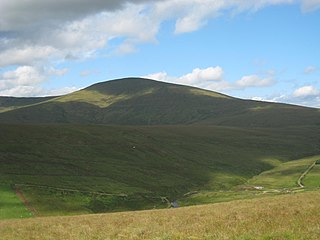
Cairnsmore of Carsphairn is a hill in the Carsphairn and Scaur Hills range, part of the Southern Uplands of Scotland. An alternative name, rarely used nowadays, is Cairnsmore of Deugh. It is the highest hill in the range, and its summit is just under 6 kilometres (3.7 mi) north-east of Carsphairn village as the crow flies, in the far north of Kirkcudbrightshire.
The Long Distance Walkers Association (LDWA) is a British not for profit, volunteer-led association whose aim is "to further the common interests of those who enjoy long distance walking". The LDWA is an association of people with the common interest of walking long distances in rural, urban, mountainous, coastal or moorland areas. The LDWA is recognised as the sports governing body for the discipline of "long distance walking" in England, Wales and Scotland.

Under Saddle Yoke is a hill in the Moffat Hills range, part of the Southern Uplands of Scotland. Despite its name, it is 10m higher than its neighbouring top, Saddle Yoke. Located in a dramatic position on a small, grassy ridge in between two deep glens, Blackhope and Carrifran, it awards excellent views into the rest of the Moffat Hills and the Ettrick Hills opposite. Although incomparable to the Scottish Highlands and not particularly precipitous, the ridge between and atop the Yokes is the narrowest summit ridge in the Southern Uplands. The electric fence that comes out of Blackshope and crosses the ridge to the north of Saddle Yoke and then continues down into Carrifran hasn't worked in 40 years. A popular round known as the Hart Fell Horseshoe begins near Blackshope and normally ascends Nether Coomb Craig first, then passing over Swatte Fell, Hart Fell and looping round Hartfell Rig to the Saddle Yokes before the descent.

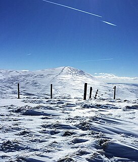
Hart Fell is a hill in the Moffat Hills range, part of the Southern Uplands of Scotland. It lies north of the town of Moffat on the border with the Scottish Borders and Dumfries and Galloway.

Ettrick Pen is a hill in the Ettrick Hills range, part of the Southern Uplands of Scotland. A remote peak, It lies southwest of the village of Ettrick, on the border of the Scottish Borders and Dumfries and Galloway. The highest of the Ettrick Hills, it is crossed by the Southern Upland Way and is a prominent landmark from many directions. Its summit is topped by an ancient cairn.

Windlestraw Law is a hill in the Moorfoot Hills range, part of the Southern Uplands of Scotland. It is the highest peak of the range, and lies north of the town of Innerleithen in the Scottish Borders. A large and boggy peak, it is usually climbed from either its western slopes or the longer route from Tweeddale to the south.
Talla Cleuch Head is a hill in the Manor Hills range, part of the Southern Uplands of Scotland. As ascents are either long or steep from all other sides, Talla Cleuch Head is normally climbed from the Megget Stane to the south-east, which allows for a deer fence to be followed to the summit.

Larg Hill is a hill in the Minnigaff Hills, a sub-range of the Galloway Hills range, part of the Southern Uplands of Scotland. The second highest and most westerly of the range, it is normally ascended with Lamachan Hill as part of a round normally starting from the north or south. Historically it was covered by woodland consisting of ash, oak, fir and beech.

Wedder Law is a hill in the Lowther Hills range, part of the Southern Uplands of Scotland. With a flat, featureless summit, it is normally ascended as part of a round of the neighbouring hills.
Uamh Bheag is a hill in the Glen Artney Hills range immediately south of the Highland Boundary Fault, part of the Central Lowlands of Scotland. The highest hill of the range, the summit is twin-topped; the lower east top has a trig point. Until 2017, it was not certain which hill was higher, and subsequently which was the Donald and Graham. That year, a survey was conducted which proved the west top to be approximately 2.4m higher. The true summit is currently marked with a cairn and a face carved out of a wooden fencepost, extending from it. It is normally ascended with neighbouring Beinn nan Eun from Glen Artney itself.

Birkscairn Hill is a hill in the Manor Hills range, part of the Southern Uplands of Scotland. It is the lowest, and normally first, Donald in a round of hills known as the Dun Rig Horseshoe, south of Peebles.

Alhang is a hill in the Carsphairn and Scaur Hills range, part of the Southern Uplands of Scotland. It is the lowest Donald hill in the range; Meikledodd Hill is 1m higher. The northern slopes of the hill are the source of the River Afton. It is most easily climbed from the Water of Ken to the east or as a round from Glen Afton to the north.

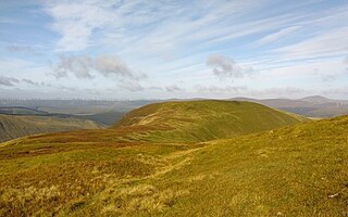
Hudderstone is a hill in the Culter Hills range, part of the Southern Uplands of Scotland. Normally ascended as part of a popular round, its southern flanks are dotted with turbines from the Clyde Extension Wind Farm.

The Rhinns of Kells are a range of hills in the Galloway Hills range, part of the Southern Uplands of Scotland. The most easterly of three parallel ridges, they are neighboured to the west by the Range of the Awful Hand and the Dungeon Hills. The eastern portion of the Minnigaff Hills range lies immediately southwest of the range. In total, these four ranges are part of the Galloway Forest Park. The ridge is located entirely within Dumfries and Galloway, with the base of the western flanks being a northwestern boundary of the county.
The Minnigaff Hills are a range of hills in the Galloway Hills range, part of the Southern Uplands of Scotland. A southerly range, they are perpendicular to the Range of the Awful Hand, Dungeon Hills and Rhinns of Kells to the north. In total, these four ranges are part of the Galloway Forest Park.
