Colorcocha or Collorcocha is a lake in the Lima Region in Peru. It is located in the Cajatambo Province, Cajatambo District. Quyllurqucha lies in the Pumarinri valley south of the Huayhuash mountain range, between Pucaccacca in the north and Millpo in the south. The lakes named Huarmicocha and Challhuacocha lie west.

Pumarinri is a 5,465-metre-high (17,930 ft) mountain in the south of the Huayhuash mountain range in the Andes of Peru. It is located in the Lima Region, Cajatambo Province, Cajatambo District. Pumarinri lies at the Pumarinri valley, south of Cuyoc.

Auxilio is a mountain in the west of the Huayhuash mountain range in the Andes of Peru, about 5,560 metres (18,241 ft) high. It is located in the Ancash Region, Bolognesi Province, Pacllon District, and in the Lima Region, Cajatambo Province, Copa District. Auxilio lies on the sub-range west of Yerupaja, south of Auxilio Lake and southwest of the mountain Huacrish.
Huacshash or Huaqshash is a mountain in the west of the Huayhuash mountain range in the Andes of Peru, about 5,644 metres (18,517 ft) high. It is located in the Lima Region, Cajatambo Province, Cajatambo District. Huacshash lies on a sub-range in the west, south of the Huayllapa River, north of the Pumarinri River and southeast of the villages of Huayllapa and Auquimarca.
Rajucollota, Suerococha, named after the nearby lake, or Diablo Mudo is a mountain in the west of the Huayhuash mountain range in the Andes of Peru, about 5,427 metres (17,805 ft) high. It is located in the Ancash Region, Bolognesi Province, Pacllon District, and in the Lima Region, Cajatambo Province, Copa District. Rajucollota lies on a sub-range west of Yerupaja, west of the mountain Huacrish, northwest of the mountain Auxilio and north of the lake Suerococha.
Challwaqucha may refer to:

Jullutahuarco is a mountain in the west of the Huayhuash mountain range in the Andes of Peru, about 5,400 metres (17,717 ft) high. It is located in the Lima Region, Cajatambo Province, Copa District. Jullutahuarco lies on the sub-range west of Yerupaja, south of Rajucollota, Huacrish and Auxilio. It is situated north of the Huayllapa River.
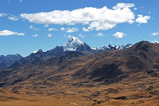
Chalhuacocha is a mountain in the Andes of Peru, about 5,200 metres (17,060 ft) high. It is located in the Lima Region, Cajatambo Province, Cajatambo District, and in the Oyón Province, Oyón District. Chalhuacocha lies northwest of Condor Huayin and east of Tocto lake.
Mitopunta is a 5,571-metre-high (18,278 ft) mountain in the Huayhuash mountain range in the Andes of Peru. It is located in the Lima Region, Cajatambo Province, Cajatambo District. Mitopunta lies on a sub-range west of the main range east of Huacshash. It is situated north of the Pumarinri valley.
Julcán is a 4,900-metre-high (16,076 ft) mountain in the Huayhuash mountain range in the Andes of Peru. It is located in the Lima Region, Cajatambo Province, Cajatambo District. Julcán lies on a sub-range west of the main range, southwest of Mitopunta and southeast of Huacshash. It is situated north of the Pumarinri valley.
Yanacushman is a mountain in the Huayhuash mountain range in the Andes of Peru, about 4,800 m (15,748 ft) high. It is located in the Lima Region, Cajatambo Province, Cajatambo District. Yanacushman lies on the southern sub-range west of the main range, northwest of Julcán and Huacshash. It is situated between the Huayllapa valley and the Pumarinri valley.
Pariauccro or Pariaucro is a massif in the Huayhuash mountain range in the Andes of Peru. This mountain has two summits, the highest one reaching an altitude of 5,572 m (18,281 ft). It is located in the Lima Region, Cajatambo Province, Cajatambo District. Pariauccro lies on a sub-range west of the main range, north of Mitopunta and northeast of Huacshash.
Huayllajirca is a mountain in the Andes of Peru, about 5,000 m (16,000 ft) high. It is located in the Lima Region, Cajatambo Province, Cajatambo District, and in the Oyón Province, Oyón District. Huayllajirca lies northwest of the mountain named Chalhuacocha and northeast of Pishtac and Tocto lake.
Pishtac (possibly from Ancash Quechua for slaughterer, is a 5,095-metre-high mountain in the Andes of Peru. It is located in the Lima Region, Cajatambo Province, Cajatambo District. Pishtac is southwest of Huayllajirca and northwest of a mountain called Chalhuacocha. A little lake named Tocto lies at its feet.
Mishihuajanan is a mountain in the Andes of Peru, about 5,100 m (16,700 ft) high. It is located in the Lima Region, Cajatambo Province, Cajatambo District, and in the Oyón Province, Oyón District. Mishihuajanan lies southwest of Millpo and north of Huayllajirca.
Puscanturpa is a mountain in the south of the Huayhuash mountain range in the Andes of Peru, about 5,400 metres (17,717 ft) high. It is located in the Huánuco Region, Lauricocha Province, Jesús District, and in the Lima Region, Cajatambo Province, Cajatambo District. Puscanturpa lies northwest of the lake and the mountain named Suerococha and northeast of Cuyoc.
Montecocha is a mountain in the Andes of Peru, about 5,200 metres (17,060 ft) high. It is located in the Lima Region, Cajatambo Province, Cajatambo District. Montecocha lies south of the Huayhuash mountain range, southwest of Millpo and east of a mountain named Shahuanacocha.


