Cajatambo District

Last updated
Cajatambo

Qaqatampu
Anexo astobamba.JPG
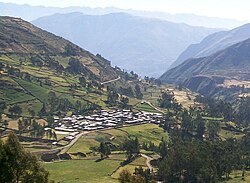
The village of Astobamba, Cajatambo District
Country Flag of Peru.svg  Peru
Region Lima
Province Cajatambo
Capital Cajatambo
Government
   Mayor José Del Carmen Flores Fuentes Rivera
(2019-2022)
Area
  Total567.96 km2 (219.29 sq mi)
Elevation
3,376 m (11,076 ft)
Population
 (2017)
  Total2,082
  Density3.7/km2 (9.5/sq mi)
Time zone UTC-5 (PET)
UBIGEO 150301

Cajatambo, Kashatampu, or Qaqatampu (Quechua) is one of five districts of the province Cajatambo in Peru. [1]

Contents

Geography

The Waywash mountain range traverses the district. Some of the highest peaks of the district are listed below: [2]

See also

Related Research Articles

Pasco Province Province in Pasco, Peru

The Pasco Province is one of the three provinces that make up the Pasco Region in Peru. The capital of this province is the city Cerro de Pasco.

Tomás Frías Province Province in Potosí Department, Bolivia

Tomás Frías is a province in the northern parts of the Bolivian Potosí Department. Its capital is Potosí which is also the capital of the department. The province is named after the former president Tomás Frías Ametller.

Aija Province Province in Ancash, Peru

The Aija Province is one of 20 provinces of the Ancash Region in Peru.

Huanca Sancos Province Province in Ayacucho, Peru

Huanca Sancos is a province in central Ayacucho, Peru. On April 3, 1983, Shining Path rebels entered the town of Lucanamarca and killed 69 people.

Cajatambo Province Province in Lima, Peru

The Cajatambo Province is one of nine provinces in the Lima Region of Peru. It is bordered to the north by the Ancash Region, to the east by the Huánuco Region, to the south by the Oyón Province, and to the west by the Huaura Province.

Bolognesi Province Province in Ancash, Peru

The Bolognesi Province is one of 20 provinces of the Ancash Region of Peru.

Huari Province Province in Ancash, Peru

The Huari Province is one of twenty provinces of the Ancash Region in Peru. Its seat is Huari.

Daniel Alcides Carrión Province Province in Pasco, Peru

The Daniel Alcides Carrión Province is the smallest of three provinces that make up the Pasco Region in Peru. It was named after the medical student Daniel Alcides Carrión. The capital of this province is Yanahuanca.

Huallanca District, Bolognesi District in Ancash, Peru

Huallanca or Wallanka is a district of the Bolognesi Province in the Ancash Region of Peru.

Espinar Province Province in Cusco, Peru

Espinar Province is one of thirteen provinces in the Cusco Region in the southern highlands of Peru.

Ocongate District District in Cusco, Peru

The Ocongate District is one of the twelve districts in the Quispicanchi Province in Peru. Created on January 2, 1857, its capital is the town of Ocongate.

Oyón Province Province in Lima, Peru

Oyón Province is a province of the Lima Region in Peru. It measures 1,886 square kilometres (728 sq mi). The capital of the province is the city of Oyón.

Melgar Province Province in Puno, Peru

Melgar Province is a province of the Puno Region in Peru. The capital of the province is the city of Ayaviri.

Laramate District is one of twenty-one districts of the province Lucanas in Peru.

Coronel Castañeda District is one of eight districts of the Parinacochas Province in Peru.

Ticlacayán District District in Pasco, Peru

Ticlacayán District is one of thirteen districts of the Pasco Province in the Pasco Region of Peru. Its seat is Ticlacayán.

Marcapomacocha District District in Junín, Peru

Marcapomacocha District is one of ten districts of the Yauli Province in the Junín Region in Peru.

Oyón District District in Lima, Peru

Oyón District is one of six districts of the province Oyón in Peru.

Chachas District District in Arequipa, Peru

Chachas District is one of fourteen districts of the province Castilla in Peru.

Puka Qaqa (Muntiqucha)

Puka Qaqa is a mountain in the Andes of Peru, about 4,800 metres (15,748 ft) high. It is located in the Lima Region, Cajatambo Province, Cajatambo District. Puka Qaqa lies south of the Waywash mountain range, northwest of Yana Hirka and south of a mountain named Muntiqucha.

References

  1. (in Spanish) Instituto Nacional de Estadística e Informática. Banco de Información Distrital Archived April 23, 2008, at the Wayback Machine . Retrieved April 11, 2008.
  2. escale.minedu.gob.pe UGEL map of the Cajatambo Province (Lima Region)

Coordinates: 10°28′17″S76°59′36″W / 10.4713°S 76.9933°W / -10.4713; -76.9933