Caujul District

Last updated
Caujul
Caujul - 1.jpg
The village of Caujul in the Oyón Province
Country Flag of Peru.svg  Peru
Region Lima
Province Oyón
FoundedJanuary 30, 1871
Capital Caujul
Government
   Mayor Abel Salazar Ríos
(2019-2022)
Area
  Total105.5 km2 (40.7 sq mi)
Elevation
3,175 m (10,417 ft)
Population
(2017)
  Total576
  Density5.5/km2 (14/sq mi)
Time zone UTC-5 (PET)
UBIGEO 150903

Caujul District is one of six districts of the province Oyón in Peru. [1]

Districts of Peru third level administrative subdivision of Peru

The districts of Peru are the third-level country subdivisions of Peru. They are subdivisions of the provinces, which in turn are subdivisions of the larger regions or departments. There are 1,838 districts in total.

Oyón Province Province in Lima, Peru

Oyón Province is a province of the Lima Region in Peru. It measures 1,886 square kilometres (728 sq mi). The capital of the province is the city of Oyón.

Peru republic in South America

Peru, officially the Republic of Peru, is a country in western South America. It is bordered in the north by Ecuador and Colombia, in the east by Brazil, in the southeast by Bolivia, in the south by Chile, and in the west by the Pacific Ocean. Peru is a megadiverse country with habitats ranging from the arid plains of the Pacific coastal region in the west to the peaks of the Andes mountains vertically extending from the north to the southeast of the country to the tropical Amazon Basin rainforest in the east with the Amazon river.

See also

Related Research Articles

Fairlawn (Washington, D.C.)

Fairlawn is a working class and middle class residential neighborhood located in southeast Washington, D.C. It is bounded by Interstate 295, Pennsylvania Avenue SE, Minnesota Avenue SE, Naylor Road SE, and Good Hope Road SE.

New Kent, Virginia census-designated place in New Kent County, Virginia

New Kent is a census-designated place (CDP) in and the county seat of New Kent County, Virginia, United States. The population as of the 2010 Census was 239.

Middle Harbor Shoreline Park public park in Oakland, California, USA

Middle Harbor Shoreline Park (MHSP) is located on San Francisco Bay and the Port of Oakland entrance channel, west of downtown Oakland, California. It is owned and operated by the Port of Oakland. The park entrance is at the intersection of 7th and Middle Harbor Streets. It is open seven days a week from 8 a.m. to dusk.

Cristiano Otoni human settlement in Brazil

Cristiano Otoni is a Brazilian municipality located in the state of Minas Gerais. The city belongs to the mesoregion Metropolitana de Belo Horizonte and to the microregion of Conselheiro Lafaiete.

Nova Boa Vista is a municipality in the state of Rio Grande do Sul, Brazil.

Imperial District is one of sixteen districts of the province Cañete in Peru.

Santa Cruz de Flores District is one of sixteen districts of the province Cañete in Peru.

Pachangara District is one of six districts of the province Oyón in Peru.

Checras District is one of twelve districts of the province Huaura in Peru.

Paccho District is one of twelve districts of the province Huaura in Peru.

Santa Leonor District is one of twelve districts of the province Huaura in Peru.

Cayna District is one of eight districts of the province Ambo in Peru.

Conchamarca District is one of eight districts of the province Ambo in Peru.

Baños District is one of seven districts of the province Lauricocha in Peru.

Queropalca District District in Huánuco, Peru

Queropalca District is one of seven districts of the province Lauricocha in Peru.

Zalesie, Przasnysz County Village in Masovian, Poland

Zalesie is a village in the administrative district of Gmina Krasne, within Przasnysz County, Masovian Voivodeship, in east-central Poland. It lies approximately 3 kilometres (2 mi) south of Krasne, 15 km (9 mi) south-east of Przasnysz, and 76 km (47 mi) north of Warsaw.

Fort Richmond

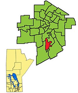
Fort Richmond is a provincial electoral division in the Canadian province of Manitoba. It was created by redistribution in 2008, out of parts of St. Norbert and Fort Garry.

Combaya is a town in the La Paz Department, Bolivia.

Tacachi Town in Cochabamba Department, Bolivia

Tacachi is a location in the Cochabamba Department in central Bolivia. It is the seat of the Tacachi Municipality, the fourth municipal section of the Punata Province.

São Martinho, Santa Catarina Municipality in South, Brazil

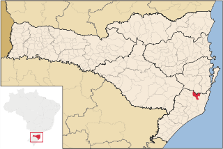
São Martinho, Santa Catarina is a municipality in the state of Santa Catarina in the South region of Brazil.

References

Coordinates: 10°48′21″S76°58′44″W / 10.80583°S 76.97889°W / -10.80583; -76.97889

Geographic coordinate system Coordinate system

A geographic coordinate system is a coordinate system that enables every location on Earth to be specified by a set of numbers, letters or symbols. The coordinates are often chosen such that one of the numbers represents a vertical position and two or three of the numbers represent a horizontal position; alternatively, a geographic position may be expressed in a combined three-dimensional Cartesian vector. A common choice of coordinates is latitude, longitude and elevation. To specify a location on a plane requires a map projection.