Omas District

Last updated
Omas
Umas
District

Peru Yauyos Omas.jpg

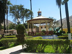
Plaza de Armas of Omas, Peru
Country Flag of Peru.svg  Peru
Region Lima
Province Yauyos
Founded July 28, 1821
Capital Omas
Government
   Mayor Luis Alberto Ponce Fernandez
Area
  Total 295.35 km2 (114.04 sq mi)
Elevation 1,539 m (5,049 ft)
Population (2005 census)
  Total 686
  Density 2.3/km2 (6.0/sq mi)
Time zone PET (UTC-5)
UBIGEO 151022

Omas District is one of thirty-three districts of the province Yauyos in Peru. [1]

Districts of Peru third level administrative subdivision of Peru

The districts of Peru are the third-level country subdivisions of Peru. They are subdivisions of the provinces, which in turn are subdivisions of the larger regions or departments. There are 1,838 districts in total.

Yauyos Province Province in Lima, Peru

The Yauyos Province is a province located in the Lima Region of Peru. It is one of the eleven that make up that region.

Peru republic in South America

Peru, officially the Republic of Peru, is a country in western South America. It is bordered in the north by Ecuador and Colombia, in the east by Brazil, in the southeast by Bolivia, in the south by Chile, and in the west by the Pacific Ocean. Peru is a megadiverse country with habitats ranging from the arid plains of the Pacific coastal region in the west to the peaks of the Andes mountains vertically extending from the north to the southeast of the country to the tropical Amazon Basin rainforest in the east with the Amazon river.

Related Research Articles

Banner, Illinois Village in Illinois, United States

Banner is a village in Fulton County, Illinois, United States. The population was 189 at the 2010 census, up from 149 at the 2000 census.

Crompond, New York CDP in New York, United States

Crompond is a community and census-designated place (CDP) located in the Town of Yorktown in Westchester County, New York. The population was 2,292 at the 2010 census.

The Flaghouse Homes was a Baltimore Public Housing Project built in 1955. They were located in the Jonestown section of Southeast Baltimore North of Little Italy and East of downtown bounded by Pratt Street on the South, Baltimore Street on the North, Central Avenue on the East and President Street on the West. They were demolished in 2001.

San Carlos (canton) Cantón in Alajuela, Costa Rica

San Carlos is the 10th canton in the province of Alajuela in Costa Rica. The canton covers an area of 3,347.98 square kilometres (1,292.66 sq mi), making it the largest canton in the country. It has a population of 178,460. ranking it fifth.

Regent Hall Church in London

The Regent Hall is a Salvation Army centre on London's Oxford Street. It is one of the oldest centres in London having been founded by the founder of the army, William Booth in 1882. The church is known as the "Rink", because it was formerly a skating rink.

Santa Cruz de Flores District is one of sixteen districts of the province Cañete in Peru.

San Andrés de Tupicocha District is one of thirty-two districts of the province Huarochirí in Peru.

San Pedro de Huancayre District is one of thirty-two districts of the province Huarochirí in Peru.

Santiago de Anchucaya District is one of thirty-two districts of the province Huarochirí in Peru.

Santo Domingo de los Olleros District is one of thirty-two districts of the province Huarochirí in Peru.

Quinches District District in Lima, Peru

Quinches District is one of thirty-three districts of the province Yauyos in Peru.

San Pedro de Pilas District District in Lima, Peru

San Pedro de Pilas District is one of thirty-three districts of the province Yauyos in Peru.

Basco, Wisconsin Unincorporated community in Wisconsin, United States

Basco is an unincorporated community in the town of Montrose, in Dane County, Wisconsin, United States. Basco is located less than 15 miles from Madison.

Ponure Village in Podlaskie, Poland

Ponure is a village in the administrative district of Gmina Czarna Białostocka, within Białystok County, Podlaskie Voivodeship, in north-eastern Poland. It lies approximately 5 kilometres (3 mi) south of Czarna Białostocka and 19 km (12 mi) north-east of the regional capital Białystok.

Stary Brus Village in Lublin, Poland

Stary Brus is a village in Włodawa County, Lublin Voivodeship, in eastern Poland. It is the seat of the gmina called Gmina Stary Brus. It lies approximately 20 kilometres (12 mi) south-west of Włodawa and 57 km (35 mi) north-east of the regional capital Lublin.

Barcarrota Place in Extremadura, Spain

Barcarrota is a Spanish municipality in the province of Badajoz, Extremadura. It has a population of 3,664 (2007) and an area of 136.1 km².

Franklin Manor-on-the-Bay, Maryland human settlement in Maryland, United States of America

Franklin Manor-on-the-Bay is an unincorporated community or populated place located in Anne Arundel County, Maryland at latitude 38.802 and longitude -76.515. The elevation is 3 feet. Franklin Manor-on-the-Bay appears on the Deale U.S. Geological Survey Map. Anne Arundel County is in the Eastern time zone (UTC-5).

Dębienko Village in Greater Poland, Poland

Dębienko is a village in the administrative district of Gmina Stęszew, within Poznań County, Greater Poland Voivodeship, in west-central Poland. It lies approximately 3 kilometres (2 mi) north-east of Stęszew and 19 km (12 mi) south-west of the regional capital Poznań.

Krąplewo Settlement in Greater Poland, Poland

Krąplewo is a settlement in the administrative district of Gmina Stęszew, within Poznań County, Greater Poland Voivodeship, in west-central Poland. It lies approximately 3 kilometres (2 mi) north-east of Stęszew and 19 km (12 mi) south-west of the regional capital Poznań.

Strużka, Chojnice County Settlement in Pomeranian, Poland

Strużka is a settlement in the administrative district of Gmina Chojnice, within Chojnice County, Pomeranian Voivodeship, in northern Poland. It lies approximately 12 kilometres (7 mi) north of Chojnice and 96 km (60 mi) south-west of the regional capital Gdańsk.

References

Coordinates: 12°30′53″S76°17′21″W / 12.51472°S 76.28917°W / -12.51472; -76.28917

Geographic coordinate system Coordinate system

A geographic coordinate system is a coordinate system that enables every location on Earth to be specified by a set of numbers, letters or symbols. The coordinates are often chosen such that one of the numbers represents a vertical position and two or three of the numbers represent a horizontal position; alternatively, a geographic position may be expressed in a combined three-dimensional Cartesian vector. A common choice of coordinates is latitude, longitude and elevation. To specify a location on a plane requires a map projection.