San Pedro de Pilas | |
|---|---|
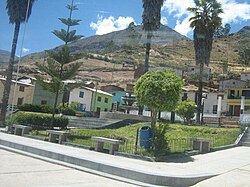 San Pedro de Pilas | |
 | |
| Country | |
| Region | Lima |
| Province | Yauyos |
| Founded | October 11, 1957 |
| Capital | San Pedro de Pilas |
| Government | |
| • Mayor | Melquiades Quispe |
| Area | |
• Total | 97.39 km2 (37.60 sq mi) |
| Elevation | 2,656 m (8,714 ft) |
| Population | |
• Total | 453 |
| • Density | 4.7/km2 (12/sq mi) |
| Time zone | UTC-5 (PET) |
| UBIGEO | 151027 |
San Pedro de Pilas District is one of thirty-three districts of the province Yauyos in Peru. [1]