Mala District

Last updated
Mala
COA Mala District in Canete Province.png
Coat of arms
Country Flag of Peru.svg  Peru
Region Lima
Province Cañete
FoundedJuly 22, 1825
Capital Mala
Government
   Mayor Sonia Ramos Ruiz
(2019-2022)
Area
  Total129.31 km2 (49.93 sq mi)
Elevation
30 m (100 ft)
Population
(2017)
  Total32,717
  Density215.61/km2 (558.4/sq mi)
Time zone UTC-5 (PET)
UBIGEO 150509

Mala District is one of sixteen districts of the province Cañete in Peru. [1] It limits on the north with San Antonio District and Santa Cruz de Flores District that separates them the Mala river. To the south-east, the Coayllo District.

Districts of Peru third level administrative subdivision of Peru

The districts of Peru are the third-level country subdivisions of Peru. They are subdivisions of the provinces, which in turn are subdivisions of the larger regions or departments. There are 1,838 districts in total.

Cañete Province Province in Lima Region, Peru

Cañete is a province located in southern Lima Region, Peru. It is bordered by the Lima Province on the north, the Ica Region on the south, the Huarochirí and Yauyos provinces on the east, and the Pacific Ocean on the west. Its capital is the town of San Vicente de Cañete District. San Luis is the Capital of the Afro-Peruvian Folklore.

Peru republic in South America

Peru, officially the Republic of Peru, is a country in western South America. It is bordered in the north by Ecuador and Colombia, in the east by Brazil, in the southeast by Bolivia, in the south by Chile, and in the west by the Pacific Ocean. Peru is a megadiverse country with habitats ranging from the arid plains of the Pacific coastal region in the west to the peaks of the Andes mountains vertically extending from the north to the southeast of the country to the tropical Amazon Basin rainforest in the east with the Amazon river.

Contents

History

There once was a zone where the Huarcos, brave and strong warriors that defended with their lives the fort of Cañete against the devastating Incas. After the Huarcos civilization crumbled, Mala was ruled by the Incas in the Pachacamac temple located 30 km of Lima.

Pachacamac archaeological site

Pachacamac is an archaeological site 40 kilometres (25 mi) southeast of Lima, Peru in the Valley of the Lurín River. The site was first settled around A.D. 200 and was named after the "Earth Maker" creator god Pacha Kamaq. The site flourished for about 1,300 years until the Spanish invaded. Pachacamac covers about 600 hectares of land.

Near the Mala river there is a pre-incan tower (the area is now called "Las Totoritas") where Diego de Almagro and Francisco Pizarro had a reunion in 1537 and they were going to make peace. According to Pedro Cieza de León, Pizarro was planning to make a stampede to Almagro because he was his enemy. From the 19th Century, the animal husbandry Rinconada de Mala, property of the Asín family, is at service but now only the remaining part of the estate. It is at the Km.86 of the Panamerican Highway.

Diego de Almagro Spanish conquistador

Diego de Almagro, also known as El Adelantado and El Viejo, was a Spanish conquistador known for his exploits in western South America. He participated with Francisco Pizarro in the Spanish conquest of Peru. From Peru Almagro led an expedition that made him the second European to set foot in central Chile. Back in Peru a longstanding conflict with Pizarro over the control of the former Inca capital of Cuzco erupted into a civil war between the two bands of conquistadores. In the battle of Las Salinas in 1538 Almagro was defeated by the Pizarro brothers and months later he was executed.

Francisco Pizarro 16th-century Spanish conquistador who conquered the Inca Empire

Francisco Pizarro González was a Spanish conquistador who led the Spanish conquest of the Inca Empire. He captured and killed Incan emperor Atahualpa, and claimed the lands for Spain.

Pedro Cieza de León Spanish conquistador

Pedro Cieza de León was a Spanish conquistador and chronicler of Peru. He is known primarily for his history and description of Peru, Crónicas del Perú. He wrote this book in four parts, but only the first was published during his lifetime; the remaining sections were not published until the 19th and 20th centuries.

Festivals

The patronal feast is celebrated at the Saint Peter's feast day, June 29. In its traditional food the district has the tamale, the chicharron, the bruta soup (a soup with dry rehydrated potatoes with noodles, also called in Spanish "mancha pecho"), the carapulcra, and the chapana (a sweet yucca).

Saint Peter apostle and first pope

Saint Peter, also known as Simon Peter, Simeon, Simon, or Cephas, was one of the Twelve Apostles of Jesus Christ, and the first leader of the early Church.

Tamale food

A tamale is a traditional Mesoamerican dish made of masa or dough, which is steamed in a corn husk or banana leaf. The wrapping can either be discarded prior to eating, or be used as a plate, the tamale eaten from within. Tamales can be filled with meats, cheeses, fruits, vegetables, chilies or any preparation according to taste, and both the filling and the cooking liquid may be seasoned.

Carapulcra

Carapulcra is a Peruvian cuisine stew of pork and dehydrated potatoes, with peanuts, aji panca and mirasol peppers, garlic, and other spices like clove. It is a modern adaptation of a traditional Andean dish. It is usually eaten with rice, boiled potatoes or yuca.

See also

Administrative divisions of Peru

Related Research Articles

Gonzalo Pizarro Spanish conquistador

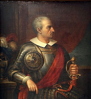
Gonzalo Pizarro y Alonso was a Spanish conquistador and younger paternal half-brother of Francisco Pizarro, the conqueror of the Inca Empire. Bastard son of Captain Gonzalo Pizarro y Rodríguez de Aguilar (senior) (1446–1522) who as colonel of infantry served in the Italian campaigns under Gonzalo Fernández de Córdoba, and in Navarre, with some distinction, and María Alonso, from Trujillo. He was the half brother of Francisco and Hernándo Pizarro and the full brother of Juan Pizarro.

Spanish conquest of the Inca Empire Period of Spanish conquest in South America

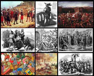
The Spanish conquest of the Inca Empire was one of the most important campaigns in the Spanish colonization of the Americas. After years of preliminary exploration and military skirmishes, 168 Spanish soldiers under conquistador Francisco Pizarro, his brothers, and their native allies captured the Sapa Inca Atahualpa in the 1532 Battle of Cajamarca. It was the first step in a long campaign that took decades of fighting but ended in Spanish victory in 1572 and colonization of the region as the Viceroyalty of Peru. The conquest of the Inca Empire, led to spin-off campaigns into present-day Chile and Colombia, as well as expeditions towards the Amazon Basin.

Manco Inca Yupanqui Inca emperor

Manco Inca Yupanqui was the founder and monarch of the independent Neo-Inca State in Vilcabamba, although he was originally a puppet Inca Emperor installed by the Spaniards. He was also known as "Manco II" and "Manco Cápac II". He was one of the sons of Huayna Capac and a younger brother of Huascar.

Lunahuaná Town in Lima, Peru

Lunahuaná is a small town in the Cañete Province in Peru. The town lies about 187 km south of Lima in the Lunahuaná valley at the bank of Cañete River. Due to the unique landscape, Lunahuaná is a very popular destination for both Peruvians and foreign tourists. According to the 2017 census, there were 4,393 inhabitants.

Hernando Pizarro Spanish conquistador

Hernando Pizarro y de Vargas was a Spanish conquistador and one of the Pizarro brothers who ruled over Peru. He ultimately died in Spain at a very advanced age, unlike his brothers who all suffered violent ends.

Diego de Almagro II called El Mozo, was the son of Spanish conquistador Diego de Almagro and a native Panamanian Indian.

San Miguel District is one of thirteen districts of the province San Miguel in Peru. San Miguel was founded by Francisco Pizarro in 1532 and is thus the oldest European town in Peru.

Illimo District District in Lambayeque, Peru

Illimo District is one of twelve districts of the province Lambayeque in Peru.

Calango District District in Lima, Peru

Calango District is one of sixteen districts of the province Cañete in Peru.

Chilca District is one of sixteen districts of the province Cañete in Peru.

Coayllo District District in Lima, Peru

Coayllo District is one of sixteen districts of the province Cañete in Peru.

Nuevo Imperial District is one of sixteen districts of the province Cañete in Peru.

Pacarán District District in Lima, Peru

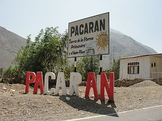
Pacarán District is one of sixteen districts of the province Cañete in Peru.

San Antonio District is one of sixteen districts of the province Cañete in Peru.

San Vicente de Cañete District is one of sixteen districts of Cañete Province in Peru.

Santa Cruz de Flores District is one of sixteen districts of the province Cañete in Peru.

Tomas District is one of thirty-three districts of the Yauyos Province in Peru.

The Battle of Ollantaytambo took place in January 1537, between the forces of Inca emperor Manco Inca and a Spanish expedition led by Hernando Pizarro during the Spanish conquest of Peru. A former ally of the Spaniards, Manco Inca rebelled in May 1536, and besieged a Spanish garrison in the city of Cusco. To end the stand-off, the besieged mounted a raid against the emperor's headquarters in the town of Ollantaytambo. The expedition, commanded by Hernando Pizarro, included 100 Spaniards and some 30,000 Indian auxiliaries against an Inca army more than 30,000 strong.

References

Coordinates: 12°39′27″S76°37′45″W / 12.65750°S 76.62917°W / -12.65750; -76.62917

Geographic coordinate system Coordinate system

A geographic coordinate system is a coordinate system that enables every location on Earth to be specified by a set of numbers, letters or symbols. The coordinates are often chosen such that one of the numbers represents a vertical position and two or three of the numbers represent a horizontal position; alternatively, a geographic position may be expressed in a combined three-dimensional Cartesian vector. A common choice of coordinates is latitude, longitude and elevation. To specify a location on a plane requires a map projection.