The Madhvani Group of Companies commonly referred to as the Madhvani Group, is one of the largest conglomerates in Uganda. The group has investments in Kenya, Uganda, Rwanda, South Sudan, Tanzania, the Middle East, India, and North America.
The Kampala–Jinja Highway is a road in Uganda, connecting the cities of Kampala and Jinja. Sometimes referred to as Kampala–Jinja Road, it is a busy road, with several towns, trading centers and other points of interest along the way. As of October 2016, a new, wider, four-lane dual carriageway expressway, the Kampala–Jinja Expressway, is proposed to be constructed south of the present highway to relieve traffic and complement existing transport infrastructure between Kampala and Jinja.
Nateete is a location in the city of Kampala, Uganda's capital.
Lweeza, also Lweza, is a neighborhood in the Buganda Region of Uganda. The correct phonetic spelling consistent with the local Ganda language is Lweeza.
Katuna is a town in the Kabale District of Uganda at the border with Rwanda. The town is also called "Gatuna" in the Kinyarwanda language.
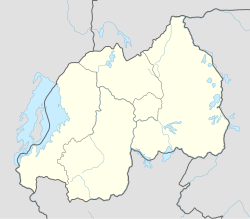
Gatuna is a small settlement in Cyumba Sector in northern Rwanda. It is located at the northern border adjacent to the town of Katuna, in neighboring Uganda.
Mirama Hills is a town in the Western Region of Uganda.
East African Business Week is a weekly Ugandan newspaper published in Kampala, Uganda's capital and largest city. It is the only exclusively business weekly published in the country.
Sanga, is an urban center in the Kiruhura District, Ankole sub-region, in the Western Region of Uganda.
The Kabale–Kisoro–Bunagana Road in Western Uganda connects the town of Kabale with the towns of Kisoro, Bunagana, at the border with the Democratic Republic of the Congo and with Kyanika, at the border with Rwanda.
Kyanika is a settlement in Kisoro District in the Western Region of Uganda.
Elegu is a town in the Northern Region of Uganda. It sits across the international border from the town of Nimule, South Sudan.
Kawanda–Birembo High Voltage Power Line is a high voltage electricity power line, under construction, connecting the high voltage substation at Kawanda, in Uganda to another high voltage substation at Birembo, in Rwanda.
Maya is a town in the Central Region of Uganda. It is one of the urban centers in Wakiso District.

The Uganda Standard Gauge Railway is a planned railway system linking the country to the neighboring countries of Kenya, Rwanda, Democratic Republic of the Congo and South Sudan, as part of the East African Railway Master Plan. The new Standard Gauge Railway (SGR), is intended to replace the old, inefficient metre-gauge railway system. The entire 1,724 kilometres (1,071 mi) SGR in Uganda will cost an estimated $12.8 billion.
Mbalwa is a neighborhood in Kyaliwajjala Parish, Kira Municipality, Wakiso District in the Central Region of Uganda.
Kijabijo is a neighborhood in Kira Town, in Wakiso District in the Buganda Region of Uganda.
Bihanga is a settlement in Ibanda District in the Western Region of Uganda. It is the location of the headquarters of Bihanga Parish, Nyamarebe sub-county.
Rusumo is a town in northwestern Tanzania, at the border with Rwanda. It sits across the Kagera River from Rusumo, Rwanda.
The Rwanda Standard Gauge Railway is a standard gauge railway (SGR) system, under development, linking the country to the neighboring countries of Tanzania and Uganda. It is intended to ease the transfer of goods between the Indian Ocean ports of Dar es Salaam and Mombasa, and the Rwandan capital Kigali. The system is expected to link, in the future, to Rwanda's two other neighbors, Burundi and the Democratic Republic of the Congo, as part of the East African Railway Master Plan. With no previously existing railway network, Rwanda is developing its railway system from scratch. The project is dependent on the construction of the Tanzanian and Ugandan SGR lines to the Rwandan border, which have not been completed as of October 2023.