Czarny Las may refer to the following places:

Adamowizna is a village in the administrative district of Gmina Grodzisk Mazowiecki, within Grodzisk Mazowiecki County, Masovian Voivodeship, in east-central Poland. It lies approximately 5 kilometres (3 mi) south of Grodzisk Mazowiecki and 30 km (19 mi) south-west of Warsaw.
Chlebnia is a village in the administrative district of Gmina Grodzisk Mazowiecki, within Grodzisk Mazowiecki County, Masovian Voivodeship, in east-central Poland. It lies approximately 5 kilometres (3 mi) north-west of Grodzisk Mazowiecki and 31 km (19 mi) west of Warsaw.

Chrzanów Duży is a village in the administrative district of Gmina Grodzisk Mazowiecki, within Grodzisk Mazowiecki County, Masovian Voivodeship, in east-central Poland. It lies approximately 3 kilometres (2 mi) north of Grodzisk Mazowiecki and 28 km (17 mi) west of Warsaw.

Chrzanów Mały is a village in the administrative district of Gmina Grodzisk Mazowiecki, within Grodzisk Mazowiecki County, Masovian Voivodeship, in east-central Poland. It lies approximately 5 kilometres (3 mi) north of Grodzisk Mazowiecki and 27 km (17 mi) west of Warsaw.

Izdebno Kościelne is a village in the administrative district of Gmina Grodzisk Mazowiecki, within Grodzisk Mazowiecki County, Masovian Voivodeship, in east-central Poland. It lies approximately 7 kilometres (4 mi) north-west of Grodzisk Mazowiecki and 34 km (21 mi) west of Warsaw.

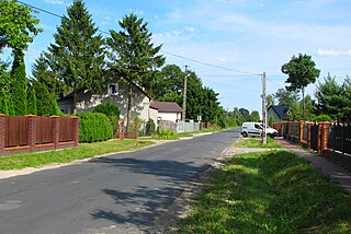
Kozerki is a village in the administrative district of Gmina Grodzisk Mazowiecki, within Grodzisk Mazowiecki County, Masovian Voivodeship, in east-central Poland. It lies approximately 2 kilometres (1 mi) south-west of Grodzisk Mazowiecki and 31 km (19 mi) south-west of Warsaw.
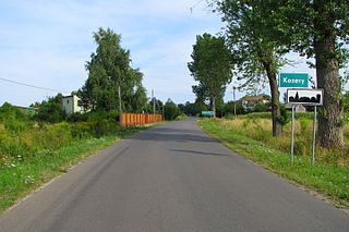
Kozery is a village in the administrative district of Gmina Grodzisk Mazowiecki, within Grodzisk Mazowiecki County, Masovian Voivodeship, in east-central Poland. It lies approximately 4 kilometres (2 mi) west of Grodzisk Mazowiecki and 32 km (20 mi) west of Warsaw.

Kraśnicza Wola is a village in the administrative district of Gmina Grodzisk Mazowiecki, within Grodzisk Mazowiecki County, Masovian Voivodeship, in east-central Poland. It lies approximately 5 kilometres (3 mi) west of Grodzisk Mazowiecki and 32 km (20 mi) west of Warsaw.

Książenice is a village in the administrative district of Gmina Grodzisk Mazowiecki, within Grodzisk Mazowiecki County, Masovian Voivodeship, in east-central Poland. It lies approximately 7 kilometres (4 mi) south-east of Grodzisk Mazowiecki and 27 km (17 mi) south-west of Warsaw.

Makówka is a village in the administrative district of Gmina Grodzisk Mazowiecki, within Grodzisk Mazowiecki County, Masovian Voivodeship, in east-central Poland. It lies approximately 7 kilometres (4 mi) south of Grodzisk Mazowiecki and 33 km (21 mi) south-west of Warsaw.

Nowe Kozery is a village in the administrative district of Gmina Grodzisk Mazowiecki, within Grodzisk Mazowiecki County, Masovian Voivodeship, in east-central Poland. It lies approximately 3 kilometres (2 mi) west of Grodzisk Mazowiecki and 32 km (20 mi) south-west of Warsaw.
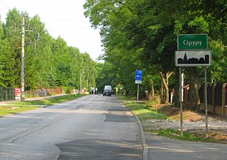
Opypy is a village in the administrative district of Gmina Grodzisk Mazowiecki, within Grodzisk Mazowiecki County, Masovian Voivodeship, in east-central Poland. It lies approximately 5 kilometres (3 mi) east of Grodzisk Mazowiecki and 26 km (16 mi) south-west of Warsaw.

Radonie is a village in the administrative district of Gmina Grodzisk Mazowiecki, within Grodzisk Mazowiecki County, Masovian Voivodeship, in east-central Poland. It lies approximately 6 kilometres (4 mi) south of Grodzisk Mazowiecki and 30 km (19 mi) south-west of Warsaw.

Tłuste is a village in the administrative district of Gmina Grodzisk Mazowiecki, within Grodzisk Mazowiecki County, Masovian Voivodeship, in east-central Poland. It lies approximately 5 kilometres (3 mi) north of Grodzisk Mazowiecki and 28 km (17 mi) west of Warsaw.
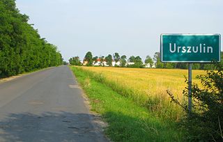
Urszulin is a village in the administrative district of Gmina Grodzisk Mazowiecki, within Grodzisk Mazowiecki County, Masovian Voivodeship, in east-central Poland. It lies approximately 8 kilometres (5 mi) south-east of Grodzisk Mazowiecki and 25 km (16 mi) south-west of Warsaw.


