
Kozerki is a village in the administrative district of Gmina Grodzisk Mazowiecki, within Grodzisk Mazowiecki County, Masovian Voivodeship, in east-central Poland. It lies approximately 2 kilometres (1 mi) south-west of Grodzisk Mazowiecki and 31 km (19 mi) south-west of Warsaw.

Książenice is a village in the administrative district of Gmina Grodzisk Mazowiecki, within Grodzisk Mazowiecki County, Masovian Voivodeship, in east-central Poland. It lies approximately 7 kilometres (4 mi) south-east of Grodzisk Mazowiecki and 27 km (17 mi) south-west of Warsaw.

Makówka is a village in the administrative district of Gmina Grodzisk Mazowiecki, within Grodzisk Mazowiecki County, Masovian Voivodeship, in east-central Poland. It lies approximately 7 kilometres (4 mi) south of Grodzisk Mazowiecki and 33 km (21 mi) south-west of Warsaw.

Mościska is a village in the administrative district of Gmina Grodzisk Mazowiecki, within Grodzisk Mazowiecki County, Masovian Voivodeship, in east-central Poland. It lies approximately 5 kilometres (3 mi) south of Grodzisk Mazowiecki and 32 km (20 mi) south-west of Warsaw.

Nowe Kozery is a village in the administrative district of Gmina Grodzisk Mazowiecki, within Grodzisk Mazowiecki County, Masovian Voivodeship, in east-central Poland. It lies approximately 3 kilometres (2 mi) west of Grodzisk Mazowiecki and 32 km (20 mi) south-west of Warsaw.
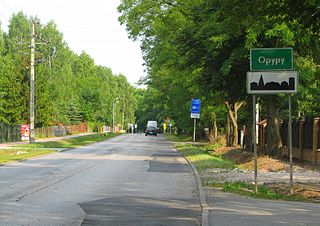
Opypy is a village in the administrative district of Gmina Grodzisk Mazowiecki, within Grodzisk Mazowiecki County, Masovian Voivodeship, in east-central Poland. It lies approximately 5 kilometres (3 mi) east of Grodzisk Mazowiecki and 26 km (16 mi) south-west of Warsaw.

Radonie is a village in the administrative district of Gmina Grodzisk Mazowiecki, within Grodzisk Mazowiecki County, Masovian Voivodeship, in east-central Poland. It lies approximately 6 kilometres (4 mi) south of Grodzisk Mazowiecki and 30 km (19 mi) south-west of Warsaw.
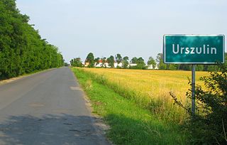
Urszulin is a village in the administrative district of Gmina Grodzisk Mazowiecki, within Grodzisk Mazowiecki County, Masovian Voivodeship, in east-central Poland. It lies approximately 8 kilometres (5 mi) south-east of Grodzisk Mazowiecki and 25 km (16 mi) south-west of Warsaw.

Ciepłe is a village in the administrative district of Gmina Żabia Wola, within Grodzisk Mazowiecki County, Masovian Voivodeship, in east-central Poland. It lies approximately 3 kilometres (2 mi) south-west of Żabia Wola, 11 km (7 mi) south of Grodzisk Mazowiecki, and 32 km (20 mi) south-west of Warsaw.

Jastrzębnik is a village in the administrative district of Gmina Żabia Wola, within Grodzisk Mazowiecki County, Masovian Voivodeship, in east-central Poland. It lies approximately 3 kilometres (2 mi) east of Żabia Wola, 12 km (7 mi) south-east of Grodzisk Mazowiecki, and 28 km (17 mi) south-west of Warsaw.

Oddział is a village in the administrative district of Gmina Żabia Wola, within Grodzisk Mazowiecki County, Masovian Voivodeship, in east-central Poland. It lies approximately 11 kilometres (7 mi) south of Grodzisk Mazowiecki and 33 km (21 mi) south-west of Warsaw.
Ojrzanów is a village in the administrative district of Gmina Żabia Wola, within Grodzisk Mazowiecki County, Masovian Voivodeship, in east-central Poland. It lies approximately 6 kilometres (4 mi) south-east of Żabia Wola, 15 km (9 mi) south-east of Grodzisk Mazowiecki, and 30 km (19 mi) south-west of Warsaw.

Osowiec is a village in the administrative district of Gmina Żabia Wola, within Grodzisk Mazowiecki County, Masovian Voivodeship, in east-central Poland. It lies approximately 3 kilometres (2 mi) west of Żabia Wola, 9 km (6 mi) south of Grodzisk Mazowiecki, and 32 km (20 mi) south-west of Warsaw.

Pieńki Słubickie is a village in the administrative district of Gmina Żabia Wola, within Grodzisk Mazowiecki County, Masovian Voivodeship, in east-central Poland. It lies approximately 6 kilometres (4 mi) south-west of Żabia Wola, 13 km (8 mi) south of Grodzisk Mazowiecki, and 35 km (22 mi) south-west of Warsaw.
Pieńki Zarębskie is a village in the administrative district of Gmina Żabia Wola, within Grodzisk Mazowiecki County, Masovian Voivodeship, in east-central Poland. It lies approximately 4 kilometres (2 mi) south-east of Żabia Wola, 14 km (9 mi) south-east of Grodzisk Mazowiecki, and 31 km (19 mi) south-west of Warsaw.
Stara Bukówka is a village in the administrative district of Gmina Żabia Wola, within Grodzisk Mazowiecki County, Masovian Voivodeship, in east-central Poland. It lies approximately 10 kilometres (6 mi) south of Grodzisk Mazowiecki and 32 km (20 mi) south-west of Warsaw.

Żabia Wola is a village in Grodzisk Mazowiecki County, Masovian Voivodeship, in east-central Poland. It is the seat of the gmina called Gmina Żabia Wola. It lies approximately 10 kilometres (6 mi) south-east of Grodzisk Mazowiecki and 30 km (19 mi) south-west of Warsaw.
Zalesie is a village in the administrative district of Gmina Żabia Wola, within Grodzisk Mazowiecki County, Masovian Voivodeship, in east-central Poland. It lies approximately 3 kilometres (2 mi) north of Żabia Wola, 8 km (5 mi) south-east of Grodzisk Mazowiecki, and 29 km (18 mi) south-west of Warsaw.

Zaręby is a village in the administrative district of Gmina Żabia Wola, within Grodzisk Mazowiecki County, Masovian Voivodeship, in east-central Poland. It lies approximately 6 kilometres (4 mi) south-east of Żabia Wola, 15 km (9 mi) south-east of Grodzisk Mazowiecki, and 30 km (19 mi) south-west of Warsaw.
Żelechów is a village in the administrative district of Gmina Żabia Wola, within Grodzisk Mazowiecki County, Masovian Voivodeship, in east-central Poland. It lies approximately 13 kilometres (8 mi) south-east of Grodzisk Mazowiecki and 29 km (18 mi) south-west of Warsaw.


