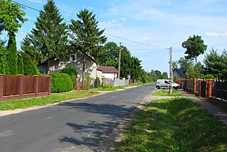
Gmina Grodzisk Mazowiecki

Last updated
Gmina Grodzisk Mazowiecki
Grodzisk Mazowiecki Commune
Gmina
POL Grodzisk Mazowiecki COA.svg
Coat of arms
Coordinates(Grodzisk Mazowiecki): 52°6′32″N20°37′30″E / 52.10889°N 20.62500°E / 52.10889; 20.62500 Coordinates: 52°6′32″N20°37′30″E / 52.10889°N 20.62500°E / 52.10889; 20.62500
CountryFlag of Poland.svg  Poland
Voivodeship Masovian
County Grodzisk Mazowiecki
Seat Grodzisk Mazowiecki
Area
  Total 107.03 km2 (41.32 sq mi)
Population (2006)
  Total 37,432
  Density 350/km2 (910/sq mi)
   Urban 27,055
  Rural 10,377
Website http://www.grodzisk.pl

Gmina Grodzisk Mazowiecki is an urban-rural gmina (administrative district) in Grodzisk Mazowiecki County, Masovian Voivodeship, in east-central Poland. Its seat is the town of Grodzisk Mazowiecki, which lies approximately 29 kilometres (18 mi) south-west of Warsaw.

Gmina administrative division of Poland

The gmina is the principal unit of the administrative division of Poland, similar to a municipality. As of 2010 there were 2,478 gminy throughout the country. The word gmina derives from the German word Gemeinde, meaning "community".

Grodzisk Mazowiecki County County in Masovian, Poland

Grodzisk Mazowiecki County is a unit of territorial administration and local government (powiat) in Masovian Voivodeship, east-central Poland. It came into being on 1 January 1999, as a result of the Polish local government reforms passed in 1998. Its administrative seat and largest town is Grodzisk Mazowiecki, which lies 29 kilometres (18 mi) south-west of Warsaw. The county also contains the towns of Milanówek, lying 2 km (1 mi) north-east of Grodzisk Mazowiecki, and Podkowa Leśna, 8 km (5 mi) east of Grodzisk Mazowiecki.

Masovian Voivodeship Voivodeship in Poland

Mazovian Voivodeship or Mazovia Province is the largest and most populous of the 16 Polish provinces, or voivodeships, created in 1999. It occupies 35,579 square kilometres (13,737 sq mi) of east-central Poland, and has 5,324,500 inhabitants. Its principal cities are Warsaw in the centre of the Warsaw metropolitan area, Radom (226,000) in the south, Płock (127,000) in the west, Siedlce (77,000) in the east, and Ostrołęka (55,000) in the north. The capital of the voivodeship is the national capital, Warsaw.

Contents

The gmina covers an area of 107.03 square kilometres (41.3 sq mi), and as of 2006 its total population is 37,432 (out of which the population of Grodzisk Mazowiecki amounts to 27,055, and the population of the rural part of the gmina is 10,377).

Villages

Apart from the town of Grodzisk Mazowiecki, Gmina Grodzisk Mazowiecki contains the villages and settlements of Adamów, Adamowizna, Chlebnia, Chrzanów Duży, Chrzanów Mały, Czarny Las, Izdebno Kościelne, Janinów, Kady, Kałęczyn, Kozerki, Kozery, Kraśnicza Wola, Książenice, Makówka, Marynin, Mościska, Natolin, Nowe Izdebno, Nowe Kłudno, Nowe Kozery, Odrano-Wola, Opypy, Radonie, Stare Kłudno, Szczęsne, Tłuste, Urszulin, Wężyk, Władków, Wólka Grodziska, Zabłotnia and Żuków.

Adamów, Grodzisk Mazowiecki County Village in Masovian, Poland

Adamów is a village in the administrative district of Gmina Grodzisk Mazowiecki, within Grodzisk Mazowiecki County, Masovian Voivodeship, in east-central Poland.

Adamowizna, Masovian Voivodeship Village in Masovian, Poland

Adamowizna is a village in the administrative district of Gmina Grodzisk Mazowiecki, within Grodzisk Mazowiecki County, Masovian Voivodeship, in east-central Poland. It lies approximately 5 kilometres (3 mi) south of Grodzisk Mazowiecki and 30 km (19 mi) south-west of Warsaw.

Chlebnia Village in Masovian, Poland

Chlebnia is a village in the administrative district of Gmina Grodzisk Mazowiecki, within Grodzisk Mazowiecki County, Masovian Voivodeship, in east-central Poland. It lies approximately 5 kilometres (3 mi) north-west of Grodzisk Mazowiecki and 31 km (19 mi) west of Warsaw.

Neighbouring gminas

Gmina Grodzisk Mazowiecki is bordered by the town of Milanówek and by the gminas of Baranów, Błonie, Brwinów, Jaktorów, Nadarzyn, Radziejowice and Żabia Wola.

Milanówek Place in Masovian, Poland

Milanówek is a town and a seat of a separate commune in Poland. Located next to the Grodzisk Mazowiecki County near Warsaw, it is often considered an outlying suburb of the capital of Poland but is in fact an independent entity administratively and culturally. Milanówek is however part of wider Warsaw agglomeration. Located on the Middle Masovian Plain, between Grodzisk Mazowiecki and Pruszkow, the town has approximately 15,449 inhabitants. Milanówek is served by Milanówek railway station.

Gmina Baranów is a rural gmina in Grodzisk Mazowiecki County, Masovian Voivodeship, in east-central Poland. Its seat is the village of Baranów, which lies approximately 10 kilometres (6 mi) west of Grodzisk Mazowiecki and 37 km (23 mi) west of Warsaw. Baranów is the most possible location for the new New Central Polish Airport - planned as the biggest hub for Central and Eastern Europe.

Gmina Błonie is an urban-rural gmina in Warsaw West County, Masovian Voivodeship, in east-central Poland. Its seat is the town of Błonie, which lies approximately 13 kilometres (8 mi) west of Ożarów Mazowiecki and 27 km (17 mi) west of Warsaw.

Related Research Articles

Grójec County County in Masovian, Poland

Grójec County is a unit of territorial administration and local government (powiat) in Masovian Voivodeship, east-central Poland. It came into being on January 1, 1999, as a result of the Polish local government reforms passed in 1998. Its administrative seat and largest town is Grójec, which lies 40 kilometres (25 mi) south of Warsaw. The county contains three other towns: Warka, 25 km (16 mi) east of Grójec, Nowe Miasto nad Pilicą, 34 km (21 mi) south-west of Grójec, and Mogielnica, 22 km (14 mi) south-west of Grójec.

Gmina Czerniewice is a rural gmina in Tomaszów Mazowiecki County, Łódź Voivodeship, in central Poland. Its seat is the village of Czerniewice, which lies approximately 19 kilometres (12 mi) north-east of Tomaszów Mazowiecki and 50 km (31 mi) east of the regional capital Łódź.

Gmina Rokiciny is a rural gmina in Tomaszów Mazowiecki County, Łódź Voivodeship, in central Poland. Its seat is the village of Rokiciny, which lies approximately 22 kilometres (14 mi) north-west of Tomaszów Mazowiecki and 28 km (17 mi) south-east of the regional capital Łódź.

Gmina Rzeczyca is a rural gmina in Tomaszów Mazowiecki County, Łódź Voivodeship, in central Poland. Its seat is the village of Rzeczyca, which lies approximately 21 kilometres (13 mi) north-east of Tomaszów Mazowiecki and 61 km (38 mi) east of the regional capital Łódź.

Gmina Żelechlinek is a rural gmina in Tomaszów Mazowiecki County, Łódź Voivodeship, in central Poland. Its seat is the village of Żelechlinek, which lies approximately 23 kilometres (14 mi) north of Tomaszów Mazowiecki and 40 km (25 mi) east of the regional capital Łódź.

Gmina Łaskarzew is a rural gmina in Garwolin County, Masovian Voivodeship, in east-central Poland. Its seat is the town of Łaskarzew, although the town is not part of the territory of the gmina.

Gmina Jaktorów is a rural gmina in Grodzisk Mazowiecki County, Masovian Voivodeship, in east-central Poland. Its seat is the village of Jaktorów, which lies approximately 8 kilometres (5 mi) west of Grodzisk Mazowiecki and 37 km (23 mi) south-west of Warsaw.

Gmina Żabia Wola is a rural gmina in Grodzisk Mazowiecki County, Masovian Voivodeship, in east-central Poland. Its seat is the village of Żabia Wola, which lies approximately 9 kilometres (5 mi) south-east of Grodzisk Mazowiecki and 31 km (19 mi) south-west of Warsaw.

Gmina Warka is an urban-rural gmina in Grójec County, Masovian Voivodeship, in east-central Poland. Its seat is the town of Warka, which lies approximately 25 kilometres (16 mi) east of Grójec and 50 km (31 mi) south of Warsaw.

Gmina Mrozy is an urban-rural gmina in Mińsk County, Masovian Voivodeship, in east-central Poland. Its seat is the town of Mrozy, which lies approximately 17 kilometres (11 mi) east of Mińsk Mazowiecki and 56 km (35 mi) east of Warsaw.

Gmina Nasielsk is an urban-rural gmina in Nowy Dwór Mazowiecki County, Masovian Voivodeship, in east-central Poland. Its seat is the town of Nasielsk, which lies approximately 21 kilometres (13 mi) north-east of Nowy Dwór Mazowiecki and 45 km (28 mi) north of Warsaw.

Gmina Pomiechówek Gmina in Masovian, Poland

Gmina Pomiechówek is a rural gmina in Nowy Dwór Mazowiecki County, Masovian Voivodeship, in east-central Poland. It takes its name from the village of Pomiechówek, but its seat is Brody-Parcele, which lies approximately 5 kilometres (3 mi) north-east of Nowy Dwór Mazowiecki and 33 km (20 mi) north-west of Warsaw.

Gmina Nadarzyn is a rural gmina in Pruszków County, Masovian Voivodeship, in east-central Poland. Its seat is the village of Nadarzyn, which lies approximately 9 kilometres (6 mi) south of Pruszków and 20 km (12 mi) south-west of Warsaw.

Gmina Radziejowice is a rural gmina in Żyrardów County, Masovian Voivodeship, in east-central Poland. Its seat is the village of Radziejowice, which lies approximately 10 kilometres (6 mi) south-east of Żyrardów and 40 km (25 mi) south-west of Warsaw.

Gmina Rakoniewice is an urban-rural gmina in Grodzisk Wielkopolski County, Greater Poland Voivodeship, in west-central Poland. Its seat is the town of Rakoniewice, which lies approximately 13 kilometres (8 mi) south-west of Grodzisk Wielkopolski and 53 km (33 mi) south-west of the regional capital Poznań.

Nowe Izdebno Village in Masovian, Poland

Nowe Izdebno is a village in the administrative district of Gmina Grodzisk Mazowiecki, within Grodzisk Mazowiecki County, Masovian Voivodeship, in east-central Poland.

Nowe Kozery Village in Masovian, Poland

Nowe Kozery is a village in the administrative district of Gmina Grodzisk Mazowiecki, within Grodzisk Mazowiecki County, Masovian Voivodeship, in east-central Poland. It lies approximately 3 kilometres (2 mi) west of Grodzisk Mazowiecki and 32 km (20 mi) south-west of Warsaw.

References