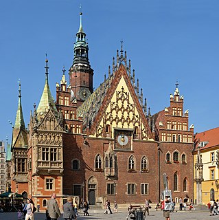
Zielona Góra County is a unit of territorial administration and local government (powiat) in Lubusz Voivodeship, western Poland. It came into being on January 1, 1999, as a result of the Polish local government reforms passed in 1998. Its administrative seat is the city of Zielona Góra, although the city is not part of the county. The county contains five towns: Sulechów, which lies 18 km (11 mi) north-east of Zielona Góra, Nowogród Bobrzański, which lies 25 km (16 mi) south-west of Zielona Góra, Babimost, which lies 32 km (20 mi) north-east of Zielona Góra, Czerwieńsk, which lies 11 km (7 mi) north-west of Zielona Góra, and Kargowa, 29 km (18 mi) north-east of Zielona Góra.

Gmina Kargowa is an urban-rural gmina in Zielona Góra County, Lubusz Voivodeship, in western Poland. Its seat is the town of Kargowa, which lies approximately 29 kilometres (18 mi) north-east of Zielona Góra.
Gmina Niegosławice is a rural gmina in Żagań County, Lubusz Voivodeship, in western Poland. Its seat is the village of Niegosławice, which lies approximately 28 kilometres (17 mi) east of Żagań and 42 km (26 mi) south of Zielona Góra.
Gmina Wartkowice is a rural gmina in Poddębice County, Łódź Voivodeship, in central Poland. Its seat is the village of Wartkowice, which lies approximately 10 kilometres (6 mi) north of Poddębice and 39 km (24 mi) north-west of the regional capital Łódź.
Gmina Łososina Dolna is a rural gmina in Nowy Sącz County, Lesser Poland Voivodeship, in southern Poland. Its seat is the village of Łososina Dolna, which lies approximately 15 kilometres (9 mi) north of Nowy Sącz and 81 km (50 mi) south-east of the regional capital Kraków.
Gmina Pokój is a rural gmina in Namysłów County, Opole Voivodeship, in south-western Poland. Its seat is the village of Pokój, which lies approximately 20 kilometres (12 mi) south-east of Namysłów and 29 km (18 mi) north of the regional capital Opole.

Gmina Leśnica, German Gemeinde Leschnitz is an urban-rural gmina in Strzelce County, Opole Voivodeship, in Upper Silesia in Poland. Its seat is the town of Leśnica (Leschnitz), which lies approximately 11 kilometres (7 mi) south-west of Strzelce Opolskie and 32 km (20 mi) south-east of the regional capital Opole.
Gmina Lubaczów is a rural gmina in Lubaczów County, Subcarpathian Voivodeship, in south-eastern Poland, on the border with Ukraine. Its seat is the town of Lubaczów, although the town is not part of the territory of the gmina.
Gmina Przywidz is a rural gmina in Gdańsk County, Pomeranian Voivodeship, in northern Poland. Its seat is the village of Przywidz, which lies approximately 22 kilometres (14 mi) west of Pruszcz Gdański and 28 km (17 mi) south-west of the regional capital Gdańsk.
Gmina Kartuzy is an urban-rural gmina in Kartuzy County, Pomeranian Voivodeship, in northern Poland. Its seat is the town of Kartuzy, which lies approximately 29 kilometres (18 mi) west of the regional capital Gdańsk.
Gmina Psary is a rural gmina in Będzin County, Silesian Voivodeship, in southern Poland. Its seat is the village of Psary, which lies approximately 6 kilometres (4 mi) north of Będzin and 17 km (11 mi) north-east of the regional capital Katowice.
Gmina Korsze is an urban-rural gmina in Kętrzyn County, Warmian-Masurian Voivodeship, in northern Poland. Its seat is the town of Korsze, which lies approximately 19 kilometres (12 mi) north-west of Kętrzyn and 61 km (38 mi) north-east of the regional capital Olsztyn.

Dolna Grupa is a village in the administrative district of Gmina Dragacz, within Świecie County, Kuyavian-Pomeranian Voivodeship, in north-central Poland. It lies approximately 4 kilometres (2 mi) west of Dragacz, 19 km (12 mi) north-east of Świecie, 7 kilometres (4 mi) west of Grudziadz and 52 km (32 mi) north of Toruń.
Ciszyca Dolna is a village in the administrative district of Gmina Tarłów, within Opatów County, Świętokrzyskie Voivodeship, in south-central Poland. It lies approximately 7 kilometres (4 mi) north-east of Tarłów, 37 km (23 mi) north-east of Opatów, and 85 km (53 mi) east of the regional capital Kielce.
Opinogóra Dolna is a village in the administrative district of Gmina Opinogóra Górna, within Ciechanów County, Masovian Voivodeship, in east-central Poland. It lies approximately 2 kilometres (1 mi) north of Opinogóra Górna, 8 km (5 mi) north-east of Ciechanów, and 80 km (50 mi) north of Warsaw.
Gilówka Dolna is a village in the administrative district of Gmina Iłów, within Sochaczew County, Masovian Voivodeship, in east-central Poland. It lies approximately 3 kilometres (2 mi) north of Iłów, 22 km (14 mi) north-west of Sochaczew, and 69 km (43 mi) west of Warsaw.
Wólka Dolna is a village in the administrative district of Gmina Kosów Lacki, within Sokołów County, Masovian Voivodeship, in east-central Poland. It lies approximately 6 kilometres (4 mi) north of Kosów Lacki, 29 km (18 mi) north of Sokołów Podlaski, and 90 km (56 mi) north-east of Warsaw.
Sucha Dolna is a village in the administrative district of Gmina Niegosławice, within Żagań County, Lubusz Voivodeship, in western Poland. It lies approximately 24 kilometres (15 mi) east of Żagań and 43 km (27 mi) south of Zielona Góra.

Gorzupia Dolna ( is a village in the administrative district of Gmina Żagań, within Żagań County, Lubusz Voivodeship, in western Poland. It lies approximately 14 kilometres north of Żagań and 28 km south-west of Zielona Góra.