
Jawor County is a unit of territorial administration and local government (powiat) in Lower Silesian Voivodeship, south-western Poland. It came into being on January 1, 1999, as a result of the Polish local government reforms passed in 1998. The county covers an area of 581.2 square kilometres (224.4 sq mi). Its administrative seat is the town of Jawor; the only other town in the county is Bolków.
Flat Lake Provincial Park is a provincial park in British Columbia, Canada.

The Beočin monastery is a Serbian Orthodox monastery, located just outside Beočin, on Fruška Gora mountain in the northern Serbian province of Vojvodina.

Wąsosz is a town in Góra County, Lower Silesian Voivodeship, in south-western Poland. It is the seat of the administrative district (gmina) called Gmina Wąsosz. It lies approximately 17 kilometres (11 mi) south-east of Góra, and 53 kilometres (33 mi) north-west of the regional capital Wrocław. The rivers Orla and Barycz meet here.
Kłoda Górowska is a village in the administrative district of Gmina Góra, within Góra County, Lower Silesian Voivodeship, in south-western Poland. Prior to 1945 it was in Germany.

Ligota is a village in the administrative district of Gmina Góra, within Góra County, Lower Silesian Voivodeship, in south-western Poland. Prior to 1945 it was in Germany. It lies approximately 6 kilometres (4 mi) north-east of Góra and 71 km (44 mi) north-west of the regional capital Wrocław.
Łagiszyn is a village in the administrative district of Gmina Góra, within Góra County, Lower Silesian Voivodeship, in south-western Poland. Prior to 1945 it was in Germany.
Nowa Wioska is a village in the administrative district of Gmina Góra, within Góra County, Lower Silesian Voivodeship, in south-western Poland. Prior to 1945 it was in Germany.
Osetno is a village in the administrative district of Gmina Góra, within Góra County, Lower Silesian Voivodeship, in south-western Poland. Prior to 1945 it was in Germany. It lies approximately 8 kilometres (5 mi) south-west of Góra and 70 km (43 mi) north-west of the regional capital Wrocław.
Rogów Górowski is a village in the administrative district of Gmina Góra, within Góra County, Lower Silesian Voivodeship, in south-western Poland. Prior to 1945 it was in Germany.
Sławęcice is a village in the administrative district of Gmina Góra, within Góra County, Lower Silesian Voivodeship, in south-western Poland. Prior to 1945 it was in Germany. It lies approximately 5 kilometres (3 mi) north-west of Góra and 74 km (46 mi) north-west of the regional capital Wrocław.
Wierzowice Małe is a village in the administrative district of Gmina Góra, within Góra County, Lower Silesian Voivodeship, in south-western Poland. Prior to 1945 it was in Germany.
Włodków Dolny is a village in the administrative district of Gmina Góra, within Góra County, Lower Silesian Voivodeship, in south-western Poland. Prior to 1945 it was in Germany.
Zawieścice is a village in the administrative district of Gmina Góra, within Góra County, Lower Silesian Voivodeship, in south-western Poland. Prior to 1945 it was in Germany.
Ksawerów is a village in the administrative district of Gmina Żmudź, within Chełm County, Lublin Voivodeship, in eastern Poland.

Bülüldüz is a village in the Lachin Rayon of Azerbaijan.
Krasnobrzeg is a settlement in the administrative district of Gmina Wronki, within Szamotuły County, Greater Poland Voivodeship, in west-central Poland.
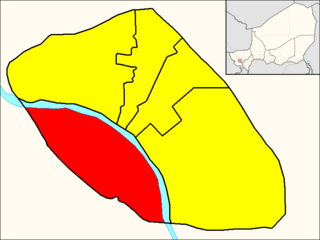
Commune V (Niamey), also known as Niamey V, is an urban commune in Niger. It is a commune of the capital city of Niamey. It is located in the south-western shore of the Niger River.

Eram Amusement Park is the largest theme park in Iran. The park was established in 1972 by Assadollah Khoram, after whom the park was named until 1979. Eram Park is located on the Tehran–Karaj Freeway in Tehran province and covers an area of 70 hectares.


