
Miechowice is a village in the administrative district of Gmina Inowrocław, within Inowrocław County, Kuyavian-Pomeranian Voivodeship, in north-central Poland. It lies approximately 4 kilometres (2 mi) south-east of Inowrocław, 37 km (23 mi) south-west of Toruń, and 44 km (27 mi) south-east of Bydgoszcz.
Żakowice is a village in the administrative district of Gmina Osięciny, within Radziejów County, Kuyavian-Pomeranian Voivodeship, in north-central Poland. It lies approximately 4 kilometres (2 mi) east of Osięciny, 17 km (11 mi) east of Radziejów, and 46 km (29 mi) south of Toruń.
Kozy is a village in the administrative district of Gmina Piotrków Kujawski, within Radziejów County, Kuyavian-Pomeranian Voivodeship, in north-central Poland. It lies approximately 7 kilometres (4 mi) south-east of Piotrków Kujawski, 16 km (10 mi) south of Radziejów, and 60 km (37 mi) south of Toruń.
Biskupice is a village in the administrative district of Gmina Radziejów, within Radziejów County, Kuyavian-Pomeranian Voivodeship, in north-central Poland. It lies approximately 4 kilometres (2 mi) east of Radziejów and 45 km (28 mi) south of Toruń.
Kolonia Dębice is a village in the administrative district of Gmina Włocławek, within Włocławek County, Kuyavian-Pomeranian Voivodeship, in north-central Poland.
Markowo is a village in the administrative district of Gmina Włocławek, within Włocławek County, Kuyavian-Pomeranian Voivodeship, in north-central Poland. It lies approximately 12 kilometres (7 mi) south-west of Włocławek and 57 km (35 mi) south-east of Toruń.
Bielawy is a village in the administrative district of Gmina Lubraniec, within Włocławek County, Kuyavian-Pomeranian Voivodeship, in north-central Poland. It lies approximately 4 kilometres (2 mi) north-east of Lubraniec, 16 km (10 mi) south-west of Włocławek, and 55 km (34 mi) south of Toruń.
Kazanie is a village in the administrative district of Gmina Lubraniec, within Włocławek County, Kuyavian-Pomeranian Voivodeship, in north-central Poland. It lies approximately 6 kilometres (4 mi) north-east of Lubraniec, 14 km (9 mi) south-west of Włocławek, and 56 km (35 mi) south of Toruń.
Kamionek is a village in the administrative district of Gmina Mogilno, within Mogilno County, Kuyavian-Pomeranian Voivodeship, in north-central Poland. It lies approximately 10 kilometres (6 mi) south of Mogilno, 62 km (39 mi) south of Bydgoszcz, and 67 km (42 mi) south-west of Toruń.
Lichosielce is a village in the administrative district of Gmina Lipsk, within Augustów County, Podlaskie Voivodeship, in north-eastern Poland, close to the border with Belarus. It lies approximately 12 kilometres (7 mi) east of Lipsk, 41 km (25 mi) east of Augustów, and 77 km (48 mi) north of the regional capital Białystok.
Makarki is a village in the administrative district of Gmina Grodzisk, within Siemiatycze County, Podlaskie Voivodeship, in north-eastern Poland. It lies approximately 3 kilometres (2 mi) south-east of Grodzisk, 17 km (11 mi) north-west of Siemiatycze, and 67 km (42 mi) south-west of the regional capital Białystok.
Mochowo is a village in Sierpc County, Masovian Voivodeship, in east-central Poland. It is the seat of the gmina called Gmina Mochowo. It lies approximately 15 kilometres (9 mi) south-west of Sierpc and 115 km (71 mi) north-west of Warsaw.
Majki is a village in the administrative district of Gmina Zawidz, within Sierpc County, Masovian Voivodeship, in east-central Poland. It lies approximately 6 kilometres (4 mi) south of Zawidz, 18 km (11 mi) south-east of Sierpc, and 99 km (62 mi) north-west of Warsaw.
Majki Duże is a village in the administrative district of Gmina Zawidz, within Sierpc County, Masovian Voivodeship, in east-central Poland. It lies approximately 6 kilometres (4 mi) south of Zawidz, 18 km (11 mi) south-east of Sierpc, and 99 km (62 mi) north-west of Warsaw.
Majki Małe is a village in the administrative district of Gmina Zawidz, within Sierpc County, Masovian Voivodeship, in east-central Poland. It lies approximately 6 kilometres (4 mi) south of Zawidz, 18 km (11 mi) south-east of Sierpc, and 99 km (62 mi) north-west of Warsaw.
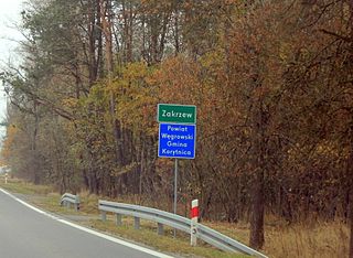
Zakrzew is a village in the administrative district of Gmina Korytnica, within Węgrów County, Masovian Voivodeship, in east-central Poland. It lies approximately 8 kilometres (5 mi) south-west of Korytnica, 18 km (11 mi) west of Węgrów, and 55 km (34 mi) east of Warsaw.
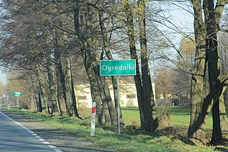
Ogrodniki is a village in the administrative district of Gmina Łochów, within Węgrów County, Masovian Voivodeship, in east-central Poland. It lies approximately 6 kilometres (4 mi) north-east of Łochów, 26 km (16 mi) north-west of Węgrów, and 65 km (40 mi) north-east of Warsaw.
Zielonka is a village in the administrative district of Gmina Wierzbinek, within Konin County, Greater Poland Voivodeship, in west-central Poland. It lies approximately 4 kilometres (2 mi) east of Wierzbinek, 32 km (20 mi) north-east of Konin, and 113 km (70 mi) east of the regional capital Poznań.
Nadstawki is a village in the administrative district of Gmina Odolanów, within Ostrów Wielkopolski County, Greater Poland Voivodeship, in west-central Poland. It lies approximately 7 kilometres (4 mi) east of Odolanów, 11 km (7 mi) south-east of Ostrów Wielkopolski, and 110 km (68 mi) south-east of the regional capital Poznań.
Padalo is a village in Krumovgrad Municipality, Kardzhali Province, southern Bulgaria.


