Niwa is a village in the administrative district of Gmina Szczytna, within Kłodzko County, Lower Silesian Voivodeship, in south-western Poland.
Rajczyn is a village in the administrative district of Gmina Wińsko, within Wołów County, Lower Silesian Voivodeship, in south-western Poland. Prior to 1945 it was in Germany.
Chałupska is a village in the administrative district of Gmina Mogilno, within Mogilno County, Kuyavian-Pomeranian Voivodeship, in north-central Poland.

Sól is a village in the administrative district of Gmina Biłgoraj, within Biłgoraj County, Lublin Voivodeship, in eastern Poland. It lies approximately 8 kilometres (5 mi) south-west of Biłgoraj and 83 km (52 mi) south of the regional capital Lublin.

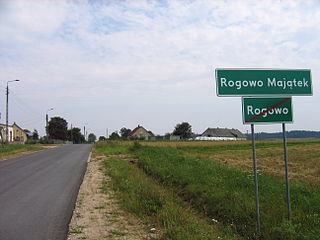
Rogowo-Majątek is a village in the administrative district of Gmina Choroszcz, within Białystok County, Podlaskie Voivodeship, in north-eastern Poland. It lies approximately 5 kilometres (3 mi) west of Choroszcz and 18 km (11 mi) west of the regional capital Białystok.
Flisów is a settlement in the administrative district of Gmina Czarna Dąbrówka, within Bytów County, Pomeranian Voivodeship, in northern Poland.

Nowy Lindów is a village in the administrative district of Gmina Kowiesy, within Skierniewice County, Łódź Voivodeship, in central Poland. It lies approximately 6 kilometres (4 mi) east of Kowiesy, 27 km (17 mi) east of Skierniewice, and 73 km (45 mi) east of the regional capital Łódź.

Stary Kromolin is a village in the administrative district of Gmina Szadek, within Zduńska Wola County, Łódź Voivodeship, in central Poland. It lies approximately 6 kilometres (4 mi) south-west of Szadek, 9 km (6 mi) north-west of Zduńska Wola, and 41 km (25 mi) west of the regional capital Łódź.

Byszów is a village in the administrative district of Gmina Klimontów, within Sandomierz County, Świętokrzyskie Voivodeship, in south-central Poland. It lies approximately 5 kilometres (3 mi) east of Klimontów, 18 km (11 mi) west of Sandomierz, and 69 km (43 mi) south-east of the regional capital Kielce.

Zakącie is a village in the administrative district of Gmina Garwolin, within Garwolin County, Masovian Voivodeship, in east-central Poland. It lies approximately 11 kilometres (7 mi) south-west of Garwolin and 54 km (34 mi) south-east of Warsaw.

Charzykowy is a village in the administrative district of Gmina Chojnice, within Chojnice County, Pomeranian Voivodeship, in northern Poland. It lies approximately 5 kilometres (3 mi) north-west of Chojnice and 102 km (63 mi) south-west of the regional capital Gdańsk.

Dzięcielec is a village in the administrative district of Gmina Łęczyce, within Wejherowo County, Pomeranian Voivodeship, in northern Poland. It lies approximately 11 kilometres (7 mi) south of Łęczyce, 25 km (16 mi) south-west of Wejherowo, and 49 km (30 mi) west of the regional capital Gdańsk.
Natać Wielka is a village in the administrative district of Gmina Nidzica, within Nidzica County, Warmian-Masurian Voivodeship, in northern Poland.
Łącko is a settlement in the administrative district of Gmina Grunwald, within Ostróda County, Warmian-Masurian Voivodeship, in northern Poland.
Dębce is a village in the administrative district of Gmina Gryfino, within Gryfino County, West Pomeranian Voivodeship, in north-western Poland, close to the German border.
Dziupla is a settlement in the administrative district of Gmina Bobolice, within Koszalin County, West Pomeranian Voivodeship, in north-western Poland.
Lundby is a suburb and borough of Gothenburg, Sweden. It is located in the central part of the Hisingen island, stretching along the northern shore of the Göta River. It is the original home of the dollhouse manufacturing company Lundby and the home of Volvo Trucks and Volvo Penta.

Roja Municipality is a municipality in Courland, Latvia. The municipality was formed in 2009 by merging Mērsrags parish and Roja parish the administrative centre being Roja. Since 2010 a separate Mērsrags municipality has been created.
Guilladje is a village and rural commune in Niger.

Draževići (Kiseljak) is a village in the municipality of Kiseljak, Bosnia and Herzegovina.


