Sulimów is a village in the administrative district of Gmina Siechnice, within Wrocław County, Lower Silesian Voivodeship, in south-western Poland. Prior to 1945 it was in Germany.
Kąkol is a village in the administrative district of Gmina Wielka Nieszawka, within Toruń County, Kuyavian-Pomeranian Voivodeship, in north-central Poland. It lies approximately 4 kilometres (2 mi) west of Wielka Nieszawka and 13 km (8 mi) south-west of Toruń.
Dziekszyn is a village in the administrative district of Gmina Janowiec Wielkopolski, within Żnin County, Kuyavian-Pomeranian Voivodeship, in north-central Poland.
Dworzysk is a village in the administrative district of Gmina Sidra, within Sokółka County, Podlaskie Voivodeship, in north-eastern Poland.
Gołocice is a village in the administrative district of Gmina Witonia, within Łęczyca County, Łódź Voivodeship, in central Poland. It lies approximately 6 kilometres (4 mi) south-west of Witonia, 9 km (6 mi) north of Łęczyca, and 42 km (26 mi) north-west of the regional capital Łódź.
Polany Surowiczne is a former village in the administrative district of Gmina Komańcza, within Sanok County, Subcarpathian Voivodeship, in south-eastern Poland, close to the border with Slovakia. It lies approximately 18 kilometres (11 mi) north-west of Komańcza, 27 km (17 mi) south-west of Sanok, and 66 km (41 mi) south of the regional capital Rzeszów.

Dębe Wielkie is a village in Mińsk County, Masovian Voivodeship, in east-central Poland. It is the seat of the gmina called Gmina Dębe Wielkie. It lies approximately 9 kilometres (6 mi) west of Mińsk Mazowiecki and 31 km (19 mi) east of Warsaw.

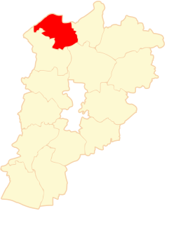
Folwark-Raciąż is a village in the administrative district of Gmina Raciąż, within Płońsk County, Masovian Voivodeship, in east-central Poland.
Łuzki-Kolonia is a village in the administrative district of Gmina Jabłonna Lacka, within Sokołów County, Masovian Voivodeship, in east-central Poland.
Szczonów is a village in the administrative district of Gmina Żerków, within Jarocin County, Greater Poland Voivodeship, in west-central Poland. It lies approximately 7 kilometres (4 mi) north of Żerków, 19 km (12 mi) north of Jarocin, and 55 km (34 mi) south-east of the regional capital Poznań.
Niezdara is a village in the administrative district of Gmina Ożarowice, within Tarnowskie Góry County, Silesian Voivodeship, in southern Poland. It lies approximately 5 kilometres (3 mi) south-west of Ożarowice, 9 km (6 mi) east of Tarnowskie Góry, and 23 km (14 mi) north of the regional capital Katowice.
Kryl is a settlement in the administrative district of Gmina Bledzew, within Międzyrzecz County, Lubusz Voivodeship, in western Poland. It lies approximately 10 kilometres (6 mi) south-west of Bledzew, 19 km (12 mi) west of Międzyrzecz, 32 km (20 mi) south of Gorzów Wielkopolski, and 59 km (37 mi) north of Zielona Góra.
Pietrzykówko is a settlement in the administrative district of Gmina Koczała, within Człuchów County, Pomeranian Voivodeship, in northern Poland. It lies approximately 9 kilometres (6 mi) north-east of Koczała, 40 km (25 mi) north-west of Człuchów, and 108 km (67 mi) south-west of the regional capital Gdańsk.
Zagaje is a settlement in the administrative district of Gmina Koczała, within Człuchów County, Pomeranian Voivodeship, in northern Poland. It lies approximately 13 kilometres (8 mi) north of Koczała, 43 km (27 mi) north of Człuchów, and 106 km (66 mi) west of the regional capital Gdańsk.
Nidowo is a village in the administrative district of Gmina Nowy Staw, within Malbork County, Pomeranian Voivodeship, in northern Poland. It lies approximately 8 kilometres (5 mi) east of Nowy Staw, 14 km (9 mi) north-east of Malbork, and 41 km (25 mi) south-east of the regional capital Gdańsk.
Bucznik is a village in the administrative district of Gmina Stary Dzierzgoń, within Sztum County, Pomeranian Voivodeship, in northern Poland. It lies approximately 4 kilometres (2 mi) east of Stary Dzierzgoń, 29 km (18 mi) east of Sztum, and 80 km (50 mi) south-east of the regional capital Gdańsk.
Psale is a settlement in the administrative district of Gmina Szemud, within Wejherowo County, Pomeranian Voivodeship, in northern Poland. It lies approximately 6 kilometres (4 mi) south-east of Szemud, 17 km (11 mi) south of Wejherowo, and 25 km (16 mi) west of the regional capital Gdańsk.
Łęknica is a village in the administrative district of Gmina Srokowo, within Kętrzyn County, Warmian-Masurian Voivodeship, in northern Poland, close to the border with the Kaliningrad Oblast of Russia.
Jeleń is a settlement in the administrative district of Gmina Ruciane-Nida, within Pisz County, Warmian-Masurian Voivodeship, in northern Poland. It lies approximately 9 kilometres (6 mi) south-west of Ruciane-Nida, 24 km (15 mi) west of Pisz, and 66 km (41 mi) east of the regional capital Olsztyn.
Zakrzewo is a village in the administrative district of Gmina Darłowo, within Sławno County, West Pomeranian Voivodeship, in north-western Poland. It lies approximately 6 kilometres (4 mi) north-east of Darłowo, 17 km (11 mi) north-west of Sławno, and 169 km (105 mi) north-east of the regional capital Szczecin. The sołectwo of Zakrzewo includes two parts known as Zakrzewo Dolne and Zakrzewo Górne.