Krumme Lanke is a Berlin U-Bahn station on the U 3. It is the line's southwestern terminus, located in the Zehlendorf district of Berlin.

Bierzyce is a village in the administrative district of Gmina Długołęka, within Wrocław County, Lower Silesian Voivodeship, in south-western Poland. Prior to 1945 it was in Germany.

Srebrniki is a village in the administrative district of Gmina Kowalewo Pomorskie, within Golub-Dobrzyń County, Kuyavian-Pomeranian Voivodeship, in north-central Poland. It lies 4 kilometres (2 mi) north-west of Kowalewo Pomorskie, 17 km (11 mi) north-west of Golub-Dobrzyń, and 23 km (14 mi) north-east of Toruń.
Wiązownica is a village in the administrative district of Gmina Radziłów, within Grajewo County, Podlaskie Voivodeship, in north-eastern Poland.
Słobódka is a village in the administrative district of Gmina Krynki, within Sokółka County, Podlaskie Voivodeship, in north-eastern Poland, close to the border with Belarus. It lies approximately 11 kilometres (7 mi) south-west of Krynki, 28 km (17 mi) south-east of Sokółka, and 38 km (24 mi) east of the regional capital Białystok.
Wilczkowice is a village in the administrative district of Gmina Michałowice, within Kraków County, Lesser Poland Voivodeship, in southern Poland. It lies approximately 14 km (9 mi) north of the regional capital Kraków.
Jelcza is a village in the administrative district of Gmina Charsznica, within Miechów County, Lesser Poland Voivodeship, in southern Poland. It lies approximately 6 kilometres (4 mi) north-west of Charsznica, 15 km (9 mi) north-west of Miechów, and 43 km (27 mi) north of the regional capital Kraków.
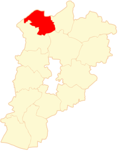
Sulmierzyce is a village in Pajęczno County, Łódź Voivodeship, in central Poland. It is the seat of the gmina called Gmina Sulmierzyce. It lies approximately 14 kilometres (9 mi) east of Pajęczno and 70 km (43 mi) south of the regional capital Łódź.
Łowisko is a village in the administrative district of Gmina Kamień, within Rzeszów County, Subcarpathian Voivodeship, in south-eastern Poland. It lies approximately 33 km (21 mi) north-east of the regional capital Rzeszów.
Miechów-Kolonia is a village in the administrative district of Gmina Kazanów, within Zwoleń County, Masovian Voivodeship, in east-central Poland.
Stare Miasto is a village in Konin County, Greater Poland Voivodeship, in west-central Poland. It is the seat of the gmina called Gmina Stare Miasto. It lies approximately 6 kilometres (4 mi) south-west of Konin and 92 km (57 mi) east of the regional capital Poznań. The village has an approximate population of 1,500.
Kopanina is a village in the administrative district of Gmina Toszek, within Gliwice County, Silesian Voivodeship, in southern Poland. It lies approximately 6 kilometres (4 mi) west of Toszek, 25 km (16 mi) north-west of Gliwice, and 46 km (29 mi) north-west of the regional capital Katowice.
Gryżyna is a village in the administrative district of Gmina Bytnica, within Krosno Odrzańskie County, Lubusz Voivodeship, in western Poland. It lies approximately 9 kilometres (6 mi) north-east of Bytnica, 21 km (13 mi) north-east of Krosno Odrzańskie, 31 km (19 mi) north-west of Zielona Góra, and 62 km (39 mi) south of Gorzów Wielkopolski.
Rakowo is a village in the administrative district of Gmina Skwierzyna, within Międzyrzecz County, Lubusz Voivodeship, in western Poland.
Kulki is a settlement in the administrative district of Gmina Chojnice, within Chojnice County, Pomeranian Voivodeship, in northern Poland. It lies approximately 20 kilometres (12 mi) north of Chojnice and 96 km (60 mi) south-west of the regional capital Gdańsk.
Karbówka is a village in the administrative district of Gmina Lubomino, within Lidzbark County, Warmian-Masurian Voivodeship, in northern Poland. It lies approximately 27 kilometres (17 mi) west of Lidzbark Warmiński and 38 km (24 mi) north-west of the regional capital Olsztyn.
Domachowo is a village in the administrative district of Gmina Polanów, within Koszalin County, West Pomeranian Voivodeship, in north-western Poland. It lies approximately 12 kilometres (7 mi) north-west of Polanów, 27 km (17 mi) east of Koszalin, and 157 km (98 mi) north-east of the regional capital Szczecin.
Jaromierki is a settlement in the administrative district of Gmina Barlinek, within Myślibórz County, West Pomeranian Voivodeship, in north-western Poland. It lies approximately 3 kilometres (2 mi) north-west of Barlinek, 24 km (15 mi) north-east of Myślibórz, and 60 km (37 mi) south-east of the regional capital Szczecin.
Wołczkowo is a village in the administrative district of Gmina Dobra, within Police County, West Pomeranian Voivodeship, in north-western Poland, close to the German border. It lies approximately 5 kilometres (3 mi) east of Dobra, 11 km (7 mi) south-west of Police, and 12 km (7 mi) north-west of the regional capital Szczecin.
Muzeum Katyńskie w Warszawie is a museum in Warsaw, Poland. The museum was established in 1993. It is located in the Polish Army Museum. Objects, documents and personal effects from the site of the Katyn massacre can be seen in the museum.