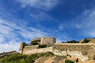
Nalgonda district is a district in the Telangana state of India. Nalgonda district has the highest number of mandals in the state with 31 mandals. The district shares boundaries with Suryapet, Rangareddy, Yadadri and Nagarkurnool districts and with the state boundary of Andhra Pradesh.

Nizamabad district is a district located in the north-western region of the Indian state of Telangana. The city of Nizamabad is the district headquarters. The district share boundaries with Jagtial, Sircilla, Nirmal, Kamareddy districts and with Nanded district of the state boundary of Maharashtra.

Ranga Reddy district is a district in the Indian state of Telangana. The district headquarters is located at Kongara Kalan Village, Ibrahimpatnam Mandal,. The district was named after the former deputy chief minister of the United Andhra Pradesh, K. V. Ranga Reddy. The district shares boundaries with Nalgonda, Yadadri Bhuvanagiri, Hyderabad, Medchal–Malkajgiri, Nagarkurnool, Mahabubnagar, Sangareddy and Vikarabad districts.

Manchala is a town is a suburb of Hyderabad in Ranga Reddy district of the Indian state of Telangana. It is located in Manchal (mandal) of Ibrahimpatnam revenue division.
Bandalemoor is a village and panchayat in Ranga Reddy district, Telangana, India. It falls under Manchal mandal.
Bodakonda is a village and panchayat in Ranga Reddy district, Telangana, India. It falls under Manchal mandal.
Cheeded is a village and panchayat in Ranga Reddy district, Telangana, India. It falls under Manchal mandal.
Japal is a village and panchayat in Ranga Reddy district, Telangana, India. It falls under Manchal mandal.
Lingampally is a village and panchayat in Ranga Reddy district, Telangana, India. It falls under Manchal mandal.
Loyapally is a village and panchayat in Ranga Reddy district, Telangana, India. It falls under Manchal mandal.
Nomula is a village and panchayat in Ranga Reddy district, Telangana, India. It falls under Manchal mandal.
Rangapur is a village in Ranga Reddy district of Telangana, India. It falls under Manchal mandal. It is also famous as "Chukkapuri Gutta" by having one of the Indian observatories in it. It is located 50 km from Hyderabad.
Tippaiguda is a village and panchayat in Ranga Reddy district, Telangana, India. It falls under Manchal mandal.

Sangareddy district, is a district in the Indian state of Telangana. This district contains a part of the Hyderabad Metropolitan Region.Sangareddy is the district headquarters of the district. It was named after the ruler Sanga, the son of queen Shankaramba, who was the ruler of Medak during the period of Nizams. The district shares boundaries with Medak, Medchal, Vikarabad, Kamareddy and Rangareddy districts and with the state boundary of Karnataka.

Mahabubabad district is a district in the Indian state of Telangana. The district was carved out from the erstwhile Warangal district following the re-organisation of districts in the state in October 2016. The district shares boundaries with Suryapet, Khammam, Bhadradri, Warangal, Mulugu and Jangaon districts.

Yadadri Bhuvanagiri District, is a district in the Indian state of Telangana. The administrative headquarters is located at Bhuvanagiri Town. The district shares boundaries with Suryapet, Nalgonda, Jangaon, Siddipet, Medchal-Malkajgiri and Rangareddy districts. It was carved out of Nalgonda district on 11 October 2016 during a large reorganization of the districts of Telangana.

Vikarabad district is a district in the Indian state of Telangana. Vikarabad is the headquarters of the district..The district shares boundaries with Sangareddy, Mahabubnagar, Narayanpet, Rangareddy districts and the state boundary of Karnataka.
Moinabad mandal is one of the 27 mandals in Ranga Reddy district of the Indian state of Telangana. It is under the administration of Chevella revenue division and has its headquarters at Moinabad.
Arutla is a village in Manchal Mandal in Rangareddy District of Telangana State, India.
Manchal is a Mandal in Ranga Reddy district, Telangana. It is located in the Ibrahimpatnam Assembly constituency.


